- Alternative title
-
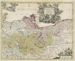
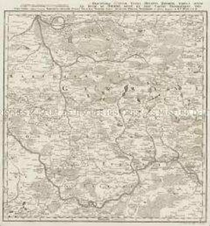
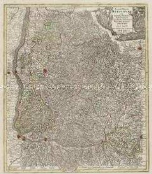
NOVA et ACCURATA / NORMANDIAE / DUCATUS TABULA / PORTUBUS LITTORIBUS
- Location
-
Deutsches Historisches Museum, Berlin
- Inventory number
-
Do 2006/91
- Measurements
-
Höhe x Breite: 51,5 x 64 cm (Blatt)
Höhe x Breite: 44,8 x 54,3 cm (Karte)
Höhe x Breite: 47,8 x 57,3 cm (Platte)
- Material/Technique
-
Druckfarbe, Papier, Kupferstich, koloriert
- Classification
-
Kartografie (Gattung)
- Subject (what)
-
Frankreich
Normandie
- Event
-
Herstellung
- (who)
-
Stecher, Verleger: Pieter Persoy
- (where)
-
Amsterdam, Niederlande
- (when)
-
um 1700
- Rights
-
Deutsches Historisches Museum
- Last update
-
24.03.2023, 9:27 AM CET
Data provider
This object is provided by:
Stiftung Deutsches Historisches Museum. If you have any questions about the object, please contact the data provider.
Stiftung Deutsches Historisches Museum. If you have any questions about the object, please contact the data provider.
Object type
- Regionalkarte
Associated
- Stecher, Verleger: Pieter Persoy
Time of origin
- um 1700
Other Objects (12)
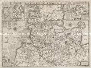
Ducatus Holsatiae Nova Tabula. Mit zwei Nebenkarten: Alluvies propè Detzbul...; Tabula Barmerensis...

Pomeraniae Ducatus Tabula
Nova et accurata Carinthiae Ducatus Tabula geographica in Superiorem et Inferiorem divisa. Mit einer Stadtansicht, einer Ansicht und einer bildlichen Darstellung
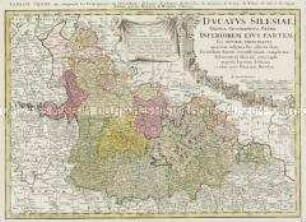
Ducatus Silesiae Tabula Geographica Prima Inferiorem eius Partem seu Nova Principatus
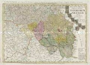
Ducatus Silesia Tabula Altera Superiorem Silesiam
Ducatus Silesiae Tabula Altera Superiorem Silesiam
Tabula Marchionatus Brandenburgici Et Ducatus Pomeraniae
Exactissima Statuum Totius Ducatus Bavariae Tabula
Tabula Ducatus Britanniae. Mit einer Nebenkarte: BREST
Ducatus Stiriae Novissima Tabula. Mit einer Stadtansicht: Grätz
Ducatus Silesiae Tabula Geographica Prima, Inferiorem Eius Partem
Accurata delineatio Brisgoviae
Ducatus Holsatiae Nova Tabula. Mit zwei Nebenkarten: Alluvies propè Detzbul...; Tabula Barmerensis...
Pomeraniae Ducatus Tabula
Nova et accurata Carinthiae Ducatus Tabula geographica in Superiorem et Inferiorem divisa. Mit einer Stadtansicht, einer Ansicht und einer bildlichen Darstellung
Ducatus Silesiae Tabula Geographica Prima Inferiorem eius Partem seu Nova Principatus
Ducatus Silesia Tabula Altera Superiorem Silesiam
Ducatus Silesiae Tabula Altera Superiorem Silesiam
Tabula Marchionatus Brandenburgici Et Ducatus Pomeraniae
Exactissima Statuum Totius Ducatus Bavariae Tabula
Tabula Ducatus Britanniae. Mit einer Nebenkarte: BREST
Ducatus Stiriae Novissima Tabula. Mit einer Stadtansicht: Grätz
Ducatus Silesiae Tabula Geographica Prima, Inferiorem Eius Partem