- Alternative title
-
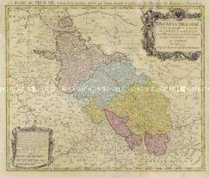
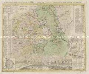
DUCATUS SILESIAE / TABULA ALTERA / SUPERIOREM / SILESIAM
- Location
-
Deutsches Historisches Museum, Berlin
- Inventory number
-
Do 2006/529
- Measurements
-
Höhe x Breite: 54 x 66,5 cm (Blatt)
Höhe x Breite: 37,4 x 54 cm (Karte)
Höhe x Breite: 42,5 x 58 cm (Platte)
- Material/Technique
-
Druckfarbe, Papier, Kupferstich, koloriert
- Classification
-
Kartografie (Gattung)
- Subject (what)
-
Oberschlesien
Polen
- Event
-
Herstellung
- (who)
-
Kartograf, Geograph: Johann Matthias Haas
Verlag: Homannsche Erben
- (where)
-
Nürnberg?, Deutschland
- (when)
-
1746
- Rights
-
Deutsches Historisches Museum
- Last update
- 24.03.2023, 9:29 AM CET
Data provider
This object is provided by:
Stiftung Deutsches Historisches Museum. If you have any questions about the object, please contact the data provider.
Stiftung Deutsches Historisches Museum. If you have any questions about the object, please contact the data provider.
Object type
- Regionalkarte
Associated
- Kartograf, Geograph: Johann Matthias Haas
- Verlag: Homannsche Erben
Time of origin
- 1746
Other Objects (12)

Superiorem Silesiam
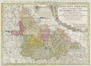
Ducatus Silesiae
Ducatus Silesiae Tabula Geographica Prima Inferiorem eius Partem seu Nova Principatus

Tabula Geographica Totam Borussiam ut et Districtum Notecensem. Mit einer Nebenkarte: Charte welche den Netz District vorstellet
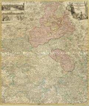
Tabula Geographica Campaniae. Mit zwei Nebenkarten: Reims und Troyes
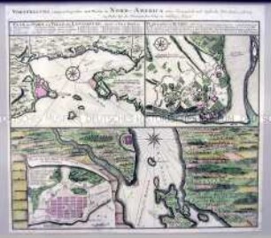
Pläne der kanadischen Städte Louisburg, Québec und Halifax unter französischer und englischer Herrschaft
Repraesentatio Geographica Circuli Egerani
La Comtè de Glatz
Circuli Supe. Saxoniae
Tractus Nordlingensis Germ. RIES dicti accurata Descriptio. Mit einer Ansicht und einem Grundriss von Nördlingen
Lusatiae Inferioris
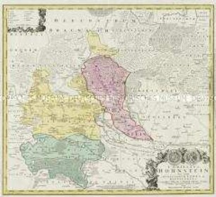
Comitauts Hohnstein
Superiorem Silesiam
Ducatus Silesiae
Ducatus Silesiae Tabula Geographica Prima Inferiorem eius Partem seu Nova Principatus
Tabula Geographica Totam Borussiam ut et Districtum Notecensem. Mit einer Nebenkarte: Charte welche den Netz District vorstellet
Tabula Geographica Campaniae. Mit zwei Nebenkarten: Reims und Troyes
Pläne der kanadischen Städte Louisburg, Québec und Halifax unter französischer und englischer Herrschaft
Repraesentatio Geographica Circuli Egerani
La Comtè de Glatz
Circuli Supe. Saxoniae
Tractus Nordlingensis Germ. RIES dicti accurata Descriptio. Mit einer Ansicht und einem Grundriss von Nördlingen
Lusatiae Inferioris