- Alternative title
-
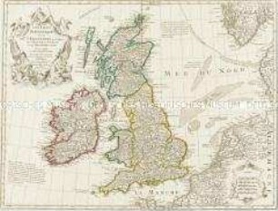
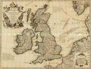
ISLES BRITANNIQUES. / Cinquieme Carte. / IRLANDE.
- Location
-
Deutsches Historisches Museum, Berlin
- Inventory number
-
Do 2006/578.10
- Measurements
-
Höhe x Breite: 44,2 x 60 cm (Blatt)
Höhe x Breite: 30,5 x 41,3 cm (Karte)
Höhe x Breite: 33,2 x 44,5 cm (Platte)
- Material/Technique
-
Papier, Kupferstich, grenzkoloriert
- Classification
-
Kartografie (Gattung)
- Subject (what)
-
Irland
- Event
-
Herstellung
- (who)
-
Historiker, Geograph: Edme Mentelle
Stecher: Pierre Francois Tardieu
Stecher: Gaspard André?
- (where)
-
Paris, Frankreich
- (when)
-
um 1782
- Rights
-
Deutsches Historisches Museum
- Last update
-
24.03.2023, 9:29 AM CET
Data provider
This object is provided by:
Stiftung Deutsches Historisches Museum. If you have any questions about the object, please contact the data provider.
Stiftung Deutsches Historisches Museum. If you have any questions about the object, please contact the data provider.
Object type
- Regionalkarte
Associated
- Historiker, Geograph: Edme Mentelle
- Stecher: Pierre Francois Tardieu
- Stecher: Gaspard André?
Time of origin
- um 1782
Other Objects (12)

Atlas Nouveau: Isles Britanniques Quatrieme Carte
Atlas Nouveau: Isles Britanniques Troisieme Carte

Atlas Nouveau: Carte de l'Isle de Cuba et des Isles Lucayes
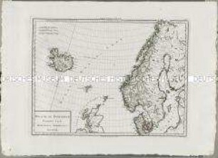
Atlas Nouveau: Royaume de Danemarck Premiere Carte

Atlas Nouveau: Russie Troisieme Carte
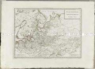
Atlas Nouveau: Russie Deuxieme Carte
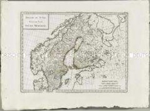
Atlas Nouveau: Royaume De Suède Troisieme Carte

Atlas Nouveau: Royaume de Danemarck Deuxieme Carte
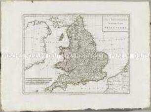
Les Isles Britanniques
Les Isles Britanniques
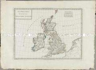
Atlas Nouveau: Isles Britanniques Deuxieme Carte
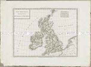
Atlas Nouveau: Isles Britanniques Premiere Carte
Atlas Nouveau: Isles Britanniques Quatrieme Carte
Atlas Nouveau: Isles Britanniques Troisieme Carte
Atlas Nouveau: Carte de l'Isle de Cuba et des Isles Lucayes
Atlas Nouveau: Royaume de Danemarck Premiere Carte
Atlas Nouveau: Russie Troisieme Carte
Atlas Nouveau: Russie Deuxieme Carte
Atlas Nouveau: Royaume De Suède Troisieme Carte
Atlas Nouveau: Royaume de Danemarck Deuxieme Carte
Les Isles Britanniques
Les Isles Britanniques
Atlas Nouveau: Isles Britanniques Deuxieme Carte