- Alternativer Titel
-
ROYAUME DE DANEMARCK / Deuxieme Carte, / DANEMARCK PROPRE LE JUTLAND / ET LES ISLES
- Standort
-
Deutsches Historisches Museum, Berlin
- Inventarnummer
-
Do 2006/578.12
- Maße
-
Höhe x Breite: 44 x 59,6 cm (Blatt)
Höhe x Breite: 30,7 x 41,3 cm (Karte)
Höhe x Breite: 33,4 x 44,3 cm (Platte)
- Material/Technik
-
Papier, Kupferstich, grenzkoloriert
- Klassifikation
-
Kartografie (Gattung)
- Bezug (was)
-
Dänemark
- Ereignis
-
Herstellung
- (wer)
-
Historiker, Geograph: Edme Mentelle
Stecher: Pierre Francois Tardieu
Stecher: Pasquier Jean Valet
- (wo)
-
Paris, Frankreich
- (wann)
-
um 1782
- Rechteinformation
-
Deutsches Historisches Museum
- Letzte Aktualisierung
-
24.03.2023, 09:30 MEZ
Datenpartner
Dieses Objekt wird bereitgestellt von:
Stiftung Deutsches Historisches Museum. Bei Fragen zum Objekt wenden Sie sich bitte an den Datenpartner.
Stiftung Deutsches Historisches Museum. Bei Fragen zum Objekt wenden Sie sich bitte an den Datenpartner.
Objekttyp
- Regionalkarte
Beteiligte
- Historiker, Geograph: Edme Mentelle
- Stecher: Pierre Francois Tardieu
- Stecher: Pasquier Jean Valet
Entstanden
- um 1782
Ähnliche Objekte (12)
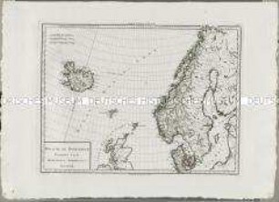
Atlas Nouveau: Royaume de Danemarck Premiere Carte
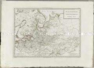
Atlas Nouveau: Russie Deuxieme Carte
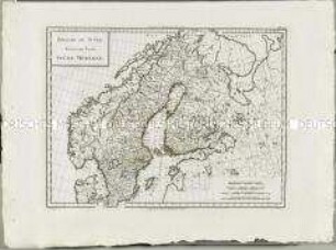
Atlas Nouveau: Royaume De Suède Troisieme Carte
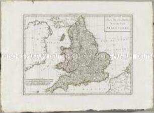
Atlas Nouveau: Isles Britanniques Troisieme Carte
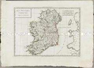
Atlas Nouveau: Isles Britanniques Cinquieme Carte

Atlas Nouveau: Isles Britanniques Quatrieme Carte

Atlas Nouveau: Carte de l'Isle de Cuba et des Isles Lucayes

Atlas Nouveau: Russie Troisieme Carte
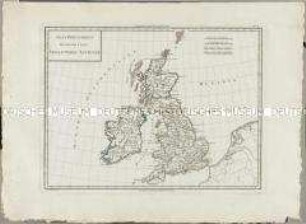
Atlas Nouveau: Isles Britanniques Deuxieme Carte
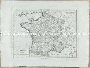
Atlas Nouveau: La France divisee en 32 gr.ds Gouvernemens
![Geographie mathématique, physique et politique de toutes les parties du monde : rédigée d'après ce qui a été publié d'exact et de nouveau par les géographes, les naturalistes, les voyageurs et les auteurs de statistique des nations les plus éclairées ... / publ. par Edme Mentelle; Malte Brun. - A Paris, Chez Henry Tardieu, Imp.-Libr., rue de Bièvre, no. 31. Laporte, Libr., rue de Savoie St.-André-des-Arcs, An XII/XIII [1803/1804]](https://iiif.deutsche-digitale-bibliothek.de/image/2/6a8cd379-76f5-4af1-a350-0d01b518cca2/full/!306,450/0/default.jpg)
Geographie mathématique, physique et politique de toutes les parties du monde : rédigée d'après ce qui a été publié d'exact et de nouveau par les géographes, les naturalistes, les voyageurs et les auteurs de statistique des nations les plus éclairées ... / publ. par Edme Mentelle; Malte Brun. - A Paris, Chez Henry Tardieu, Imp.-Libr., rue de Bièvre, no. 31. Laporte, Libr., rue de Savoie St.-André-des-Arcs, An XII/XIII [1803/1804]
![Cours de cosmographie, de géographie, de chronologie et d'histoire ancienne et moderne ... / par le C. Mentelle. - Paris : Bernard, IX [1800/1801]. - 3 Bde.](https://iiif.deutsche-digitale-bibliothek.de/image/2/fffd7bda-a248-453a-8977-f2df266fb991/full/!306,450/0/default.jpg)
Cours de cosmographie, de géographie, de chronologie et d'histoire ancienne et moderne ... / par le C. Mentelle. - Paris : Bernard, IX [1800/1801]. - 3 Bde.
Atlas Nouveau: Royaume de Danemarck Premiere Carte
Atlas Nouveau: Russie Deuxieme Carte
Atlas Nouveau: Royaume De Suède Troisieme Carte
Atlas Nouveau: Isles Britanniques Troisieme Carte
Atlas Nouveau: Isles Britanniques Cinquieme Carte
Atlas Nouveau: Isles Britanniques Quatrieme Carte
Atlas Nouveau: Carte de l'Isle de Cuba et des Isles Lucayes
Atlas Nouveau: Russie Troisieme Carte
Atlas Nouveau: Isles Britanniques Deuxieme Carte
Atlas Nouveau: La France divisee en 32 gr.ds Gouvernemens
Geographie mathématique, physique et politique de toutes les parties du monde : rédigée d'après ce qui a été publié d'exact et de nouveau par les géographes, les naturalistes, les voyageurs et les auteurs de statistique des nations les plus éclairées ... / publ. par Edme Mentelle; Malte Brun. - A Paris, Chez Henry Tardieu, Imp.-Libr., rue de Bièvre, no. 31. Laporte, Libr., rue de Savoie St.-André-des-Arcs, An XII/XIII [1803/1804]