- Alternativer Titel
-
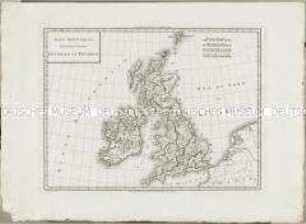
ISLES BRITANNIQUES. / Troisieme Carte, / ANGLETERRE
- Standort
-
Deutsches Historisches Museum, Berlin
- Inventarnummer
-
Do 2006/578.8
- Maße
-
Höhe x Breite: 44,5 x 60,3 cm (Blatt)
Höhe x Breite: 30,3 x 41,3 cm (Karte)
Höhe x Breite: 33,3 x 44 cm (Platte)
- Material/Technik
-
Papier, Kupferstich, grenzkoloriert
- Klassifikation
-
Kartografie (Gattung)
- Bezug (was)
-
England
Großbritannien
- Ereignis
-
Herstellung
- (wer)
-
Historiker, Geograph: Edme Mentelle
Stecher: Pierre Francois Tardieu
Stecher: Gaspard André?
- (wo)
-
Paris, Frankreich
- (wann)
-
um 1782
- Rechteinformation
-
Deutsches Historisches Museum
- Letzte Aktualisierung
- 24.03.2023, 09:32 MEZ
Datenpartner
Dieses Objekt wird bereitgestellt von:
Stiftung Deutsches Historisches Museum. Bei Fragen zum Objekt wenden Sie sich bitte an den Datenpartner.
Stiftung Deutsches Historisches Museum. Bei Fragen zum Objekt wenden Sie sich bitte an den Datenpartner.
Objekttyp
- Regionalkarte
Beteiligte
- Historiker, Geograph: Edme Mentelle
- Stecher: Pierre Francois Tardieu
- Stecher: Gaspard André?
Entstanden
- um 1782
Ähnliche Objekte (12)

Atlas Nouveau: Isles Britanniques Quatrieme Carte
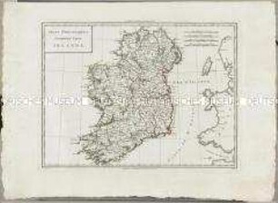
Atlas Nouveau: Isles Britanniques Cinquieme Carte

Atlas Nouveau: Russie Troisieme Carte

Atlas Nouveau: Carte de l'Isle de Cuba et des Isles Lucayes
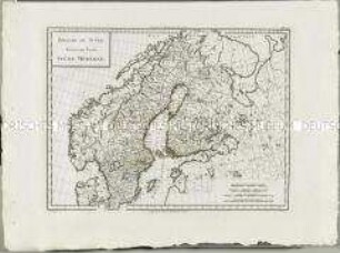
Atlas Nouveau: Royaume De Suède Troisieme Carte
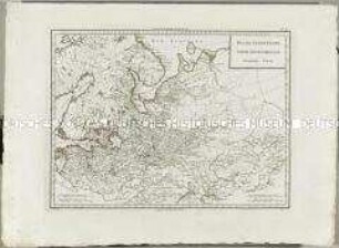
Atlas Nouveau: Russie Deuxieme Carte
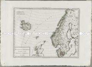
Atlas Nouveau: Royaume de Danemarck Premiere Carte

Atlas Nouveau: Royaume de Danemarck Deuxieme Carte
Atlas Nouveau: Isles Britanniques Premiere Carte
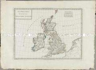
Atlas Nouveau: Isles Britanniques Deuxieme Carte
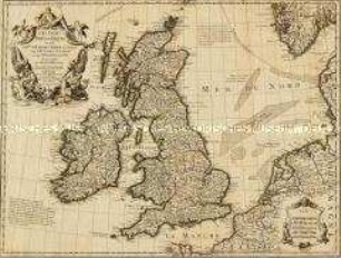
Les Isles Britanniques
Les Isles Britanniques
Atlas Nouveau: Isles Britanniques Quatrieme Carte
Atlas Nouveau: Isles Britanniques Cinquieme Carte
Atlas Nouveau: Russie Troisieme Carte
Atlas Nouveau: Carte de l'Isle de Cuba et des Isles Lucayes
Atlas Nouveau: Royaume De Suède Troisieme Carte
Atlas Nouveau: Russie Deuxieme Carte
Atlas Nouveau: Royaume de Danemarck Premiere Carte
Atlas Nouveau: Royaume de Danemarck Deuxieme Carte
Atlas Nouveau: Isles Britanniques Premiere Carte
Atlas Nouveau: Isles Britanniques Deuxieme Carte
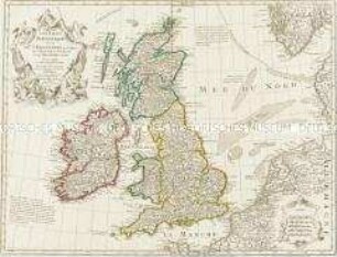
Les Isles Britanniques
Les Isles Britanniques
Atlas Nouveau: Isles Britanniques Quatrieme Carte
Atlas Nouveau: Isles Britanniques Cinquieme Carte
Atlas Nouveau: Russie Troisieme Carte
Atlas Nouveau: Carte de l'Isle de Cuba et des Isles Lucayes
Atlas Nouveau: Royaume De Suède Troisieme Carte
Atlas Nouveau: Russie Deuxieme Carte
Atlas Nouveau: Royaume de Danemarck Premiere Carte
Atlas Nouveau: Royaume de Danemarck Deuxieme Carte
Atlas Nouveau: Isles Britanniques Premiere Carte
Atlas Nouveau: Isles Britanniques Deuxieme Carte
Les Isles Britanniques