- Alternativer Titel
-
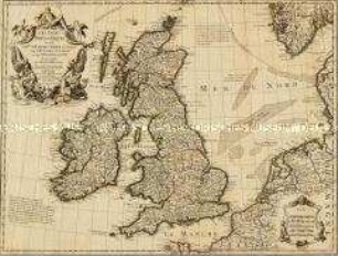
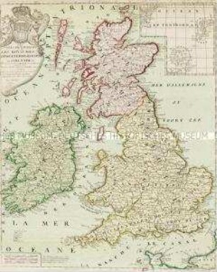
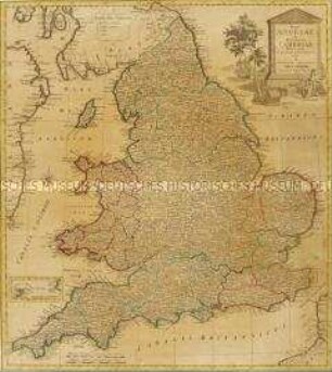
LES ISLES / BRITANNIQUES / ou sont / le R.me d'ANGLETERRE tiré de Sped
- Standort
-
Deutsches Historisches Museum, Berlin
- Inventarnummer
-
Do 2006/117
- Maße
-
Höhe x Breite: 54,3 x 70,9 cm (Blatt)
Höhe x Breite: 45,3 x 59,5 cm (Karte)
Höhe x Breite: 47,8 x 61,8 cm (Platte)
- Material/Technik
-
Druckfarbe, Papier, Kupferstich, grenzkoloriert
- Klassifikation
-
Kartografie (Gattung)
- Bezug (was)
-
England
Schottland
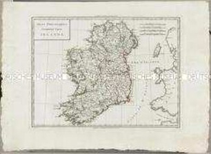
Irland
Großbritannien
Britische Inseln
- Ereignis
-
Herstellung
- (wer)
-
Kartograf: Guillaume Delisle
Kartograf: John Speed
Kartograf, Landmesser: Timothy Pont
Landvermesser: William Petty
- (wo)
-
Paris, Frankreich
- (wann)
-
1772
- Rechteinformation
-
Deutsches Historisches Museum
- Letzte Aktualisierung
-
24.03.2023, 09:30 MEZ
Datenpartner
Dieses Objekt wird bereitgestellt von:
Stiftung Deutsches Historisches Museum. Bei Fragen zum Objekt wenden Sie sich bitte an den Datenpartner.
Stiftung Deutsches Historisches Museum. Bei Fragen zum Objekt wenden Sie sich bitte an den Datenpartner.
Objekttyp
- Regionalkarte
Beteiligte
- Kartograf: Guillaume Delisle
- Kartograf: John Speed
- Kartograf, Landmesser: Timothy Pont
- Landvermesser: William Petty
Entstanden
- 1772
Ähnliche Objekte (12)
Les Isles Britanniques
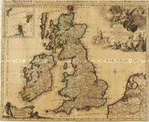
Les Isles Britanniques. Mit einer Nebenkarte: Orkney- und Shetlandinseln
Les Isles Britanniques. Mit einer Nebenkarte: Orkney- und Shetlandinseln
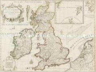
Atlas Nouveau: Isles Britanniques Troisieme Carte
Atlas Nouveau: Isles Britanniques Cinquieme Carte

Atlas Nouveau: Isles Britanniques Quatrieme Carte
Les Isles Britanniques. Mit einer Nebenkarte: Orkney und Shetland Inseln

Carte des Isles Britanniques. Mit einer Nebenkarte: Suplément pour les Isles Orcades et de Schetland
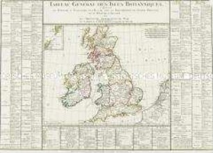
Tableau Général des Isles Britanniques. Mit einer Nebenkarte: Orkney- und Shetlandinseln
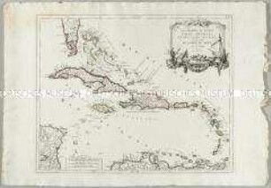
Les Grandes et Petites Isles Antilles et les Isles Lucayes
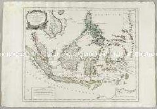
Archipel des Indes Orientales. Mit einer Nebenkarte: Isles Marianes
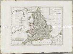
Regni Angliae et Principatus Cambriae. Mit einer Nebenkarte: Isles of Scilly
Les Isles Britanniques
Les Isles Britanniques. Mit einer Nebenkarte: Orkney- und Shetlandinseln
Les Isles Britanniques. Mit einer Nebenkarte: Orkney- und Shetlandinseln
Atlas Nouveau: Isles Britanniques Troisieme Carte
Atlas Nouveau: Isles Britanniques Cinquieme Carte
Atlas Nouveau: Isles Britanniques Quatrieme Carte
Les Isles Britanniques. Mit einer Nebenkarte: Orkney und Shetland Inseln
Carte des Isles Britanniques. Mit einer Nebenkarte: Suplément pour les Isles Orcades et de Schetland
Tableau Général des Isles Britanniques. Mit einer Nebenkarte: Orkney- und Shetlandinseln
Les Grandes et Petites Isles Antilles et les Isles Lucayes
Archipel des Indes Orientales. Mit einer Nebenkarte: Isles Marianes