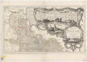
Druck | Landkarte | Territorialkarte
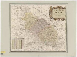
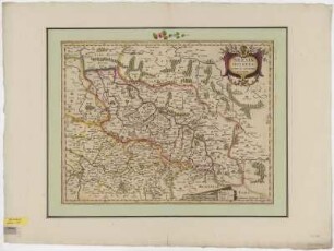
Territorialkarte von Schlesien, 1:1 900 000, Kupferstich, um 1745
Le Duché De Silesie : divisé en XVII. Principautées ; Avec Priv. du Roi / Par et chez le Rouge. - [Ca. 1:1 900 000]. - Paris : Le Rouge , [um 1745]. - 1 Kt. : Kupferst. ; 26 x 20 cm. Maßstab in graph. Form (Miles com. d'Allemagne). - Nullmeridian: Ferro. - Titelkartusche unten links. - Mit Wappen. - Mit Bildkartusche oben rechts
in color
- Measurements
-
26 x 20 cm; 1:1900000 (Maßstab)
- Location
-
Sächsische Landesbibliothek - Staats- und Universitätsbibliothek Dresden (SLUB)
SLUB/Kartensammlung
- Inventory number
-
SLUB/KS A15110
- Other number(s)
-
90009023 (Dokumentnummer)
df_dk_0010024 (Aufnahmenummer)
Subject (what)
Wappen
Grenzen
Druckgrafik
Grenzen
Druckgrafik
Subject (where)
Schlesien (Dargestellter Ort)
Subject (event)
Herstellung (Abgebildetes Objekt)
Classification
Druckgrafik (Gattung)
Event
Herstellung
(when)
2009
(description)
Aufnahme
Event
Digitalisierung
(description)
DFG-Karten
- Last update
-
31.03.2023, 11:12 AM CEST
Object type
- Druck; Territorialkarte; Landkarte
Time of origin
- 2009
Other Objects (12)
Karte von Schlesien und angrenzenden Ländern, 1:860 000, Kupferstich, 1757
Karte von Oberschlesien, 1:410 000, Kupferstich, 1758
Kriegskarte von Schlesien, 1:650 000, Kupferstich, 1741
Karte von dem Herzogtum Westfalen, 1:240 000, Kupferstich, 1757
Karte von Niederschlesien, 1:410 000, Kupferstich, 1758
Territorialkarte der Grafschaft Glatz, 1:1 330 000, Kupferstich, um 1759
Karte von Schlesien, 1:1 700 000, Kupferstich, um 1790
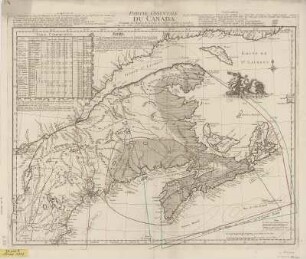
Karte von Ostcanada, 1:1 900 000, Kupferstich, 1755
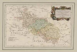
Karte von Schlesien, 1:960 000, Kupferstich, um 1640
Karte von den Herzogtümern Berg und Jülich, 1:310 000, Kupferstich, 1757
Karte von Schlesien, 1:1 300 000, Kupferstich, 1624
Karte von Schlesien und Umgebung, 1:1 200 000, Kupferstich, um 1719
Karte von Schlesien und angrenzenden Ländern, 1:860 000, Kupferstich, 1757
Karte von Oberschlesien, 1:410 000, Kupferstich, 1758
Kriegskarte von Schlesien, 1:650 000, Kupferstich, 1741
Karte von dem Herzogtum Westfalen, 1:240 000, Kupferstich, 1757
Karte von Niederschlesien, 1:410 000, Kupferstich, 1758
Territorialkarte der Grafschaft Glatz, 1:1 330 000, Kupferstich, um 1759
Karte von Schlesien, 1:1 700 000, Kupferstich, um 1790
Karte von Ostcanada, 1:1 900 000, Kupferstich, 1755
Karte von Schlesien, 1:960 000, Kupferstich, um 1640
Karte von den Herzogtümern Berg und Jülich, 1:310 000, Kupferstich, 1757
Karte von Schlesien, 1:1 300 000, Kupferstich, 1624