Druck | Inselkarte | Länderkarte | Territorialkarte
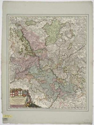
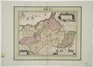
Karte des Fürstentums Fulda, 1:210 000, Kupferstich, nach 1715
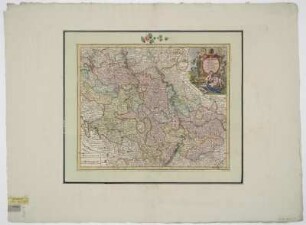
S.R.I. Principatus Fuldensis In Buchonia : cum adiacentibus quibusdam Regionibus adumbratus / â Joh. Baptista Homanno Sacrae Caesareae Maiestatis Geographo. - [Ca. 1:210 000]. - Noribergae , [nach 1715]. - 1 Kt. : Kupferst. ; 56 x 48 cm. Maßstab in graph. Form (Milliaria Germanica communia, Horae Itineris). - Titelkartusche unten rechts. - Mit Kt.-Netz. - Mit Wappen
in color
- Maße
-
56 x 48 cm; 1:210000 (Maßstab)
- Standort
-
Sächsische Landesbibliothek - Staats- und Universitätsbibliothek Dresden (SLUB)
SLUB/Kartensammlung
- Inventarnummer
-
SLUB/KS A13158
- Weitere Nummer(n)
-
90010687 (Dokumentnummer)
df_dk_0011324 (Aufnahmenummer)
Bezug (was)
Grenze
Bergzeichnung
Flusslauf
Wappen
Druckgrafik
Bergzeichnung
Flusslauf
Wappen
Druckgrafik
Bezug (wo)
Fulda (Dargestellter Ort)
Bezug (Ereignis)
Herstellung (Abgebildetes Objekt)
Klassifikation
Druckgrafik (Gattung)
Ereignis
Herstellung
(wann)
2009
(Beschreibung)
Aufnahme
Ereignis
Digitalisierung
(Beschreibung)
DFG-Karten
- Letzte Aktualisierung
-
31.03.2023, 11:08 MESZ
Objekttyp
- Druck; Länderkarte; Territorialkarte; Inselkarte
Entstanden
- 2009
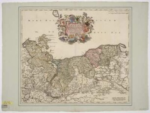
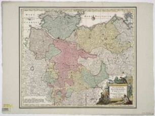
Ähnliche Objekte (12)
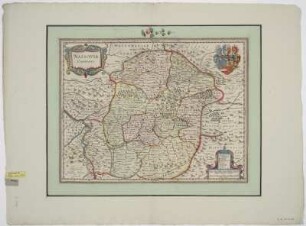
Karte der Grafschaft Nassau, 1:300 000, Kupferstich, um 1630
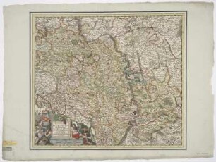
Karte vom Kurfürstentum Pfalz, 1:490 000, Kupferstich, um 1725
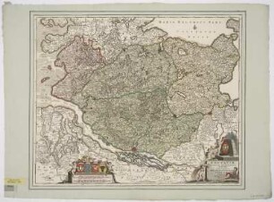
Karte vom Kurfürstentum Pfalz, 1:310 000, Kupferstich, um 1680
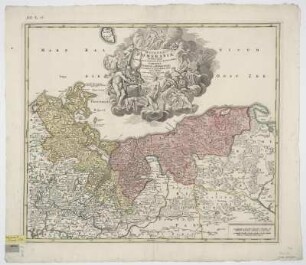
Karte von Holstein und angrenzenden Herzogtümern, 1:310 000, Kupferstich, nach 1705
Karte von dem Herzogtum Pommern, 1:780 000, Kupferstich, ab 1701
Karte von dem Kurrheinischen Reichskreis, 1:620 000, Kupferstich, vor 1715
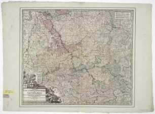
Karte von dem Kurrheinischen Reichskreis, 1: 620 000, Kupferstich, vor 1757
Karte vom Kurfürstentum Pfalz, 1:530 000, Kupferstich, um 1630
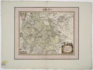
Karte von dem Herzogtum Mecklenburg, 1:520 000, Kupferstich, um 1683
Karte von dem Herzogtum Pommern, 1:780 000, Kupferstich, um 1710
Karte vom Niedersächsischen Reichskreis, 1:850 000, Kupferstich, um 1757
Karte von der Republik Venedig, 1:820 000, Kupferstich, 1712-1715. - Aus: Atlas mapparum geographicarum generalium & specialium Centum Foliis compositum et quotidianis usibus accommodatum - Norimbergae, 1791
Karte der Grafschaft Nassau, 1:300 000, Kupferstich, um 1630
Karte vom Kurfürstentum Pfalz, 1:490 000, Kupferstich, um 1725
Karte vom Kurfürstentum Pfalz, 1:310 000, Kupferstich, um 1680
Karte von Holstein und angrenzenden Herzogtümern, 1:310 000, Kupferstich, nach 1705
Karte von dem Herzogtum Pommern, 1:780 000, Kupferstich, ab 1701
Karte von dem Kurrheinischen Reichskreis, 1:620 000, Kupferstich, vor 1715
Karte von dem Kurrheinischen Reichskreis, 1: 620 000, Kupferstich, vor 1757
Karte vom Kurfürstentum Pfalz, 1:530 000, Kupferstich, um 1630
Karte von dem Herzogtum Mecklenburg, 1:520 000, Kupferstich, um 1683
Karte von dem Herzogtum Pommern, 1:780 000, Kupferstich, um 1710
Karte vom Niedersächsischen Reichskreis, 1:850 000, Kupferstich, um 1757