- Alternativer Titel
-
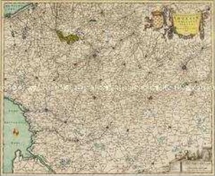
TABVLA GENERALIS / HOLSATIAE / complectens / HOLSATIAE DITHMARSIAE STORMARIAE ET VARGRIAE
- Standort
-
Deutsches Historisches Museum, Berlin
- Inventarnummer
-
Do 2006/445
- Maße
-
Höhe x Breite: 56 x 65,6 cm (Blatt)
Höhe x Breite: 46,4 x 55,5 cm (Karte)
Höhe x Breite: 49,2 x 58,2 cm (Platte)
- Material/Technik
-
Druckfarbe, Papier, Kupferstich, koloriert
- Klassifikation
-
Kartografie (Gattung)
- Bezug (was)
-
Holstein
Stormarn
Dithmarschen
Wagrien
- Ereignis
-
Herstellung
- (wer)
-
Geograph, Kartograf, Verleger, Kupferstecher: Johann Baptist Homann
- (wo)
-
Nürnberg, Deutschland
- (wann)
-
um 1700
- Rechteinformation
-
Deutsches Historisches Museum
- Letzte Aktualisierung
-
24.03.2023, 09:28 MEZ
Datenpartner
Dieses Objekt wird bereitgestellt von:
Stiftung Deutsches Historisches Museum. Bei Fragen zum Objekt wenden Sie sich bitte an den Datenpartner.
Stiftung Deutsches Historisches Museum. Bei Fragen zum Objekt wenden Sie sich bitte an den Datenpartner.
Objekttyp
- Regionalkarte
Beteiligte
- Geograph, Kartograf, Verleger, Kupferstecher: Johann Baptist Homann
Entstanden
- um 1700
Ähnliche Objekte (12)
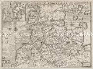
Ducatus Holsatiae Nova Tabula. Mit zwei Nebenkarten: Alluvies propè Detzbul...; Tabula Barmerensis...
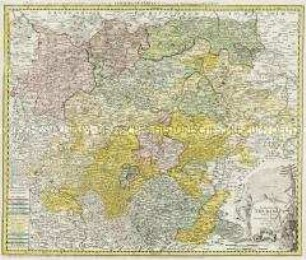
Landgraviatus Thuringiae Tabula Generalis
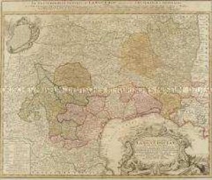
Gubernatio Generalis Languedociae
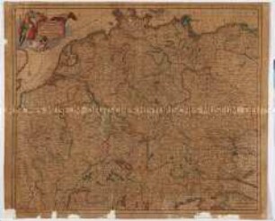
Accuratissima Germaniae Tabula

Tabula Marchionatus Brandenburgici
Pomeraniae Ducatus Tabula
Geographica Artesiae Comitatus Tabula
Misniae et Lusatiae Tabula
Totius Alsatiae Novissima Tabula
Tabula ducatuum Livoniae et Curlandiae
Archiducatus Austriae Inferioris accuratissima tabula
Tabula Marchionatus Brandenburgici Et Ducatus Pomeraniae
Ducatus Holsatiae Nova Tabula. Mit zwei Nebenkarten: Alluvies propè Detzbul...; Tabula Barmerensis...
Landgraviatus Thuringiae Tabula Generalis
Gubernatio Generalis Languedociae
Accuratissima Germaniae Tabula
Tabula Marchionatus Brandenburgici
Pomeraniae Ducatus Tabula
Geographica Artesiae Comitatus Tabula
Misniae et Lusatiae Tabula
Totius Alsatiae Novissima Tabula
Tabula ducatuum Livoniae et Curlandiae
Archiducatus Austriae Inferioris accuratissima tabula