- Alternative title
-
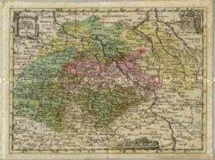
MISNIAE/ ET LVSATI=/ AE TABVLA./ Descripta à M. Bartholomeo/ Sculteto Gorlit.
- Location
-
Deutsches Historisches Museum, Berlin
- Inventory number
-
Do 2002/80
- Measurements
-
Höhe x Breite: 46,8 x 29 cm (Blatt), Höhe x Breite: 29,5 x 21 cm (Platte)
- Material/Technique
-
Papier, Kupferstich
- Classification
-
Kartografie (Gattung)
- Subject (what)
-
Meißen
Lausitz
Sachsen
- Event
-
Herstellung
- (who)
-
Kartograf: Bartholomäus Schultz
- (where)
-
Görlitz, Deutschland [historisch: Heiliges Römisches Reich]
- (when)
-
um 1600
- Rights
-
Deutsches Historisches Museum
- Last update
- 24.03.2023, 9:29 AM CET
Data provider
This object is provided by:
Stiftung Deutsches Historisches Museum. If you have any questions about the object, please contact the data provider.
Stiftung Deutsches Historisches Museum. If you have any questions about the object, please contact the data provider.
Object type
- Regionalkarte
Associated
- Kartograf: Bartholomäus Schultz
Time of origin
- um 1600
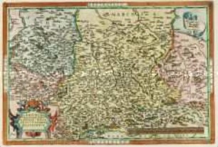
Other Objects (12)
Tabula Compendia Saxoniae Thur. Misn. et Lusatiae

Lusatiae Inferioris
Lusatiae Superioris
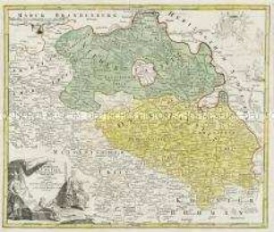
Totius Marchionatus Lusatiae
Totius Marchionatus Lusatiae
Saxoniae, Misniae, Thuringiae ... descriptio
Tabula ducatuum Livoniae et Curlandiae
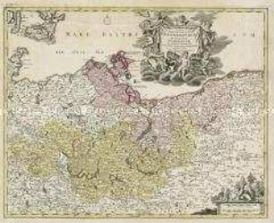
Tabula Marchionatus Brandenburgici Et Ducatus Pomeraniae
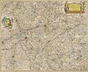
Comitatus Hannoniae et Archiepiscopatus Cameracensis Tabula
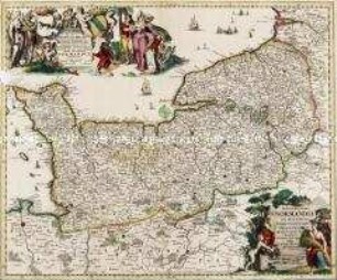
Nova et Accurata Normandiae Ducatus Tabula
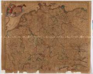
Accuratissima Germaniae Tabula
Pomeraniae Ducatus Tabula
Tabula Compendia Saxoniae Thur. Misn. et Lusatiae
Lusatiae Inferioris
Lusatiae Superioris
Totius Marchionatus Lusatiae
Totius Marchionatus Lusatiae
Saxoniae, Misniae, Thuringiae ... descriptio
Tabula ducatuum Livoniae et Curlandiae
Tabula Marchionatus Brandenburgici Et Ducatus Pomeraniae
Comitatus Hannoniae et Archiepiscopatus Cameracensis Tabula
Nova et Accurata Normandiae Ducatus Tabula
Accuratissima Germaniae Tabula