- Alternative title
-
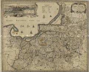
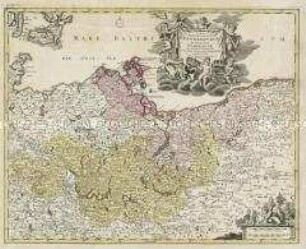
GEOGRAPHICA / ARTESIAE / COMITATUS / TABULA.
- Material/Technique
-
Druckfarbe, Papier, Kupferstich, koloriert
- Measurements
-
Höhe x Breite: 52,3 x 61,8 cm (Blatt)
Höhe x Breite: 44,6 x 54,3 cm (Karte)
Höhe x Breite: 47 x 56,8 cm (Platte)
- Location
-
Deutsches Historisches Museum, Berlin
- Inventory number
-
Do 2006/76
Subject (what)
Artois
Classification
Kartografie (Gattung)
Event
Herstellung
(who)
Kartograf, Verleger, Kupferstecher: Nicolas Visscher (1618)
(where)
Amsterdam, Niederlande
(when)
um 1650
- Rights
-
Deutsches Historisches Museum
- Last update
-
24.03.2023, 9:29 AM CET
Data provider
Object type
- Regionalkarte
Associated
- Kartograf, Verleger, Kupferstecher: Nicolas Visscher (1618)
Time of origin
- um 1650
Other Objects (12)
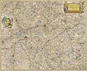
Comitatus Hannoniae et Archiepiscopatus Cameracensis Tabula
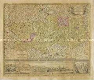
Tabula Prussiae. Mit einer Ansicht: Konigsberg
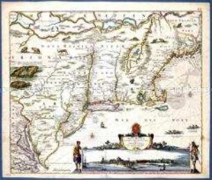
Novi Belgii Novaeque Angliae Nec Non Partis Virginiae Tabula.
Nova et accurata Carinthiae Ducatus Tabula geographica in Superiorem et Inferiorem divisa. Mit einer Stadtansicht, einer Ansicht und einer bildlichen Darstellung
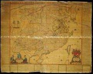
Nova et Accuratissima Sinarum Imperii Tabula. Karte erschienen in Blaeu, Joan: Atlas Maior. Lateinische Ausgabe
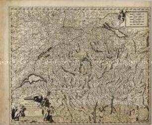
Exactißima Helvetiae
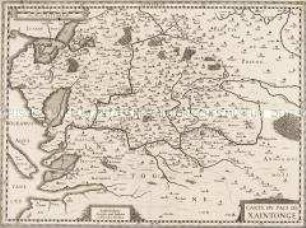
Carte du Pais de Xaintonge

Comitatus Glatz
Karte von Mansfeld...,
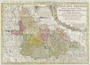
Ducatus Silesiae Tabula Geographica Prima Inferiorem eius Partem seu Nova Principatus
Tabula Marchionatus Brandenburgici Et Ducatus Pomeraniae
Marchia Media
Comitatus Hannoniae et Archiepiscopatus Cameracensis Tabula
Tabula Prussiae. Mit einer Ansicht: Konigsberg
Novi Belgii Novaeque Angliae Nec Non Partis Virginiae Tabula.
Nova et accurata Carinthiae Ducatus Tabula geographica in Superiorem et Inferiorem divisa. Mit einer Stadtansicht, einer Ansicht und einer bildlichen Darstellung
Nova et Accuratissima Sinarum Imperii Tabula. Karte erschienen in Blaeu, Joan: Atlas Maior. Lateinische Ausgabe
Exactißima Helvetiae
Carte du Pais de Xaintonge
Comitatus Glatz
Karte von Mansfeld...,
Ducatus Silesiae Tabula Geographica Prima Inferiorem eius Partem seu Nova Principatus
Tabula Marchionatus Brandenburgici Et Ducatus Pomeraniae