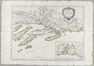
- Alternative title
-
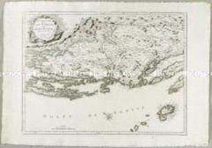
NOUVELLE / CARTE / DE / L'ISTRIE
- Location
-
Deutsches Historisches Museum, Berlin
- Inventory number
-
Do 2006/880
- Measurements
-
Höhe x Breite: 53,5 x 73 cm (Blatt)
Höhe x Breite: 43,7 x 55,3 cm (Karte)
Höhe x Breite: 46,3 x 57,5 cm (Platte)
- Material/Technique
-
Papier, Kupferstich, grenzkoloriert
- Classification
-
Kartografie (Gattung)
- Subject (what)
-
Istrien
Kroatien
- Event
-
Herstellung
- (who)
-
Stecher, Kartograf: Paolo Santini
- (where)
-
Venedig, Italien
- (when)
-
1780
- Rights
-
Deutsches Historisches Museum
- Last update
-
24.03.2023, 9:32 AM CET
Data provider
This object is provided by:
Stiftung Deutsches Historisches Museum. If you have any questions about the object, please contact the data provider.
Stiftung Deutsches Historisches Museum. If you have any questions about the object, please contact the data provider.
Object type
- Regionalkarte
Associated
- Stecher, Kartograf: Paolo Santini
Time of origin
- 1780
Other Objects (12)
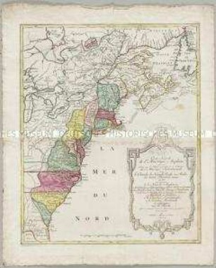
Carte Nouvelle de l'Amerique Angloise
Nouvelle Carte de la Partie Occidentale de Dalmatie
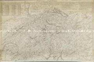
Nouvelle Carte Hydrographique et Routiere de la Suisse
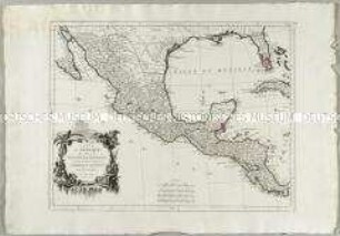
Carte du Mexique et de la Nouvelle Espagne
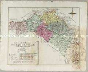
Carte nouvelle des Royaumes de Galizie et Lodomerie
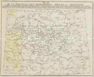
Grand Atlas D'Allemagne. Übersicht: Plan de la Nouvelle Carte Geographique Speciale D'Allemagne
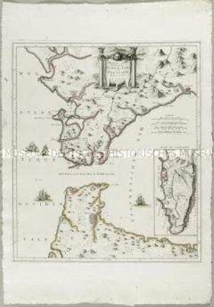
Nouvelle Carte de la Partie Orientale de Dalmatie. Mit einer Nebenkarte: Baye ou Bocche di Cattaro
Nouvelle Carte du Détroit de Gibraltar et de I'Isle de Cadix. Mit einer Nebenkarte: Plan de Gibraltar
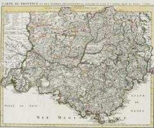
Carte de Provence
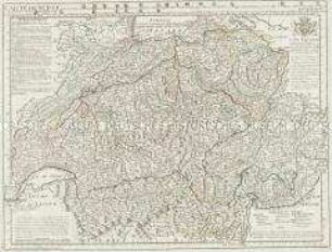
Carte de Suisse
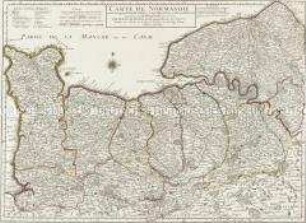
Carte de Normandie
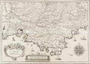
Carte de Provence
Carte Nouvelle de l'Amerique Angloise
Nouvelle Carte de la Partie Occidentale de Dalmatie
Nouvelle Carte Hydrographique et Routiere de la Suisse
Carte du Mexique et de la Nouvelle Espagne
Carte nouvelle des Royaumes de Galizie et Lodomerie
Grand Atlas D'Allemagne. Übersicht: Plan de la Nouvelle Carte Geographique Speciale D'Allemagne
Nouvelle Carte de la Partie Orientale de Dalmatie. Mit einer Nebenkarte: Baye ou Bocche di Cattaro
Nouvelle Carte du Détroit de Gibraltar et de I'Isle de Cadix. Mit einer Nebenkarte: Plan de Gibraltar
Carte de Provence
Carte de Suisse
Carte de Normandie
Carte de Provence
Carte Nouvelle de l'Amerique Angloise
Nouvelle Carte de la Partie Occidentale de Dalmatie
Nouvelle Carte Hydrographique et Routiere de la Suisse
Carte du Mexique et de la Nouvelle Espagne
Carte nouvelle des Royaumes de Galizie et Lodomerie
Grand Atlas D'Allemagne. Übersicht: Plan de la Nouvelle Carte Geographique Speciale D'Allemagne
Nouvelle Carte de la Partie Orientale de Dalmatie. Mit einer Nebenkarte: Baye ou Bocche di Cattaro
Nouvelle Carte du Détroit de Gibraltar et de I'Isle de Cadix. Mit einer Nebenkarte: Plan de Gibraltar
Carte de Provence
Carte de Suisse
Carte de Normandie