Druck
Stadtplan von Pompei, Neapel, Italien, ca. 1:3 000, Stahlstich, 1832
Pompeii / Published under the superintendence of the Society for the Diffusion of Useful Knowledge; drawn by W. B. Clarke; engr. by T. E. Nicholson. - [Ca. 1:3 000]. - London : Baldwin & Cradock , 1832. - 1 Kt. : Stahlst. ; 39 x 30 cm. - Maßstab in graph. Form (English Feet, French Metres). - SE oben. - Mit Gebäudekennzeichnung u. Bergstrichen. - Mit 2 Nebenkt.: Domus Pansae. Plan of the Coast in the Vincinity of Vesuvius. - Mit 1 Ansicht: [Pompei]. - Am unteren Kt.-Rand 15 Abb. von Gebäuden
in color
- Maße
-
30,5 x 39,5 cm; 1:3000 (Maßstab)
- Standort
-
Sächsische Landesbibliothek - Staats- und Universitätsbibliothek Dresden (SLUB)
SLUB/Kartensammlung
- Inventarnummer
-
SLUB/KS 30254
- Weitere Nummer(n)
-
90059114 (Dokumentnummer)
df_dk_0009554 (Aufnahmenummer)
Bezug (was)
Stadtplan
Ansicht
Antike
Ausgrabung
Gebäudeverzeichnis
Profanbau
Druckgrafik
Ansicht
Antike
Ausgrabung
Gebäudeverzeichnis
Profanbau
Druckgrafik
Bezug (wo)
Pompei (Dargestellter Ort)
Bezug (Ereignis)
Herstellung (Abgebildetes Objekt)
Klassifikation
Druckgrafik (Gattung)
Ereignis
Herstellung
(wann)
2012
(Beschreibung)
Aufnahme
- Letzte Aktualisierung
-
31.03.2023, 11:12 MESZ
Ähnliche Objekte (12)
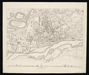
Stadtplan von Warschau, Polen, ca. 1:15 000, Lithographie, 1831
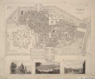
Plan von Turin, 1:8 000, Kupferstich, 1833
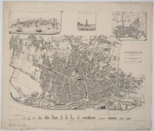
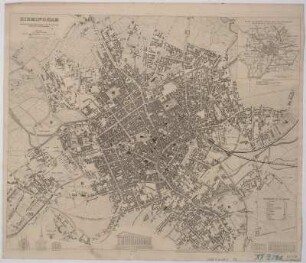
Plan von Liverpool, 1:13000, Stahlstich, 1836
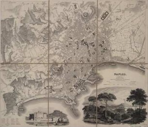
Plan von Neapel, 1:20 000, Kupferstich, 1835
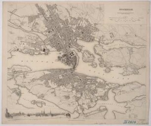
Plan und Ansicht von Stockholm, 1:20 000, Stahlstich, 1836
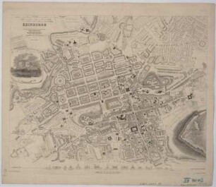
Plan von Edinburgh, 1:8 700, Stahlstich, 1834
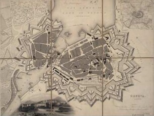
Plan von Genf, 1:5 000, 1841
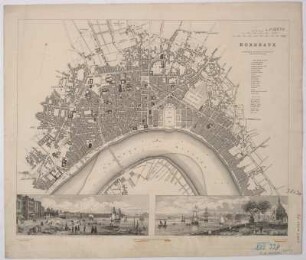
Plan und Ansichten von Bordeaux, 1:10 000, Stahlstich, 1832
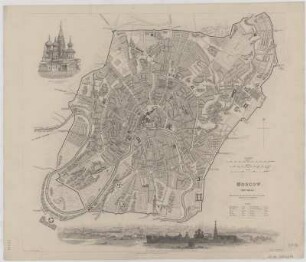
Plan von Moskau, 1:35 000, Kupferstich, 1836
Plan von Birmingham, 1:9 000, Stahlstich, 1839
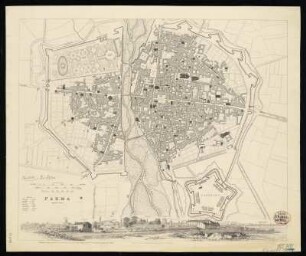
Stadtplan von Parma, Italien, 1:8 000, Stahlstich, 1840

Athens
Stadtplan von Warschau, Polen, ca. 1:15 000, Lithographie, 1831
Plan von Turin, 1:8 000, Kupferstich, 1833
Plan von Liverpool, 1:13000, Stahlstich, 1836
Plan von Neapel, 1:20 000, Kupferstich, 1835
Plan und Ansicht von Stockholm, 1:20 000, Stahlstich, 1836
Plan von Edinburgh, 1:8 700, Stahlstich, 1834
Plan von Genf, 1:5 000, 1841
Plan und Ansichten von Bordeaux, 1:10 000, Stahlstich, 1832
Plan von Moskau, 1:35 000, Kupferstich, 1836
Plan von Birmingham, 1:9 000, Stahlstich, 1839
Stadtplan von Parma, Italien, 1:8 000, Stahlstich, 1840