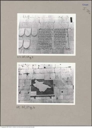
Kupferstich (koloriert)
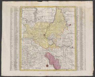
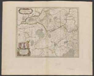
Herzogtum Magdeburg (Landkarte)
Landkarte des Herzogtums Magdeburg. Die Grenzen sind gelb koloriert. Im Osten die Grenze zu Anhalt Mittelmark, im Süden zu Halberstadt, im Westen zu Braunschweig und im Norden zur Alten Mark. Unten links ist ein kleiner Ausschnitt des Saal-Kreises eingefügt.
Beschriftung: Das Herzogthum Magdeburg Nro. 322.
Druckplatte hergestellt: Reilly, ?
- Standort
-
Stiftung Händel-Haus Halle, Halle (Saale)
- Sammlung
-
Bilder- und Graphiksammlung
- Inventarnummer
-
BS-IIa 63
- Maße
-
H: 30,7 cm; B: 48,1 cm (Blattmaß). H: 22,6 cm; B: 28,7 cm (Plattenmaß)
- Material/Technik
-
Kupferstich (koloriert)
- Bezug (was)
-
Kupferstich
Stadt
Karte
- Ereignis
-
Herstellung
- (wann)
-
1790
- (Beschreibung)
-
Druckplatte hergestellt
Druckplatte hergestellt - Obj. 86464
- Rechteinformation
-
Stiftung Händel-Haus Halle
- Letzte Aktualisierung
-
28.03.2025, 12:09 MEZ
Datenpartner
Dieses Objekt wird bereitgestellt von:
Stiftung Händel-Haus. Bei Fragen zum Objekt wenden Sie sich bitte an den Datenpartner.
Stiftung Händel-Haus. Bei Fragen zum Objekt wenden Sie sich bitte an den Datenpartner.
Objekttyp
- Kupferstich (koloriert)
Entstanden
- 1790
Ähnliche Objekte (12)
Landkarte des Herzogtums Magdeburg
Landkarte des Herzogtums Magdeburg
Magdeburg, Landkarte
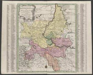
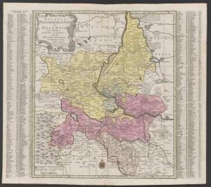
Landkarte des Herzogtums Magdeburg, der Anhaltischen Fürstentümer und des Saalkreises
Landkarte des Herzogtums von Benevent
Fürstentum Anhalt und Erzstift Magdeburg: Landkarte
Landkarte : Landkarte Angolas
Landkarte : Landkarte Südwestafrikas
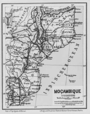
Landkarte : Landkarte Mosambiks
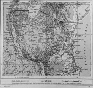
Landkarte : Landkarte Ostafrikas
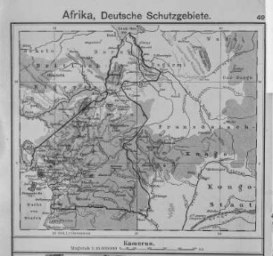
Landkarte : Landkarte Kameruns
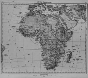
Landkarte : Landkarte Afrikas
Landkarte des Herzogtums Magdeburg
Landkarte des Herzogtums Magdeburg
Magdeburg, Landkarte
Landkarte des Herzogtums Magdeburg, der Anhaltischen Fürstentümer und des Saalkreises
Landkarte des Herzogtums von Benevent
Fürstentum Anhalt und Erzstift Magdeburg: Landkarte
Landkarte : Landkarte Angolas
Landkarte : Landkarte Südwestafrikas
Landkarte : Landkarte Mosambiks
Landkarte : Landkarte Ostafrikas
Landkarte : Landkarte Kameruns