Karten und Pläne
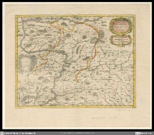
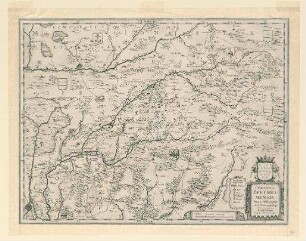
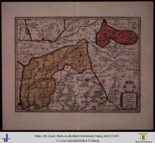
Comitatus Wertheimici finitimarumque regionum nova et exacta descriptio
Enthält: Wappen mit Löwenstein-Wertheim mit Grafenkrone, Waldungen schematisch
- Reference number
-
Landesarchiv Baden-Württemberg, Abt. Staatsarchiv Wertheim, R-K Nr. 706
- Dimensions
-
30 x 38,5 (Höhe x Breite)
- Further information
-
Ausführung: Stich
Maßstab: [1:212.000]
- Context
-
Karten und Pläne >> A. Allgemein
- Holding
-
Landesarchiv Baden-Württemberg, Abt. Staatsarchiv Wertheim, R-K Karten und Pläne
- Indexentry place
-
Wertheim (Grafschaft), 12. Jh.-1806
- Creator
-
Autor/Fotograf: J. Kahl
- Date of creation
-
1786
- Other object pages
- View digital item at providers-website
- Rights
-
Es gelten die Nutzungsbedingungen des Landesarchivs Baden-Württemberg.
- Last update
-
26.03.2024, 9:05 AM CET
Data provider
This object is provided by:
Landesarchiv Baden-Württemberg. If you have any questions about the object, please contact the data provider.
Landesarchiv Baden-Württemberg. If you have any questions about the object, please contact the data provider.
Object type
- Karten und Pläne
Associated
- Autor/Fotograf: J. Kahl
Time of origin
- 1786
Other Objects (12)
Comitatus Wertheimici finitimarumque regionum nova et exacta descriptio
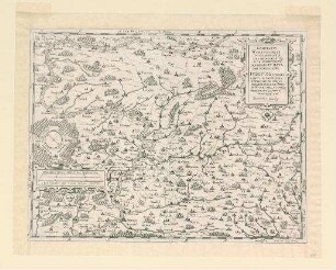
Comitatus Wertheimici finitimarumque regionum nova et exacta descriptio
Comitatus Wertheimici finitimarumque regionum nova et exacta descriptio

Comitatus Wertheimici finitimarumque regionum nova et exacta descriptio

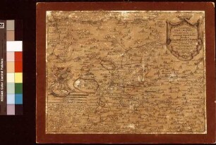
Comitatus Wertheimici finitimarumque regionum nova et exacta descriptio (Nachdruck)
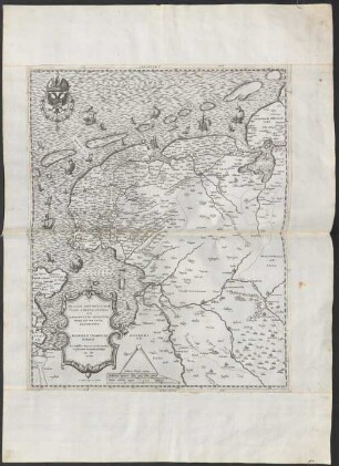
Comitatus Wertheimici Finitimarumque Regionum Nova Et Exacta Descriptio. Apud Gerardum Valk et Petrum Schenk Amstelaedami
Frisiae Antoniovissimae Trans Rhenum Provinc. Et Adiacentium Regionum Nova Et Exacta Descriptio
Comitatus Bentheimensis nova descriptio
Comitatus Bentheimensis nova descriptio
Italiae Nova Et Exacta Descriptio.
"Nova et exacta Asiae geographica descriptio"
Regni Bohemiae nova et exacta descriptio
Comitatus Wertheimici finitimarumque regionum nova et exacta descriptio
Comitatus Wertheimici finitimarumque regionum nova et exacta descriptio
Comitatus Wertheimici finitimarumque regionum nova et exacta descriptio
Comitatus Wertheimici finitimarumque regionum nova et exacta descriptio
Comitatus Wertheimici finitimarumque regionum nova et exacta descriptio (Nachdruck)
Comitatus Wertheimici Finitimarumque Regionum Nova Et Exacta Descriptio. Apud Gerardum Valk et Petrum Schenk Amstelaedami
Frisiae Antoniovissimae Trans Rhenum Provinc. Et Adiacentium Regionum Nova Et Exacta Descriptio
Comitatus Bentheimensis nova descriptio
Comitatus Bentheimensis nova descriptio
Italiae Nova Et Exacta Descriptio.
"Nova et exacta Asiae geographica descriptio"