- Alternative title
-
Plan du Typa ou de Macao
Partie Du Japon ou Nipon
Isle De Soufre
- Location
-
München, Bayerische Staatsbibliothek -- 4 Mapp. 344 h-2
- Dimensions
-
Gesamtgr. 23 x 34 cm, je Teil versch. Größen
- Extent
-
4 Kt. auf 1 Bl.
- Language
-
Französisch
- Notes
-
Kupferst.
Maßstab in graph. Form (Milles de 60 au Degré, Lieues Marines). - Enth. außerdem: Plan du Typa ou de Macao. Partie Du Japon ou Nipon. Isle De Soufre. - Mit 1 Nebenkt.: Plan Du Havre De St. Pierre Et St. Paul. - Nullmeridian: Paris. - Gedruckte Zählung oben rechts: 139. - Oben links: Cook 3e. Voyage
- Bibliographic citation
-
Atlas Encyclopédique ; 2 ; 139
- Keyword
-
Entdeckung
Geschichte
Iwōjima
Japan
Awatscha-Bucht
Typa
Macau
- URN
-
urn:nbn:de:bvb:12-bsb00130665-3
- Last update
-
16.04.2025, 8:33 AM CEST
Data provider
This object is provided by:
Bayerische Staatsbibliothek. If you have any questions about the object, please contact the data provider.
Bayerische Staatsbibliothek. If you have any questions about the object, please contact the data provider.
Object type
- Altkarte
Associated
Time of origin
- [1788]
Other Objects (12)
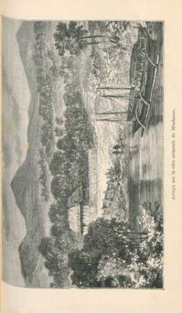
Arroyo sur la côte orientale de Mindanao

État de la navigation nationale sur toute la côte orientale
Cote orientale de Madagascar.
Fondation de la nouvelle colonie de Natal, sur la cote orientale d'Afrique.

La trouvaille de Baye
Nouvelle Carte de la Partie Orientale de Dalmatie. Mit einer Nebenkarte: Baye ou Bocche di Cattaro

La romanité orientale
La Politique orientale

Capítulo LI. - La península de Kamtschatka.
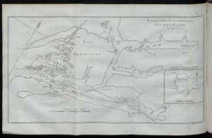
Plan De La Baye Dusky
"Kamtschatka"
Kamtschatka.
Arroyo sur la côte orientale de Mindanao
État de la navigation nationale sur toute la côte orientale
Cote orientale de Madagascar.
Fondation de la nouvelle colonie de Natal, sur la cote orientale d'Afrique.
La trouvaille de Baye
Nouvelle Carte de la Partie Orientale de Dalmatie. Mit einer Nebenkarte: Baye ou Bocche di Cattaro
La romanité orientale
La Politique orientale
Capítulo LI. - La península de Kamtschatka.
Plan De La Baye Dusky
"Kamtschatka"