Regionalkarte
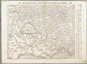
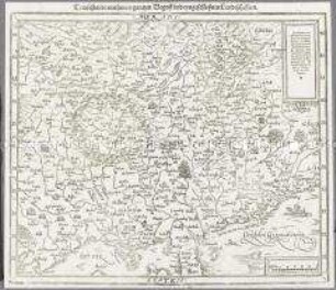
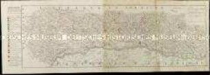
Chorographia Bavariae: Beschreibung Des Lanndts Vnd Loblichen Fürstenthumbs Obern Vnd Nidern Baiirn
- Alternative title
-
CHOROGRA / PHIA BAVARIAE
- Location
-
Deutsches Historisches Museum, Berlin
- Inventory number
-
Do 2006/1193
- Measurements
-
Höhe x Breite: 170 x 168 cm (Blatt)
Höhe x Breite: 158 x 153 cm (Karte)
- Material/Technique
-
Karte: Papier, Leinwand, Kupferstich
- Classification
-
Kartografie (Gattung)
- Subject (what)
-
Bayern
- Event
-
Herstellung
- (who)
-
Stecher: Peter Weiner
Geograph, Kartograf: Philipp Apian
- (where)
-
München ?, Deutschland [historisch: Bayern, Herzogtum]
- (when)
-
1579
- Rights
-
Deutsches Historisches Museum
- Last update
-
24.03.2023, 9:27 AM CET
Data provider
This object is provided by:
Stiftung Deutsches Historisches Museum. If you have any questions about the object, please contact the data provider.
Stiftung Deutsches Historisches Museum. If you have any questions about the object, please contact the data provider.
Object type
- Regionalkarte
Associated
- Stecher: Peter Weiner
- Geograph, Kartograf: Philipp Apian
Time of origin
- 1579
Other Objects (12)
Teütschland mit seinem gantzen begriff vnd eingeschlossnen landschafften. Aus: Münster, Sebastian: Cosmographey oder beschreibung aller laender, herrschafften, fürnemsten stetten, geschichten, gebreüchen, hantierungen etc., (Basel: Heinrich Petri, 1564). Bl. 6
Teutschlandt / mit seinem gantzen Begriff vnd eyngeschlossnen Landtschafften. Aus: Sebastian Münster: Cosmographey, das ist Beschreibung Aller Laender, Herrschafften und fuernemesten Stetten des gantzen Erdbodens. (Basel: Sebastian Henricpetri, 1598), Bl. 7
La Province d'Alsace

Carte Générale de l'Empire d'Allemagne. Mit einer Übersichtskarte
Carte des environs de la Mer-Noire
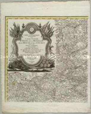
Carte Geographique representant le cours entier du Rhin, de la Moselle, de la Meuse et de l'Escaut

Kolorierte Tuschfederzeichnung der Grafschaft Eger
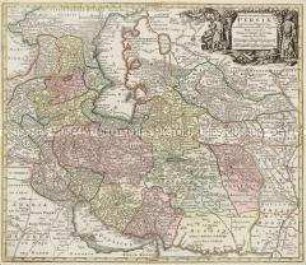
Opulentissimi Regni Persiae iuxta suas Provincias
La Principauté d'Orange et Comtat de Venaissin

Icon Sinus Baiarum

Karte: Beschreibung der Schweiz

Charte von Schwaben No. 49
Teütschland mit seinem gantzen begriff vnd eingeschlossnen landschafften. Aus: Münster, Sebastian: Cosmographey oder beschreibung aller laender, herrschafften, fürnemsten stetten, geschichten, gebreüchen, hantierungen etc., (Basel: Heinrich Petri, 1564). Bl. 6
Teutschlandt / mit seinem gantzen Begriff vnd eyngeschlossnen Landtschafften. Aus: Sebastian Münster: Cosmographey, das ist Beschreibung Aller Laender, Herrschafften und fuernemesten Stetten des gantzen Erdbodens. (Basel: Sebastian Henricpetri, 1598), Bl. 7
La Province d'Alsace
Carte Générale de l'Empire d'Allemagne. Mit einer Übersichtskarte
Carte des environs de la Mer-Noire
Carte Geographique representant le cours entier du Rhin, de la Moselle, de la Meuse et de l'Escaut
Kolorierte Tuschfederzeichnung der Grafschaft Eger
Opulentissimi Regni Persiae iuxta suas Provincias
La Principauté d'Orange et Comtat de Venaissin
Icon Sinus Baiarum
Karte: Beschreibung der Schweiz