- Alternative title
-
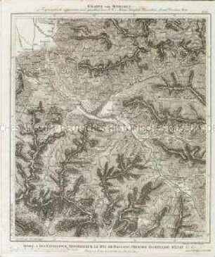
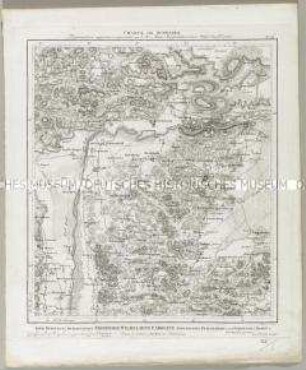
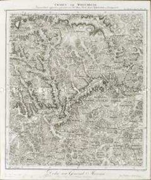
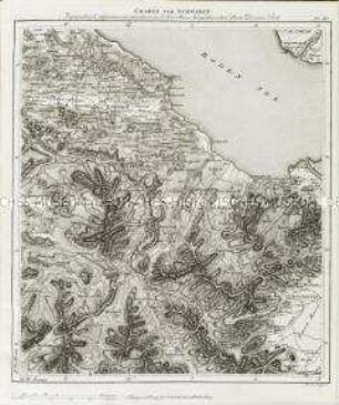
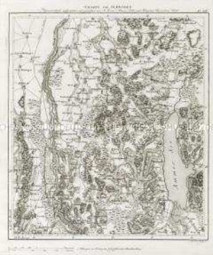
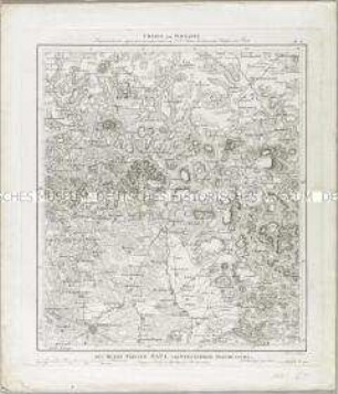
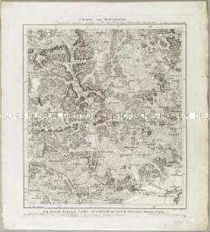
CHARTE von SCHWABEN / Trigonometrisch aufgenommen und gezeichnet von I. A. von Amman, Ritter und Königlich Baierschem Rath
- Location
-
Deutsches Historisches Museum, Berlin
- Inventory number
-
Do 2006/794.23
- Measurements
-
Höhe x Breite: 47 x 39,3 cm (Blatt)
Höhe x Breite: 39,5 x 34,5 cm (Karte)
- Material/Technique
-
Papier, Kupferstich
- Classification
-
Kartografie (Gattung)
- Subject (what)
-
Schweiz
Frauenfeld
- Event
-
Herstellung
- (who)
-
Kartograf, Landvermesser: Ignaz Ambros von Amman
Stecher: Gottlieb Friedrich Abel
Verlag: J. G. Cotta'sche Buchhandlung
- (where)
-
Stuttgart, Deutschland
- (when)
-
um 1812
- Rights
-
Deutsches Historisches Museum
- Last update
-
24.03.2023, 9:30 AM CET
Data provider
This object is provided by:
Stiftung Deutsches Historisches Museum. If you have any questions about the object, please contact the data provider.
Stiftung Deutsches Historisches Museum. If you have any questions about the object, please contact the data provider.
Object type
- Regionalkarte
Associated
- Kartograf, Landvermesser: Ignaz Ambros von Amman
- Stecher: Gottlieb Friedrich Abel
- Verlag: J. G. Cotta'sche Buchhandlung
Time of origin
- um 1812
Other Objects (12)
Charte von Schwaben No. 60

Charte von Schwaben No. 51

Charte von Schwaben No. 52
Charte von Schwaben No. 18

Charte von Schwaben No. 6

Charte von Schwaben No. 21
Charte von Schwaben No. 31
Charte von Schwaben No. 50
Charte von Schwaben No. 36
Charte von Schwaben No. 8

Charte von Schwaben No. 33
Charte von Schwaben No. 16
Charte von Schwaben No. 60
Charte von Schwaben No. 51
Charte von Schwaben No. 52
Charte von Schwaben No. 18
Charte von Schwaben No. 6
Charte von Schwaben No. 21
Charte von Schwaben No. 31
Charte von Schwaben No. 50
Charte von Schwaben No. 36
Charte von Schwaben No. 8
Charte von Schwaben No. 33