Altkarte | Stadtplan
Die Donau von Ulm bis Presburg : mit besonderer Rücksicht auf die Dampfschifffahrt
- Alternative title
-
Panorama der Donau von Ulm bis Preßburg
- Location
-
München, Bayerische Staatsbibliothek -- Hbks/X 9 f
- Dimensions
-
141 x 29 cm, gefaltet
- Extent
-
1 Kt.
- Language
-
Deutsch
- Notes
-
Lithographie
Mit 5 Stadtpl.: Ulm. Regensburg. Passau. Linz. Wien. - Mit 1 Nebenkt.: Uebersichts-Kärtchen. - Mit 1 Entfernungstab.: Tabelle über die Entfernungen sowohl zu Wasser als zu Lande, der längs der Donau, von Ulm bis Presburg liegenden Städte in deutsch. Meilen. - Maßstab auch in graph. Form (deutsche Meilen). - Mit Bergstrichen. - Umschlagtitel: Panorama der Donau von Ulm bis Preßburg
- Bibliographic citation
-
Panorama der Donau von Ulm bis Preßburg / von Friedrich Mayer ; Kartenband
- Keyword
-
Innenstadt
Hydrologie
Bandkarte
Linz
Wien
Ulm
Obere Donau
Passau
Regensburg
- Event
-
Veröffentlichung
- (where)
-
[Pforzheim]
- (who)
-
[Finck]
- (when)
-
[1841]
- Contributor
- URN
-
urn:nbn:de:bvb:12-bsb00090740-4
- Last update
-
16.04.2025, 8:49 AM CEST
Data provider
This object is provided by:
Bayerische Staatsbibliothek. If you have any questions about the object, please contact the data provider.
Bayerische Staatsbibliothek. If you have any questions about the object, please contact the data provider.
Object type
- Altkarte
- Stadtplan
Associated
- Groß, Rudolph
- Birmelin, Joh.
- [Finck]
Time of origin
- [1841]
Other Objects (12)
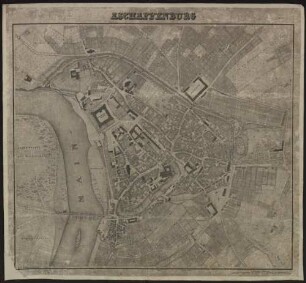
Aschaffenburg
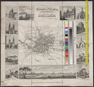
Grundriss von Nürnberg und seinen Umgebungen : Seiner Majestaet dem Könige Ludwig von Bayern in tiefster Ehrfurcht gewidmet vom Verleger
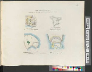
Plan" i drevnich" ukrěplenij v" g.g. Starodubě, Perejaslavlě, Sěvskě i Taganrogě
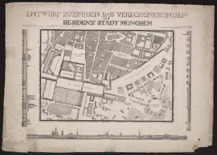
Entwurf Zu Einigen Bau-Verschönerungen Der Residenz-Stadt München
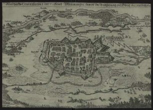
Warhaffte Contrafactur der Statt Memmingen sampt der Belagerung und Abzug : Anno 1647, den 13./23. Novem.
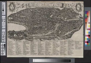
Roma
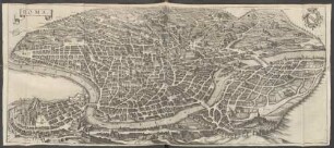
Roma
Pianta Della Citta Di Roma : Nell' Anno MDCCCXXX
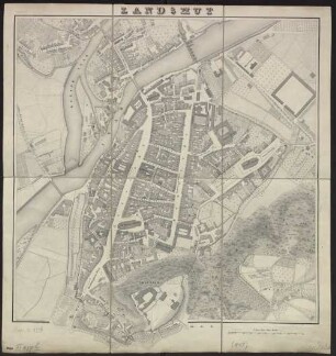
Landshut
![[München] : [Stadtplan]](https://iiif.deutsche-digitale-bibliothek.de/image/2/37f66f74-6abb-4fab-842a-69e82e132b34/full/!306,450/0/default.jpg)
[München] : [Stadtplan]
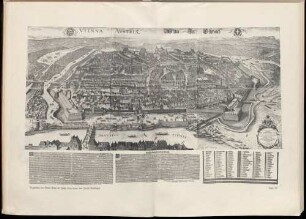
Vogelschau der Stadt Wien im Jahre 1609 (1640) von Jacob Hoefnagel
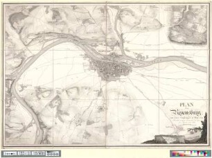
Plan von Regensburg mit seinen Umgebungen im Jahre 1829
Aschaffenburg
Grundriss von Nürnberg und seinen Umgebungen : Seiner Majestaet dem Könige Ludwig von Bayern in tiefster Ehrfurcht gewidmet vom Verleger
Plan" i drevnich" ukrěplenij v" g.g. Starodubě, Perejaslavlě, Sěvskě i Taganrogě
Entwurf Zu Einigen Bau-Verschönerungen Der Residenz-Stadt München
Warhaffte Contrafactur der Statt Memmingen sampt der Belagerung und Abzug : Anno 1647, den 13./23. Novem.
Roma
Roma
Pianta Della Citta Di Roma : Nell' Anno MDCCCXXX
Landshut
[München] : [Stadtplan]
Vogelschau der Stadt Wien im Jahre 1609 (1640) von Jacob Hoefnagel