Regionalkarte
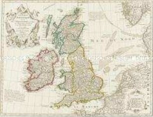
Les Isles Britanniques. Mit einer Nebenkarte: Orkney- und Shetlandinseln
- Alternative title
-
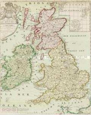
LES ISLES BRITANNIQUES / Comprenant les Royaumes / D'ANGLETERRE, ECOSSE, / et IRLANDE.
- Location
-
Deutsches Historisches Museum, Berlin
- Inventory number
-
Do 2006/118
- Measurements
-
Höhe x Breite: 57,5 x 81 cm (Blatt)
Höhe x Breite: 50,7 x 66,5 cm (Karte)
Höhe x Breite: 52,8 x 68 cm (Platte)
- Material/Technique
-
Druckfarbe, Papier, Kupferstich, grenzkoloriert
- Classification
-
Kartografie (Gattung)
- Subject (what)
-
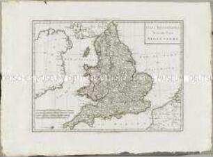
England
Schottland
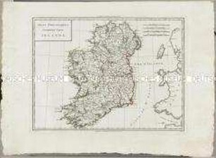
Irland
Großbritannien
Britische Inseln
- Event
-
Herstellung
- (who)
-
Geograph, Verleger: Jean-Baptiste Crepy?
- (where)
-
Paris, Frankreich
- (when)
-
1780
- Rights
-
Deutsches Historisches Museum
- Last update
-
24.03.2023, 9:29 AM CET
Data provider
This object is provided by:
Stiftung Deutsches Historisches Museum. If you have any questions about the object, please contact the data provider.
Stiftung Deutsches Historisches Museum. If you have any questions about the object, please contact the data provider.
Object type
- Regionalkarte
Associated
- Geograph, Verleger: Jean-Baptiste Crepy?
Time of origin
- 1780
Other Objects (12)
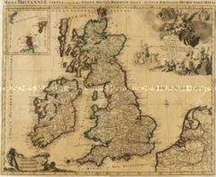
Les Isles Britanniques. Mit einer Nebenkarte: Orkney- und Shetlandinseln
Les Isles Britanniques. Mit einer Nebenkarte: Orkney und Shetland Inseln
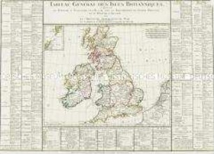
Tableau Général des Isles Britanniques. Mit einer Nebenkarte: Orkney- und Shetlandinseln
Les Isles Britanniques
Les Isles Britanniques

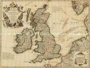
Carte des Isles Britanniques. Mit einer Nebenkarte: Suplément pour les Isles Orcades et de Schetland
Atlas Nouveau: Isles Britanniques Troisieme Carte
Atlas Nouveau: Isles Britanniques Cinquieme Carte

Atlas Nouveau: Isles Britanniques Quatrieme Carte
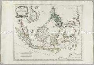
Archipel des Indes Orientales. Mit einer Nebenkarte: Isles Marianes
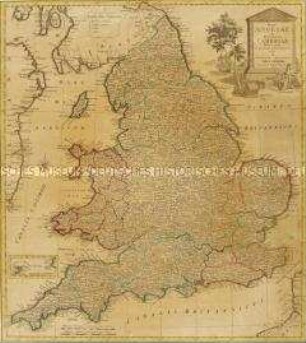
Regni Angliae et Principatus Cambriae. Mit einer Nebenkarte: Isles of Scilly
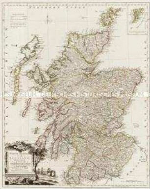
North Britain or Scotland divided into its Counties. Mit einer Nebenkarte: Shetland Isles
Les Isles Britanniques. Mit einer Nebenkarte: Orkney- und Shetlandinseln
Les Isles Britanniques. Mit einer Nebenkarte: Orkney und Shetland Inseln
Tableau Général des Isles Britanniques. Mit einer Nebenkarte: Orkney- und Shetlandinseln
Les Isles Britanniques
Les Isles Britanniques
Carte des Isles Britanniques. Mit einer Nebenkarte: Suplément pour les Isles Orcades et de Schetland
Atlas Nouveau: Isles Britanniques Troisieme Carte
Atlas Nouveau: Isles Britanniques Cinquieme Carte
Atlas Nouveau: Isles Britanniques Quatrieme Carte
Archipel des Indes Orientales. Mit einer Nebenkarte: Isles Marianes
Regni Angliae et Principatus Cambriae. Mit einer Nebenkarte: Isles of Scilly