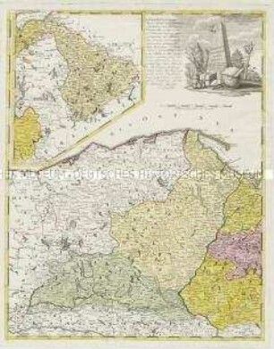
Regionalkarte
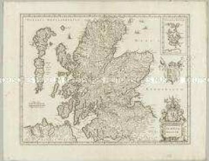
North Britain or Scotland divided into its Counties. Mit einer Nebenkarte: Shetland Isles
- Alternativer Titel
-
NORTH BRITAIN / OR / SCOTLAND / Divided into its
- Standort
-
Deutsches Historisches Museum, Berlin
- Inventarnummer
-
Do 2006/282
- Maße
-
Höhe x Breite: 79,2 x 63,3 cm (Blatt)
Höhe x Breite: 64,7 x 51,6 cm (Karte)
Höhe x Breite: 68,2 x 54,4 cm (Platte)
- Material/Technik
-
Druckfarbe, Papier, Kupferstich, grenzkoloriert
- Klassifikation
-
Kartografie (Gattung)
- Bezug (was)
-
Schottland
- Ereignis
-
Herstellung
- (wer)
-
Kartograf, Stecher, Verleger: William Faden
Stecher, Geograph, Kartograf: Thomas Kitchin
- (wo)
-
London, Großbritannien und Nordirland
- (wann)
-
1778
- Rechteinformation
-
Deutsches Historisches Museum
- Letzte Aktualisierung
-
24.03.2023, 09:30 MEZ
Datenpartner
Dieses Objekt wird bereitgestellt von:
Stiftung Deutsches Historisches Museum. Bei Fragen zum Objekt wenden Sie sich bitte an den Datenpartner.
Stiftung Deutsches Historisches Museum. Bei Fragen zum Objekt wenden Sie sich bitte an den Datenpartner.
Objekttyp
- Regionalkarte
Beteiligte
- Kartograf, Stecher, Verleger: William Faden
- Stecher, Geograph, Kartograf: Thomas Kitchin
Entstanden
- 1778
Ähnliche Objekte (12)
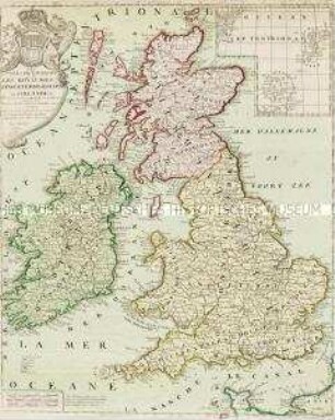
Les Isles Britanniques. Mit einer Nebenkarte: Orkney und Shetland Inseln
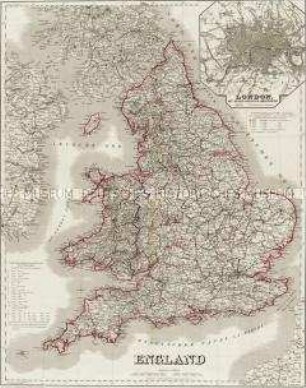
England. Mit einer Nebenkarte: London
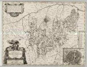
Territorium Norimbergense. Mit einer Nebenkarte: Nurnberg
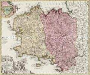
Tabula Ducatus Britanniae. Mit einer Nebenkarte: BREST
Borussiae Occidentalis Tabula. Mit einer Nebenkarte: Ermland
Scotia Regnum. Mit einer Nebenkarte: Orcades Insulae.
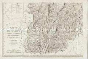
Carte du Tyrol. Mit einer Nebenkarte: Carte Générale
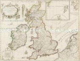
Les Isles Britanniques. Mit einer Nebenkarte: Orkney- und Shetlandinseln
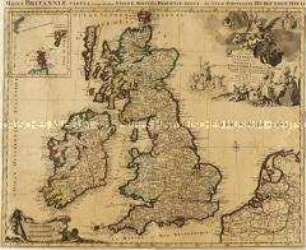
Les Isles Britanniques. Mit einer Nebenkarte: Orkney- und Shetlandinseln
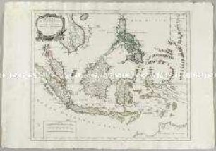
Archipel des Indes Orientales. Mit einer Nebenkarte: Isles Marianes
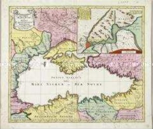
Nova Mappa Maris Nigri et Freti Constantinopolitani. Mit einer Nebenkarte
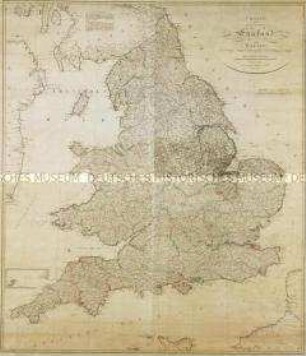
Charte von England und Wallis. Mit einer Nebenkarte (Insel Scilly)
Les Isles Britanniques. Mit einer Nebenkarte: Orkney und Shetland Inseln
England. Mit einer Nebenkarte: London
Territorium Norimbergense. Mit einer Nebenkarte: Nurnberg
Tabula Ducatus Britanniae. Mit einer Nebenkarte: BREST
Borussiae Occidentalis Tabula. Mit einer Nebenkarte: Ermland
Scotia Regnum. Mit einer Nebenkarte: Orcades Insulae.
Carte du Tyrol. Mit einer Nebenkarte: Carte Générale
Les Isles Britanniques. Mit einer Nebenkarte: Orkney- und Shetlandinseln
Les Isles Britanniques. Mit einer Nebenkarte: Orkney- und Shetlandinseln
Archipel des Indes Orientales. Mit einer Nebenkarte: Isles Marianes
Nova Mappa Maris Nigri et Freti Constantinopolitani. Mit einer Nebenkarte