- Location
-
München, Bayerische Staatsbibliothek -- Mapp. 45 g
- Dimensions
-
14 x 9 cm
- Extent
-
1 Kt.
- Language
-
Deutsch
- Notes
-
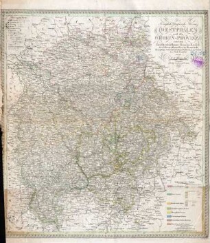
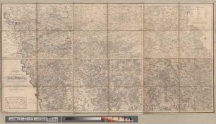
Stahlstich
Mit 4 Nebenkt. - Maßstab in graph. Form (geographische Meilen). - Mit Bergstrichen. - Zählung oben links: Lief. LVI. - Titel links Mitte
- Bibliographic citation
-
Radefeld, Carl C.: Atlas Zum Handgebrauch für die Gesammte Erdbeschreibung ; 44
- Keyword
-
Westfalen
- Event
-
Veröffentlichung
- (where)
-
Hildburghausen ; Amsterdam ; New York
- (who)
-
Bibliographisches Institut
- (when)
-
s.a. [erschienen: nach 1840]
- Contributor
- URN
-
urn:nbn:de:bvb:12-bsb00042544-2
- Last update
-
16.04.2025, 8:38 AM CEST
Data provider
This object is provided by:
Bayerische Staatsbibliothek. If you have any questions about the object, please contact the data provider.
Bayerische Staatsbibliothek. If you have any questions about the object, please contact the data provider.
Object type
- Altkarte
Associated
- Renner, L.
- Bibliographisches Institut
Time of origin
- s.a. [erschienen: nach 1840]
Other Objects (12)

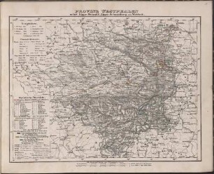
Provinz Westphalen
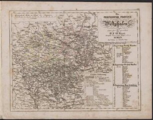
Die Preussische Provinz Westphalen

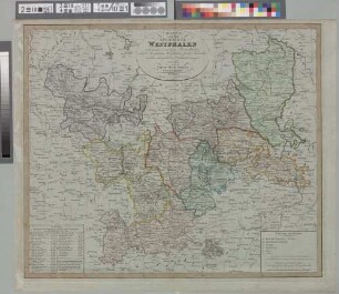
Die Provinz Westphalen Und Die Rheinprovinz
Provinz Westphalen nebst Lippe-Detmold, Lippe-Schaumburg und Waldeck

Westphalia : = Westphalen
Westphalia : = Westphalen
Charte von dem Königreiche Westphalen
Die Königlich Preussische Provinz Westphalen und die Rhein-Provinz nebst dem Kurfürstenthume Hessen-Kassel, Grossherzogthume Hessen-Darmstadt, Herzogthume Nassau, Fürstenthume Waldeck und dem Gebiete der Stadt Frankfurt
Westphaliae Totius Finitimarumque Regionum Accurata descriptio : = Westphalen
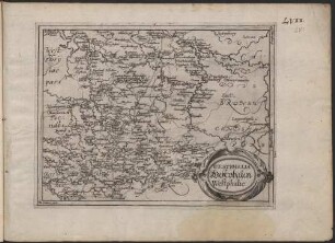
Das zum Erzstift und Kurfürstenthum Koelln gehörige Herzogthum Westphalen
Das zum Erzstift und Kurfürstenthum Koelln gehörige Herzogthum Westphalen
Charte von den Herzogthümern Berg und Westphalen : nebst den angränzenden Landestheilen
Provinz Westphalen
Die Preussische Provinz Westphalen
Die Provinz Westphalen Und Die Rheinprovinz
Provinz Westphalen nebst Lippe-Detmold, Lippe-Schaumburg und Waldeck
Westphalia : = Westphalen
Westphalia : = Westphalen
Charte von dem Königreiche Westphalen
Die Königlich Preussische Provinz Westphalen und die Rhein-Provinz nebst dem Kurfürstenthume Hessen-Kassel, Grossherzogthume Hessen-Darmstadt, Herzogthume Nassau, Fürstenthume Waldeck und dem Gebiete der Stadt Frankfurt
Westphaliae Totius Finitimarumque Regionum Accurata descriptio : = Westphalen
Das zum Erzstift und Kurfürstenthum Koelln gehörige Herzogthum Westphalen
Das zum Erzstift und Kurfürstenthum Koelln gehörige Herzogthum Westphalen