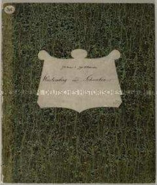
- Alternative title
-
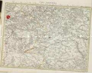
(Großer) Topographischer Atlas des Königreichs Baiern herausgegeben vom K. topographischen Bureau in München.
- Location
-
Deutsches Historisches Museum, Berlin
- Inventory number
-
Do 2006/1267.1-44
- Measurements
-
Höhe x Breite: 59 x 91 cm, Tiefe: 3,5 cm (Mappe)
- Material/Technique
-
Pappe (grün), Papier, Papier : Leinwand, Kupferstich, Lithographie
- Classification
-
Kartografie (Gattung)
- Subject (what)
-
Bayern
- Event
-
Herstellung
- (where)
-
München, Deutschland [historisch: Bayern, Königreich]
- (when)
-
1812 bis 1867
- Rights
-
Deutsches Historisches Museum
- Last update
-
24.03.2023, 9:30 AM CET
Data provider
This object is provided by:
Stiftung Deutsches Historisches Museum. If you have any questions about the object, please contact the data provider.
Stiftung Deutsches Historisches Museum. If you have any questions about the object, please contact the data provider.
Object type
- Regionalkarte
Time of origin
- 1812 bis 1867
Other Objects (12)

Atlas von Russland (unvollständig)
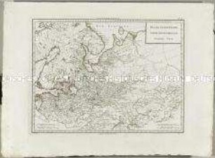
Charte von Schwaben (unvollständig; Titel nicht erhalten)

Atlas Nouveau: Russie Troisieme Carte
Atlas Nouveau: Russie Deuxieme Carte
Grand Atlas . Bl. 55 (Frankreich): Pour servir de Suite au grand Atlas d'Allemagne

Militair-Karte von Deutschland in fünf und zwanzig Blättern (unvollständig)

Atlas Nouveau: Isles Britanniques Quatrieme Carte
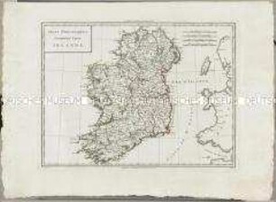
Atlas Nouveau: Isles Britanniques Cinquieme Carte
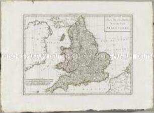
Atlas Nouveau: Isles Britanniques Troisieme Carte
Atlas Nouveau: Royaume de Danemarck Premiere Carte
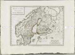
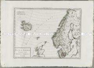
Atlas Nouveau: Royaume De Suède Troisieme Carte

Atlas Nouveau: Royaume de Danemarck Deuxieme Carte
Atlas von Russland (unvollständig)
Charte von Schwaben (unvollständig; Titel nicht erhalten)
Atlas Nouveau: Russie Troisieme Carte
Atlas Nouveau: Russie Deuxieme Carte
Grand Atlas . Bl. 55 (Frankreich): Pour servir de Suite au grand Atlas d'Allemagne
Militair-Karte von Deutschland in fünf und zwanzig Blättern (unvollständig)
Atlas Nouveau: Isles Britanniques Quatrieme Carte
Atlas Nouveau: Isles Britanniques Cinquieme Carte
Atlas Nouveau: Isles Britanniques Troisieme Carte
Atlas Nouveau: Royaume de Danemarck Premiere Carte
Atlas Nouveau: Royaume De Suède Troisieme Carte