Regionalkarte
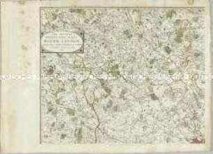
The second part of the general survey of England and Wales containing the whole of Devon and a portion of the adjoining counties (Titel nicht erhalten, unvollständig)
- Alternativer Titel
-
The second part of the general survey of England and Wales containing the whole of Devon and a portion of the adjoining counties
- Standort
-
Deutsches Historisches Museum, Berlin
- Inventarnummer
-
Do 2006/1266.1-48
- Maße
-
Höhe x Breite: 67 x 93,5 cm (Blatt 3)
Höhe x Breite: 58,5 x 88 cm (Karte 3)
- Material/Technik
-
Papier, Stahlstich
- Klassifikation
-
Kartografie (Gattung)
- Bezug (was)
-
England
Großbritannien
- Ereignis
-
Herstellung
- (wer)
-
Kartograf, Landvermesser: William Mudge
Stecher, Verleger: Benjamin Baker
Stecher: Ebenezer Bourne
Stecher, Verleger: Thomas Frederick Colby
Landvermesser, Stecher, Verleger: James Gardner
Verleger: ? Ramshaw
- (wo)
-
London, Großbritannien und Nordirland
- (wann)
-
1805 bis 1824
- Rechteinformation
-
Deutsches Historisches Museum
- Letzte Aktualisierung
-
24.03.2023, 09:28 MEZ
Datenpartner
Dieses Objekt wird bereitgestellt von:
Stiftung Deutsches Historisches Museum. Bei Fragen zum Objekt wenden Sie sich bitte an den Datenpartner.
Stiftung Deutsches Historisches Museum. Bei Fragen zum Objekt wenden Sie sich bitte an den Datenpartner.
Objekttyp
- Regionalkarte
Beteiligte
- Kartograf, Landvermesser: William Mudge
- Stecher, Verleger: Benjamin Baker
- Stecher: Ebenezer Bourne
- Stecher, Verleger: Thomas Frederick Colby
- Landvermesser, Stecher, Verleger: James Gardner
- Verleger: ? Ramshaw
Entstanden
- 1805 bis 1824
Ähnliche Objekte (12)
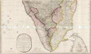
A Map of the Peninsula of India
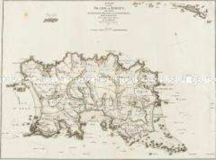
A Plan Of The Island Of Jersey
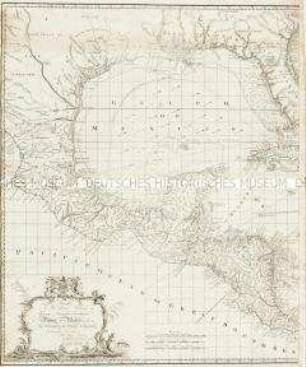
Chart of the West Indies.
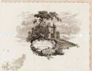
The County Palatine of Lancaster.
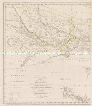
The Kingdoms of Bengal, Bahár, and parts of Orissa

An actual Survey, of the Provinces of Bengal, Bahar &c.
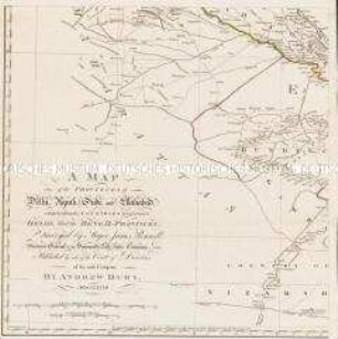
A Map of the Provinces of Delhi, Agrah, Oude, and Ellahabad, comprehending the Countries lying between Delhi, and the Bengal-Provinces
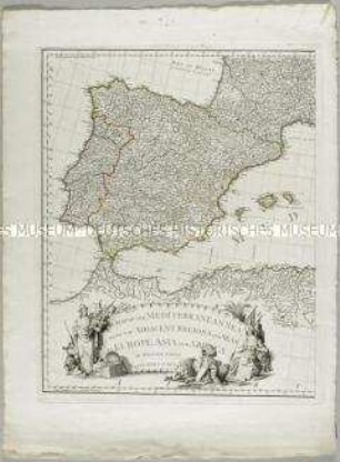
A Map of the Mediterranean Sea with the adjacent regions an seas in Europe, Asia and Africa
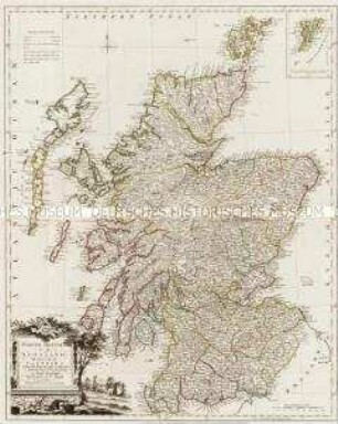
North Britain or Scotland divided into its Counties. Mit einer Nebenkarte: Shetland Isles
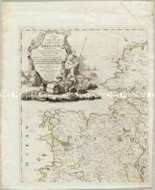
Landkarte von Irland mit einer Nebenkarte: The Sea Coasts of Great Britain and Ireland.
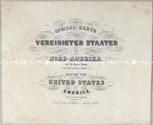
Special-Karte der Vereinigten Staaten von Nord-Amerika / Map of the United States. Mit einem Titelblatt und einer Nebenkarte
The Country twenty-five miles round London
A Map of the Peninsula of India
A Plan Of The Island Of Jersey
Chart of the West Indies.
The County Palatine of Lancaster.
The Kingdoms of Bengal, Bahár, and parts of Orissa
An actual Survey, of the Provinces of Bengal, Bahar &c.
A Map of the Provinces of Delhi, Agrah, Oude, and Ellahabad, comprehending the Countries lying between Delhi, and the Bengal-Provinces
A Map of the Mediterranean Sea with the adjacent regions an seas in Europe, Asia and Africa
North Britain or Scotland divided into its Counties. Mit einer Nebenkarte: Shetland Isles
Landkarte von Irland mit einer Nebenkarte: The Sea Coasts of Great Britain and Ireland.
Special-Karte der Vereinigten Staaten von Nord-Amerika / Map of the United States. Mit einem Titelblatt und einer Nebenkarte