- Alternative title
-
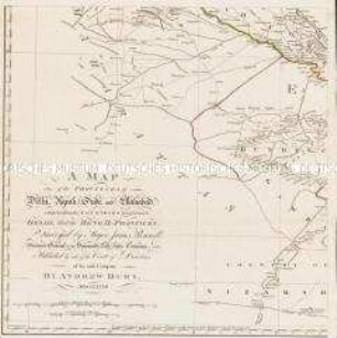
The KINGDOMS of / BENGAL, BAHÁR, / and parts of / ORISSA,
- Location
-
Deutsches Historisches Museum, Berlin
- Inventory number
-
Do 2006/270.1-2
- Measurements
-
Höhe x Breite: 79,8 x 63,2 cm (Blatt 1)
Höhe x Breite: 56,8 x 50 cm (Karte 1)
Höhe x Breite: 62 x 53,4 cm (Platte 1)
Höhe x Breite: 79,3 x 63 cm (Blatt 2)
Höhe x Breite: 56,7 x 49,8 cm (Karte 2)
Höhe x Breite: 61,5 x 53,4 cm (Platte 2)
- Material/Technique
-
Druckfarbe, Papier, Kupferstich, grenzkoloriert
- Classification
-
Kartografie (Gattung)
- Subject (what)
-
Indien
Südasien
Bengalen
Bihar
Orissa
- Event
-
Herstellung
- (who)
-
Geograph: William Bolts
Verlag: Jefferys and Faden
- (where)
-
London, Großbritannien und Nordirland
- (when)
-
1773
- Rights
-
Deutsches Historisches Museum
- Last update
- 24.03.2023, 9:30 AM CET
Data provider
This object is provided by:
Stiftung Deutsches Historisches Museum. If you have any questions about the object, please contact the data provider.
Stiftung Deutsches Historisches Museum. If you have any questions about the object, please contact the data provider.
Object type
- Regionalkarte
Associated
- Geograph: William Bolts
- Verlag: Jefferys and Faden
Time of origin
- 1773
Other Objects (12)

An actual Survey, of the Provinces of Bengal, Bahar &c.
A Map of the Provinces of Delhi, Agrah, Oude, and Ellahabad, comprehending the Countries lying between Delhi, and the Bengal-Provinces

Tabula Geographica Totam Borussiam ut et Districtum Notecensem. Mit einer Nebenkarte: Charte welche den Netz District vorstellet
Charte von Schwaben No. 60

Holstein, Lauenburg, Hamburg u. Lübeck
Charte von Schwaben (unvollständig; Titel nicht erhalten)
La Flandre, le Hainaut, le Brabant, l'Artois une partie de la Picardie, et du Luxembourg
Atlas Nouveau: Isles Britanniques Troisieme Carte
Grand Atlas . Bl. 43 (Böhmen...): Contenant une Partie du Royaume de Boheme, Scavoir la Ville de Prague, les Cercles de Ragonitz, Saatz, Leitmeriz, Kaurizim et de Buntzlau.
Gouvernemens généraux du Maine et Perche, de l'Anjou, de la Touraine et du Saumurois
Electoratus sive Marchia Brandenburgensis
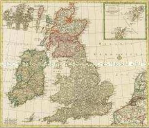
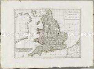
Nova Totius Angliae Scotiae Et Hiberniae. Mit einer Nebenkarte: Orcades Insulae borealiores
An actual Survey, of the Provinces of Bengal, Bahar &c.
A Map of the Provinces of Delhi, Agrah, Oude, and Ellahabad, comprehending the Countries lying between Delhi, and the Bengal-Provinces
Tabula Geographica Totam Borussiam ut et Districtum Notecensem. Mit einer Nebenkarte: Charte welche den Netz District vorstellet
Charte von Schwaben No. 60
Holstein, Lauenburg, Hamburg u. Lübeck
Charte von Schwaben (unvollständig; Titel nicht erhalten)
La Flandre, le Hainaut, le Brabant, l'Artois une partie de la Picardie, et du Luxembourg
Atlas Nouveau: Isles Britanniques Troisieme Carte
Grand Atlas . Bl. 43 (Böhmen...): Contenant une Partie du Royaume de Boheme, Scavoir la Ville de Prague, les Cercles de Ragonitz, Saatz, Leitmeriz, Kaurizim et de Buntzlau.
Gouvernemens généraux du Maine et Perche, de l'Anjou, de la Touraine et du Saumurois
Electoratus sive Marchia Brandenburgensis