- Alternative title
-
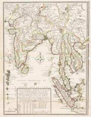
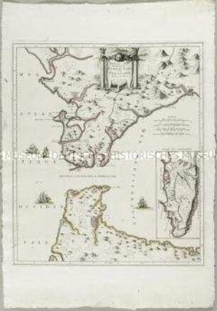
PRESQU'ISLE / DES INDES / ORIENTALES / en deçà du Gange,
- Location
-
Deutsches Historisches Museum, Berlin
- Inventory number
-
Do 2006/260
- Measurements
-
Höhe x Breite: 83,5 x 58,5 cm (Blatt)
Höhe x Breite: 74,2 x 50,4 cm (Karte)
Höhe x Breite: 78,8 x 54 cm (Platte)
- Material/Technique
-
Druckfarbe, Papier, Kupferstich, grenzkoloriert
- Classification
-
Kartografie (Gattung)
- Subject (what)
-
Asien
Südasien
Indien
- Event
-
Herstellung
- (who)
-
Geograph, Kartograf: Louis Brion de la Tour (1756)
- (where)
-
Paris, Frankreich
- (when)
-
1780
- Rights
-
Deutsches Historisches Museum
- Last update
-
24.03.2023, 9:30 AM CET
Data provider
This object is provided by:
Stiftung Deutsches Historisches Museum. If you have any questions about the object, please contact the data provider.
Stiftung Deutsches Historisches Museum. If you have any questions about the object, please contact the data provider.
Object type
- Regionalkarte
Associated
- Geograph, Kartograf: Louis Brion de la Tour (1756)
Time of origin
- 1780
Other Objects (12)
Les Indes Orientales
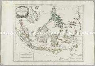
Archipel des Indes Orientales. Mit einer Nebenkarte: Isles Marianes
L'Isle de France
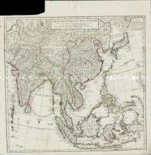
Carte des Indes et de la Chine
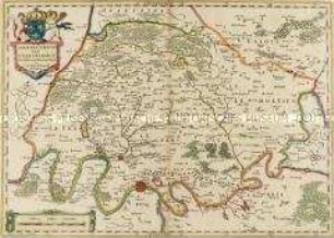
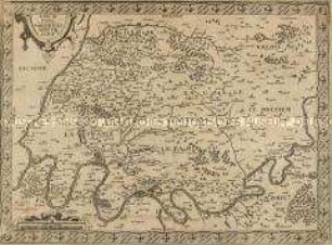
Ager Parisiensis Vulgo l'Isle De France
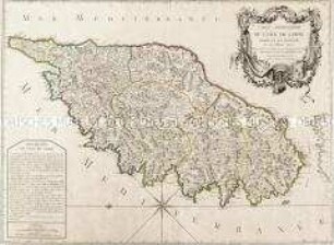
Carte particuliere de l'Isle de Corse
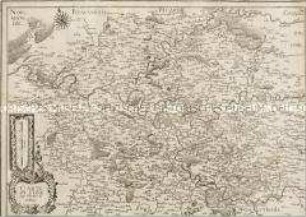
Carte de l'Isle de France et Brie
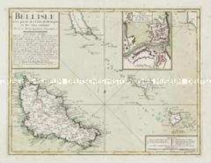
Bell'Isle avec partie des Côtes de Bretagne et les Isles voisines. Mit einer Nebenkarte: Plan de la Citadelle de Bell'Isle et du Palais

Atlas Nouveau: Carte de l'Isle de Cuba et des Isles Lucayes
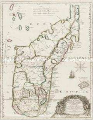
Isle Dauphine, communement nommée par les Europeens Madagascar, et St. Laurens et par les habitans du Pays Madecase
Nouvelle Carte du Détroit de Gibraltar et de I'Isle de Cadix. Mit einer Nebenkarte: Plan de Gibraltar
Grand Atlas . Bl. 46 (Frankreich. Champagne, Picárdie): Contenante une Partie d'Isle de France, de Champagne, de Picardie etc.
Les Indes Orientales
Archipel des Indes Orientales. Mit einer Nebenkarte: Isles Marianes
L'Isle de France
Carte des Indes et de la Chine
Ager Parisiensis Vulgo l'Isle De France
Carte particuliere de l'Isle de Corse
Carte de l'Isle de France et Brie
Bell'Isle avec partie des Côtes de Bretagne et les Isles voisines. Mit einer Nebenkarte: Plan de la Citadelle de Bell'Isle et du Palais
Atlas Nouveau: Carte de l'Isle de Cuba et des Isles Lucayes
Isle Dauphine, communement nommée par les Europeens Madagascar, et St. Laurens et par les habitans du Pays Madecase
Nouvelle Carte du Détroit de Gibraltar et de I'Isle de Cadix. Mit einer Nebenkarte: Plan de Gibraltar