- Alternativer Titel
-
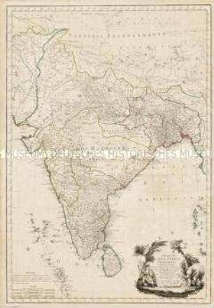
LES INDES ORIENTALES / Sous le Nom dêsqueles est compris / L'EMPIRE DU GRAND MOGOL, LES DEUX PRES= / QU'ISLES DE CA ET DE LA LE GANGE,
- Standort
-
Deutsches Historisches Museum, Berlin
- Inventarnummer
-
Do 2006/258
- Maße
-
Höhe x Breite: 79 x 58 cm (Blatt)
Höhe x Breite: 59,8 x 43,9 cm (Karte)
Höhe x Breite: 63,3 x 49 cm (Platte)
- Material/Technik
-
Druckfarbe, Papier, Kupferstich, grenzkoloriert
- Klassifikation
-
Kartografie (Gattung)
- Bezug (was)
-
Asien
Südasien
Indien
Südostasien
- Ereignis
-
Herstellung
- (wer)
-
Geograph, Stecher, Verleger: Nicolas de Fer
Verleger: Guillaume Danet
- (wo)
-
Paris, Frankreich
- (wann)
-
1721
- Rechteinformation
-
Deutsches Historisches Museum
- Letzte Aktualisierung
- 24.03.2023, 09:29 MEZ
Datenpartner
Dieses Objekt wird bereitgestellt von:
Stiftung Deutsches Historisches Museum.
Bei Fragen zum Objekt wenden Sie sich bitte an den Datenpartner.
Objekttyp
- Regionalkarte
Beteiligte
- Geograph, Stecher, Verleger: Nicolas de Fer
- Verleger: Guillaume Danet
Entstanden
- 1721
Ähnliche Objekte (12)
Presqu'Isle des Indes Orientales
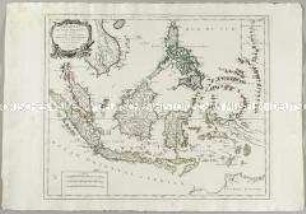
Archipel des Indes Orientales. Mit einer Nebenkarte: Isles Marianes
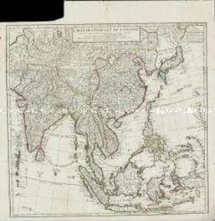
Carte des Indes et de la Chine
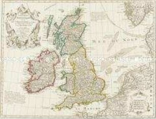
Les Isles Britanniques
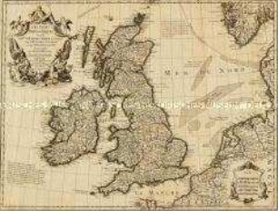
Les Isles Britanniques
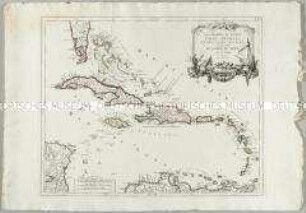
Les Grandes et Petites Isles Antilles et les Isles Lucayes
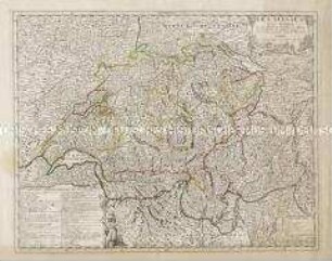
Les Suisses, Leurs Alliez
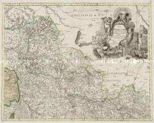
Les Etats de la Saxe
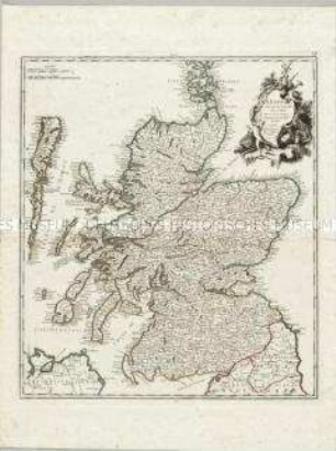
L'Ecosse suivant les Nouvelles Observationt
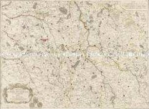
Les Provinces de Berry Bourbonnois et Nivernois
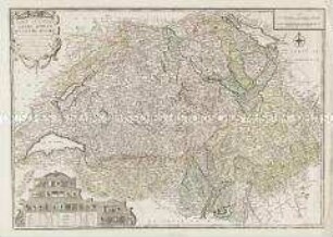
Les Suisses Leurs Sujets et Leurs Alliez
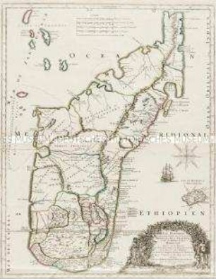
Isle Dauphine, communement nommée par les Europeens Madagascar, et St. Laurens et par les habitans du Pays Madecase
Presqu'Isle des Indes Orientales
Archipel des Indes Orientales. Mit einer Nebenkarte: Isles Marianes
Carte des Indes et de la Chine
Les Isles Britanniques
Les Isles Britanniques
Les Grandes et Petites Isles Antilles et les Isles Lucayes
Les Suisses, Leurs Alliez
Les Etats de la Saxe
L'Ecosse suivant les Nouvelles Observationt
Les Provinces de Berry Bourbonnois et Nivernois
Les Suisses Leurs Sujets et Leurs Alliez