- Alternativer Titel
-
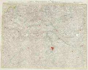
PRVSSIA
- Standort
-
Deutsches Historisches Museum, Berlin
- Inventarnummer
-
Do 2010/174
- Maße
-
Höhe x Breite: 43 x 53,5 cm (Blatt)
Höhe x Breite: 34,8 x 47 cm (Karte)
Höhe x Breite: 37,3 x 49,5 cm (Platte)
- Material/Technik
-
Papier, Kupferstich, koloriert
- Klassifikation
-
Kartografie (Gattung)
- Bezug (was)
-
Preußen
- Ereignis
-
Herstellung
- (wer)
-
Geograph, Astronom, Stecher, Kartograf, Landvermesser, Verleger: Gerard Mercator
- (wo)
-
Duisburg, Deutschland
- (wann)
-
um 1580
- Rechteinformation
-
Deutsches Historisches Museum
- Letzte Aktualisierung
-
24.03.2023, 09:27 MEZ
Datenpartner
Dieses Objekt wird bereitgestellt von:
Stiftung Deutsches Historisches Museum. Bei Fragen zum Objekt wenden Sie sich bitte an den Datenpartner.
Stiftung Deutsches Historisches Museum. Bei Fragen zum Objekt wenden Sie sich bitte an den Datenpartner.
Objekttyp
- Regionalkarte
Beteiligte
- Geograph, Astronom, Stecher, Kartograf, Landvermesser, Verleger: Gerard Mercator
Entstanden
- um 1580
Ähnliche Objekte (12)

Tabula Geographica Totam Borussiam ut et Districtum Notecensem. Mit einer Nebenkarte: Charte welche den Netz District vorstellet
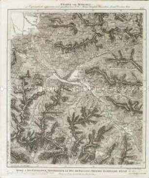
Charte von Schwaben No. 60

Holstein, Lauenburg, Hamburg u. Lübeck
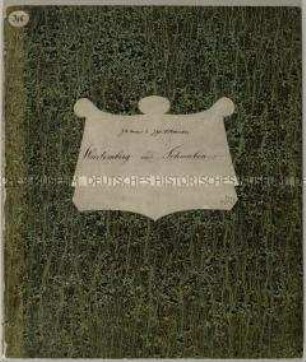
Charte von Schwaben (unvollständig; Titel nicht erhalten)
La Flandre, le Hainaut, le Brabant, l'Artois une partie de la Picardie, et du Luxembourg
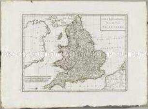
Atlas Nouveau: Isles Britanniques Troisieme Carte
Grand Atlas . Bl. 43 (Böhmen...): Contenant une Partie du Royaume de Boheme, Scavoir la Ville de Prague, les Cercles de Ragonitz, Saatz, Leitmeriz, Kaurizim et de Buntzlau.
Gouvernemens généraux du Maine et Perche, de l'Anjou, de la Touraine et du Saumurois
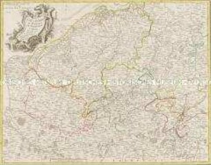
Electoratus sive Marchia Brandenburgensis
China
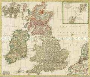
Nova Totius Angliae Scotiae Et Hiberniae. Mit einer Nebenkarte: Orcades Insulae borealiores

Chorographische Karte des Koenigreichs Hannover. (Titel nicht erhalten!) Mit zwei Nebenkarten: Kleine Postkarte des Königreichs Hannover; Post Karte des Königreichs Hannover
Tabula Geographica Totam Borussiam ut et Districtum Notecensem. Mit einer Nebenkarte: Charte welche den Netz District vorstellet
Charte von Schwaben No. 60
Holstein, Lauenburg, Hamburg u. Lübeck
Charte von Schwaben (unvollständig; Titel nicht erhalten)
La Flandre, le Hainaut, le Brabant, l'Artois une partie de la Picardie, et du Luxembourg
Atlas Nouveau: Isles Britanniques Troisieme Carte
Grand Atlas . Bl. 43 (Böhmen...): Contenant une Partie du Royaume de Boheme, Scavoir la Ville de Prague, les Cercles de Ragonitz, Saatz, Leitmeriz, Kaurizim et de Buntzlau.
Gouvernemens généraux du Maine et Perche, de l'Anjou, de la Touraine et du Saumurois
Electoratus sive Marchia Brandenburgensis
China
Nova Totius Angliae Scotiae Et Hiberniae. Mit einer Nebenkarte: Orcades Insulae borealiores