Regionalkarte
Chorographische Karte des Koenigreichs Hannover. (Titel nicht erhalten!) Mit zwei Nebenkarten: Kleine Postkarte des Königreichs Hannover; Post Karte des Königreichs Hannover
- Alternativer Titel
-
Chorographische / KARTE / DES / Koenigreichs Hannover
- Standort
-
Deutsches Historisches Museum, Berlin
- Inventarnummer
-
Do 2006/804.1-32
- Maße
-
Höhe x Breite: 30,7 x 42,5 cm, Tiefe: 1 cm (Atlas)
Höhe x Breite: 30 x 41,3 cm (Blatt 1)
Höhe x Breite: 27,6 x 38,8 cm (Karte 1)
Höhe x Breite: 42,7 x 56,7 cm (Blatt 32)
Höhe x Breite: 39,6 x 54,3 cm (Karte 32)
- Material/Technik
-
Papier, Kupferstich, grenzkoloriert
- Klassifikation
-
Kartografie (Gattung)
- Bezug (was)
-
Hannover
Braunschweig
Oldenburg (Oldenburg)
Norddeutschland
- Ereignis
-
Herstellung
- (wer)
-
Kartograf: Wilhelm Müller
Stecher, Kartograf: W. Wagner
Stecher: ? Schwab
Stecher: J. F. Saltzenberg
Stecher, Kartograf: F. Dorndorf
- (wo)
-
Hannover?, Deutschland
- (wann)
-
um 1818
- Rechteinformation
-
Deutsches Historisches Museum
- Letzte Aktualisierung
- 24.03.2023, 09:29 MEZ
Datenpartner
Dieses Objekt wird bereitgestellt von:
Stiftung Deutsches Historisches Museum. Bei Fragen zum Objekt wenden Sie sich bitte an den Datenpartner.
Stiftung Deutsches Historisches Museum. Bei Fragen zum Objekt wenden Sie sich bitte an den Datenpartner.
Objekttyp
- Regionalkarte
Beteiligte
- Kartograf: Wilhelm Müller
- Stecher, Kartograf: W. Wagner
- Stecher: ? Schwab
- Stecher: J. F. Saltzenberg
- Stecher, Kartograf: F. Dorndorf
Entstanden
- um 1818
Ähnliche Objekte (12)

Chorographische Karte des Königreichs Hannover, Grossherzogtums Oldenburg, Herzogthums Braunschweig, der Fürstenthümer Lippe-Detmold, Schaumburg Lippe und Pyrmont, der Gebiete der freien Reichsstädte Hamburg und Bremen und der angrenzenden Gegenden
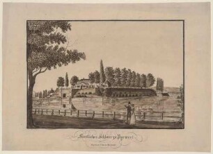
Das Schloss Pyrmont in Bad Pyrmont in Niedersachsen

Tafel 66: Entwurf für ein Rathaus

Zum Kapitel künstlicher Lüftung.

Nochmals Dr. Katz' Spreutafeln.

Verwendung der Hohlbacksteine im Bauwesen.

Gypsdielen, Schilfbretter, Spreutafeln.

Verwendung der Hohlbacksteine im Bauwesen.

Der Brunnenplatz in Bad Pyrmont in Niedersachsen

Die Partheil-Probstschen Konzentrationsbestrebungen

Dinge und Bilder

Wie lernt das Kind die Muttersprache verstehen? : (Schluß)
Chorographische Karte des Königreichs Hannover, Grossherzogtums Oldenburg, Herzogthums Braunschweig, der Fürstenthümer Lippe-Detmold, Schaumburg Lippe und Pyrmont, der Gebiete der freien Reichsstädte Hamburg und Bremen und der angrenzenden Gegenden
Das Schloss Pyrmont in Bad Pyrmont in Niedersachsen
Tafel 66: Entwurf für ein Rathaus
Zum Kapitel künstlicher Lüftung.
Nochmals Dr. Katz' Spreutafeln.
Verwendung der Hohlbacksteine im Bauwesen.
Gypsdielen, Schilfbretter, Spreutafeln.
Verwendung der Hohlbacksteine im Bauwesen.
Der Brunnenplatz in Bad Pyrmont in Niedersachsen
Die Partheil-Probstschen Konzentrationsbestrebungen
Dinge und Bilder