Militärkarte
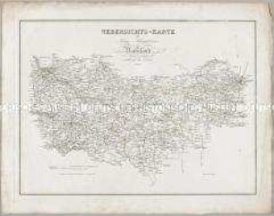
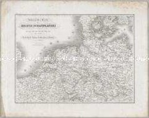
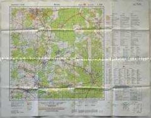
Karten und Plane zur Kriegsgeschichte von Bayern: Uebersichts-Karte von Schlesien
- Alternative title
-
Uebersichts-Karte / von / SCHLESIEN / zur
- Location
-
Deutsches Historisches Museum, Berlin
- Inventory number
-
Do 2006/1259
- Measurements
-
Höhe x Breite: 48 x 60 cm (Blatt)
Höhe x Breite: 35 x 47,5 cm (Karte)
Höhe x Breite: 44 x 54,7 cm (Platte)
- Material/Technique
-
Papier, Kupferstich
- Classification
-
Kartografie (Gattung)
- Subject (what)
-
Schlesien
Militär
- Event
-
Herstellung
- (who)
-
Kartograf: C. Macco
Kartograf, Topograph: Johann Georg Mayr
- (where)
-
München, Deutschland [historisch: Bayern, Königreich]
- (when)
-
um 1826
- Rights
-
Deutsches Historisches Museum
- Last update
-
24.03.2023, 9:32 AM CET
Data provider
This object is provided by:
Stiftung Deutsches Historisches Museum. If you have any questions about the object, please contact the data provider.
Stiftung Deutsches Historisches Museum. If you have any questions about the object, please contact the data provider.
Object type
- Militärkarte
Associated
- Kartograf: C. Macco
- Kartograf, Topograph: Johann Georg Mayr
Time of origin
- um 1826
Other Objects (12)
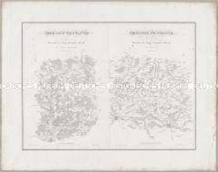
Karten und Plane zur Kriegsgeschichte von Bayern: Uebersichts-Karte des Kriegs-Schauplatzes in Russland
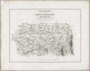
Karten und Plane zur Kriegsgeschichte von Bayern: Uebersichts-Karte eines Theils des Kriegs Schauplatzes in Frankreich
Karten und Plane zur Kriegsgeschichte von Bayern: Umgegend von Pultusk / Umgegend von Polotzk
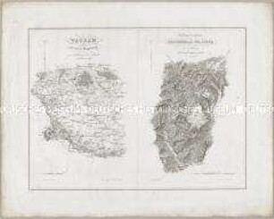
Karten und Plane zur Kriegsgeschichte von Bayern: Wagram; Die Gegend zwischen Reichenhall und Lofer
Karten und Plane zur Kriegsgeschichte von Bayern: Uebersichtskarte des Kriegsschauplatzes waehrend der Jahre 1800, 1805, 1806, 1807, 1809, 1813, 1814, und 1815

Topografische Karte vom Truppenübungsplatz Altengrabow
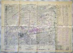
Topografische Karte des Truppenübungsplatzes Munster-Nord
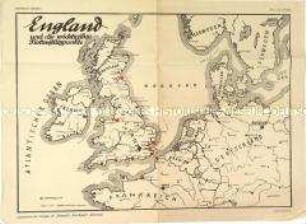
Militärische Karte mit den englischen Flottenstützpunkten
Topografische Karte des Truppenübungsplatzes Munster-Nord
Topografische Karte des Truppenübungsplatzes Munster-Nord

Strategische Karte für Transporte auf dem Seeweg
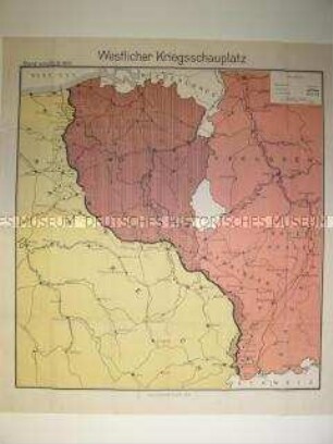
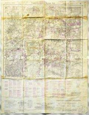
Militärstrategische Karte der Westfront vom September 1917
Karten und Plane zur Kriegsgeschichte von Bayern: Uebersichts-Karte des Kriegs-Schauplatzes in Russland
Karten und Plane zur Kriegsgeschichte von Bayern: Uebersichts-Karte eines Theils des Kriegs Schauplatzes in Frankreich
Karten und Plane zur Kriegsgeschichte von Bayern: Umgegend von Pultusk / Umgegend von Polotzk
Karten und Plane zur Kriegsgeschichte von Bayern: Wagram; Die Gegend zwischen Reichenhall und Lofer
Karten und Plane zur Kriegsgeschichte von Bayern: Uebersichtskarte des Kriegsschauplatzes waehrend der Jahre 1800, 1805, 1806, 1807, 1809, 1813, 1814, und 1815
Topografische Karte vom Truppenübungsplatz Altengrabow
Topografische Karte des Truppenübungsplatzes Munster-Nord
Militärische Karte mit den englischen Flottenstützpunkten
Topografische Karte des Truppenübungsplatzes Munster-Nord
Topografische Karte des Truppenübungsplatzes Munster-Nord
Strategische Karte für Transporte auf dem Seeweg