Militärkarte
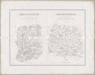
Karten und Plane zur Kriegsgeschichte von Bayern: Uebersichts-Karte eines Theils des Kriegs Schauplatzes in Frankreich
- Alternativer Titel
-
Uebersichts-Karte / eines Theils des / KRIEGS SCHAUPLATZES / in
- Standort
-
Deutsches Historisches Museum, Berlin
- Inventarnummer
-
Do 2006/1264
- Maße
-
Höhe x Breite: 48 x 60 cm (Blatt)
Höhe x Breite: 35 x 47,3 cm (Karte)
Höhe x Breite: 44 x 55,5 cm (Platte)
- Material/Technik
-
Papier, Kupferstich
- Klassifikation
-
Kartografie (Gattung)
- Bezug (was)
-
Frankreich
- Ereignis
-
Herstellung
- (wer)
-
Kartograf, Stecher: Franz Lau
Kartograf, Topograph, Stecher: Johann Georg Mayr
- (wo)
-
München, Deutschland [historisch: Bayern, Königreich]
- (wann)
-
um 1826
- Rechteinformation
-
Deutsches Historisches Museum
- Letzte Aktualisierung
-
24.03.2023, 09:31 MEZ
Datenpartner
Dieses Objekt wird bereitgestellt von:
Stiftung Deutsches Historisches Museum. Bei Fragen zum Objekt wenden Sie sich bitte an den Datenpartner.
Stiftung Deutsches Historisches Museum. Bei Fragen zum Objekt wenden Sie sich bitte an den Datenpartner.
Objekttyp
- Militärkarte
Beteiligte
- Kartograf, Stecher: Franz Lau
- Kartograf, Topograph, Stecher: Johann Georg Mayr
Entstanden
- um 1826
Ähnliche Objekte (12)
Karten und Plane zur Kriegsgeschichte von Bayern: Umgegend von Pultusk / Umgegend von Polotzk
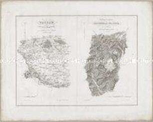
Karten und Plane zur Kriegsgeschichte von Bayern: Wagram; Die Gegend zwischen Reichenhall und Lofer
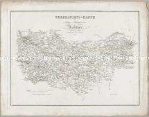
Karten und Plane zur Kriegsgeschichte von Bayern: Uebersichts-Karte des Kriegs-Schauplatzes in Russland

Karten und Plane zur Kriegsgeschichte von Bayern: Hanau
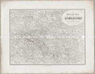
Karten und Plane zur Kriegsgeschichte von Bayern: Uebersichts-Karte von Schlesien
![372-374 [Rezension] Rost, Hans, Das konfessionelle Schicksal Deutschlands](https://iiif.deutsche-digitale-bibliothek.de/image/2/5ced28d8-fa4c-4da7-9cea-e846e5af2f17/full/!306,450/0/default.jpg)
372-374 [Rezension] Rost, Hans, Das konfessionelle Schicksal Deutschlands
![59-61 [Rezension] Hutten, Kurt, Seher, Grübler, Enthusiasten](https://iiif.deutsche-digitale-bibliothek.de/image/2/f85390b4-6723-4eca-bba2-405124a93a1d/full/!306,450/0/default.jpg)
59-61 [Rezension] Hutten, Kurt, Seher, Grübler, Enthusiasten
![618-619 [Rezension] Rich, Arthur, Die Anfänge der Theologie Huldrych Zwinglis](https://iiif.deutsche-digitale-bibliothek.de/image/2/ced40a1a-ff22-4148-92b7-546dda139191/full/!306,450/0/default.jpg)
618-619 [Rezension] Rich, Arthur, Die Anfänge der Theologie Huldrych Zwinglis
![678-679 [Rezension] Stadelmann, Rudolf, Das Zeitalter der Reformation](https://iiif.deutsche-digitale-bibliothek.de/image/2/f9388ae0-2280-4dca-888b-50591468d6c7/full/!306,450/0/default.jpg)
678-679 [Rezension] Stadelmann, Rudolf, Das Zeitalter der Reformation
![231-232 [Rezension] Delius, Walter, Die evangelische Kirche und die Revolution 1848](https://iiif.deutsche-digitale-bibliothek.de/image/2/06645c64-1afd-4da0-846f-39c0abcdb1f2/full/!306,450/0/default.jpg)
231-232 [Rezension] Delius, Walter, Die evangelische Kirche und die Revolution 1848
![205-207 [Rezension] Vereinigung der Seele mit Gott](https://iiif.deutsche-digitale-bibliothek.de/image/2/61c0f3ad-d405-4708-bec2-010a27afcd1c/full/!306,450/0/default.jpg)
205-207 [Rezension] Vereinigung der Seele mit Gott
![742-743 [Rezension] Solzbacher, Joseph, Kaspar Ulenberg](https://iiif.deutsche-digitale-bibliothek.de/image/2/0bd5c30e-b4ee-4e1a-be2a-547f1a5b04e9/full/!306,450/0/default.jpg)
742-743 [Rezension] Solzbacher, Joseph, Kaspar Ulenberg
Karten und Plane zur Kriegsgeschichte von Bayern: Umgegend von Pultusk / Umgegend von Polotzk
Karten und Plane zur Kriegsgeschichte von Bayern: Wagram; Die Gegend zwischen Reichenhall und Lofer
Karten und Plane zur Kriegsgeschichte von Bayern: Uebersichts-Karte des Kriegs-Schauplatzes in Russland
Karten und Plane zur Kriegsgeschichte von Bayern: Hanau
Karten und Plane zur Kriegsgeschichte von Bayern: Uebersichts-Karte von Schlesien
372-374 [Rezension] Rost, Hans, Das konfessionelle Schicksal Deutschlands
59-61 [Rezension] Hutten, Kurt, Seher, Grübler, Enthusiasten
618-619 [Rezension] Rich, Arthur, Die Anfänge der Theologie Huldrych Zwinglis
678-679 [Rezension] Stadelmann, Rudolf, Das Zeitalter der Reformation
231-232 [Rezension] Delius, Walter, Die evangelische Kirche und die Revolution 1848
205-207 [Rezension] Vereinigung der Seele mit Gott