- Alternativer Titel
-
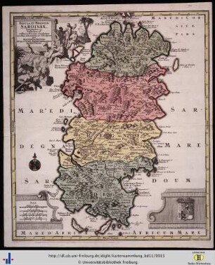
INSULA ET REGNUM / SARDINIAE, / Longitudine 45. / Latitudine 26.
- Standort
-
Deutsches Historisches Museum, Berlin
- Inventarnummer
-
Do 2006/584
- Maße
-
Höhe x Breite: 73 x 58,3 cm (Blatt)
Höhe x Breite: 55 x 47,3 cm (Karte)
Höhe x Breite: 58 x 50 cm (Platte)
- Material/Technik
-
Papier, Kupferstich, koloriert
- Klassifikation
-
Kartografie (Gattung)
- Bezug (was)
-
Sardinien
- Ereignis
-
Herstellung
- (wer)
-
Stecher, Geograph, Verleger: Tobias Konrad Lotter
- (wo)
-
Augsburg, Deutschland [historisch: Heiliges Römisches Reich deutscher Nation]
- (wann)
-
nach 1756
- Rechteinformation
-
Deutsches Historisches Museum
- Letzte Aktualisierung
-
24.03.2023, 09:32 MEZ
Datenpartner
Dieses Objekt wird bereitgestellt von:
Stiftung Deutsches Historisches Museum. Bei Fragen zum Objekt wenden Sie sich bitte an den Datenpartner.
Stiftung Deutsches Historisches Museum. Bei Fragen zum Objekt wenden Sie sich bitte an den Datenpartner.
Objekttyp
- Regionalkarte
Beteiligte
- Stecher, Geograph, Verleger: Tobias Konrad Lotter
Entstanden
- nach 1756
Ähnliche Objekte (12)
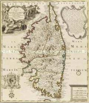
Insula Corsica

Rugia Insula ac Ducatus
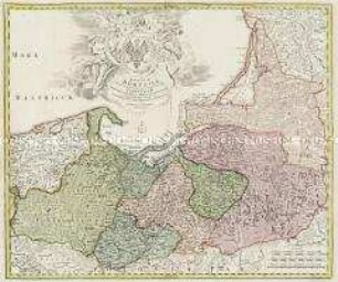
Regnum Borussiae
Regnum Borussiae
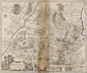
Navarra Regnum
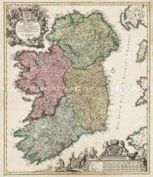
Hiberniae Regnum
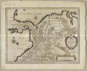
Terra Firma et Novum Regnum Granatense et Popayan
"SARDINIAE REGNUM ET INSULA ..."
Insula et Regnum Sardiniae.
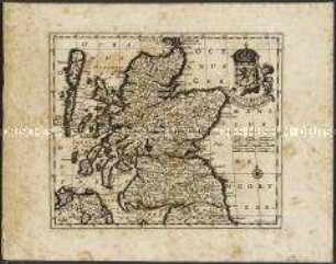
Scotiae Regnum / Königreich Schottland.

Mappa Geographica Regnum Bohemiae
Mappa Geographica Regnum Bohemiae
Insula Corsica
Rugia Insula ac Ducatus
Regnum Borussiae
Regnum Borussiae
Navarra Regnum
Hiberniae Regnum
Terra Firma et Novum Regnum Granatense et Popayan
"SARDINIAE REGNUM ET INSULA ..."
Insula et Regnum Sardiniae.
Scotiae Regnum / Königreich Schottland.
Mappa Geographica Regnum Bohemiae
Mappa Geographica Regnum Bohemiae
Insula Corsica
Rugia Insula ac Ducatus
Regnum Borussiae
Regnum Borussiae
Navarra Regnum
Hiberniae Regnum
Terra Firma et Novum Regnum Granatense et Popayan
"SARDINIAE REGNUM ET INSULA ..."
Insula et Regnum Sardiniae.
Scotiae Regnum / Königreich Schottland.
Mappa Geographica Regnum Bohemiae