- Alternative title
-
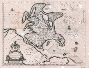
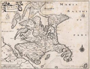
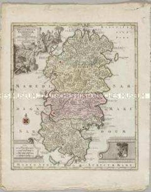
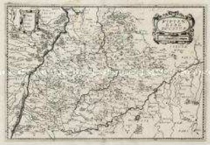
RVGIA/ INSVLA AC DVCATVS/ accuratissimè descripta ab E. Lubino./ Adjecta sunt ad utrumq[ue] latus Baronum et Nobilium/ antiquissimarum familiarum in Insula Rugia habi=/ tantium, juxta alphabeti ordinem, Insignia./ Arces nobilium pleraeq[ue] hoc signo notantur.
- Location
-
Deutsches Historisches Museum, Berlin
- Inventory number
-
Do 2002/132
- Measurements
-
Höhe x Breite: 52 x 61,1 cm (Blatt), Höhe x Breite: 38,2 x 49,5 cm (Platte)
- Material/Technique
-
Papier, Kupferstich, koloriert
- Classification
-
Kartografie (Gattung)
- Subject (what)
-
Rügen
Pommern
- Event
-
Herstellung
- (who)
-
Kartograf: Eilhard Lübben
Kupferstecher: Willem Janszoon Blaeu
- (where)
-
Amsterdam [historisch: Amstelodami], Niederlande
- (when)
-
um 1600
- Rights
-
Deutsches Historisches Museum
- Last update
-
24.03.2023, 9:31 AM CET
Data provider
This object is provided by:
Stiftung Deutsches Historisches Museum. If you have any questions about the object, please contact the data provider.
Stiftung Deutsches Historisches Museum. If you have any questions about the object, please contact the data provider.
Object type
- Regionalkarte
Associated
- Kartograf: Eilhard Lübben
- Kupferstecher: Willem Janszoon Blaeu
Time of origin
- um 1600
Other Objects (12)
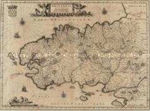
Britannia Ducatus / Sarnia Insula / Carte de Bretagne
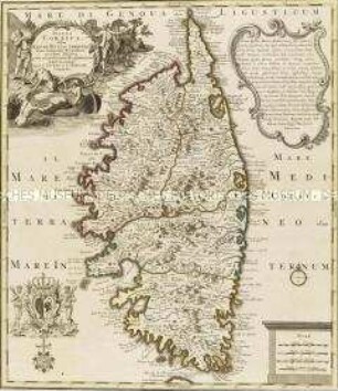
Insula Corsica
Rugia Insula ac Ducatus
Rugia Insula ac Ducatus

Rugia Insula ac Ducatus
Insula et Regnum Sardiniae

Ducatus Pomeraniae
Ducatus Lutzenburgensis
Ducatus Silesiae
Bavaria Ducatus
Wirtenberg Ducatus
Ducatus Breslanus
Britannia Ducatus / Sarnia Insula / Carte de Bretagne
Insula Corsica
Rugia Insula ac Ducatus
Rugia Insula ac Ducatus
Rugia Insula ac Ducatus
Insula et Regnum Sardiniae
Ducatus Pomeraniae
Ducatus Lutzenburgensis
Ducatus Silesiae
Bavaria Ducatus
Wirtenberg Ducatus
Ducatus Breslanus
Britannia Ducatus / Sarnia Insula / Carte de Bretagne
Insula Corsica
Rugia Insula ac Ducatus
Rugia Insula ac Ducatus
Rugia Insula ac Ducatus
Insula et Regnum Sardiniae
Ducatus Pomeraniae
Ducatus Lutzenburgensis
Ducatus Silesiae
Bavaria Ducatus
Wirtenberg Ducatus