- Alternative title
-
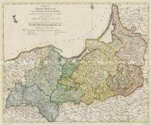
REGNUM / BORUSSIAE / Glorioris auspicÿs Serenissimi et Potentissimi Prin. / FRIDERICI III
- Location
-
Deutsches Historisches Museum, Berlin
- Inventory number
-
Do 2006/517
- Measurements
-
Höhe x Breite: 57 x 62,2 cm (Blatt)
Höhe x Breite: 46,5 x 55,3 cm (Karte)
Höhe x Breite: 49,2 x 58,4 cm (Platte)
- Material/Technique
-
Druckfarbe, Papier, Kupferstich, koloriert
- Classification
-
Kartografie (Gattung)
- Subject (what)
-
Preußen
Polen
- Event
-
Herstellung
- (who)
-
Verleger, Kupferstecher, Geograph, Kartograf: Johann Baptist Homann
- (where)
-
Nürnberg, Deutschland
- (when)
-
um 1710
- Rights
-
Deutsches Historisches Museum
- Last update
- 24.03.2023, 9:30 AM CET
Data provider
This object is provided by:
Stiftung Deutsches Historisches Museum. If you have any questions about the object, please contact the data provider.
Stiftung Deutsches Historisches Museum. If you have any questions about the object, please contact the data provider.
Object type
- Regionalkarte
Associated
- Verleger, Kupferstecher, Geograph, Kartograf: Johann Baptist Homann
Time of origin
- um 1710
Other Objects (12)

Regnum Borussiae
Tractuum Borussiae
Prospectus Regni Borussiae
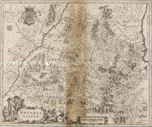
Navarra Regnum
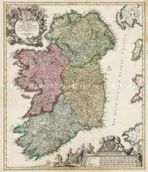
Hiberniae Regnum
Regnum Borussiae Gloriosis auspicijs Serenissimi e(t) Potentissimi Princ(ipis) Friderici III. Primi Borussiae Regis, March(ionis) Et Elect(oris) Brand(enburgensis) inauguratum die 18. Ian(uarii) A(nno) 1701. Geographice cum vicinis Regionibus adumbratum
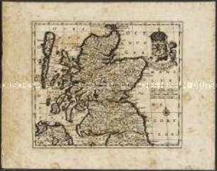
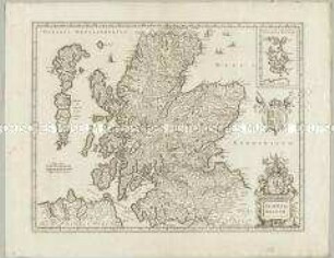
Scotiae Regnum / Königreich Schottland.
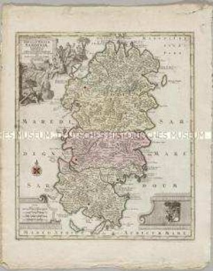
Insula et Regnum Sardiniae

Mappa Geographica Regnum Bohemiae
Mappa Geographica Regnum Bohemiae
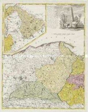
Borussiae Occidentalis Tabula. Mit einer Nebenkarte: Ermland
Scotia Regnum. Mit einer Nebenkarte: Orcades Insulae.
Regnum Borussiae
Tractuum Borussiae
Prospectus Regni Borussiae
Navarra Regnum
Hiberniae Regnum
Regnum Borussiae Gloriosis auspicijs Serenissimi e(t) Potentissimi Princ(ipis) Friderici III. Primi Borussiae Regis, March(ionis) Et Elect(oris) Brand(enburgensis) inauguratum die 18. Ian(uarii) A(nno) 1701. Geographice cum vicinis Regionibus adumbratum
Scotiae Regnum / Königreich Schottland.
Insula et Regnum Sardiniae
Mappa Geographica Regnum Bohemiae
Mappa Geographica Regnum Bohemiae
Borussiae Occidentalis Tabula. Mit einer Nebenkarte: Ermland