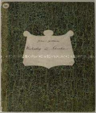
- Alternative title
-
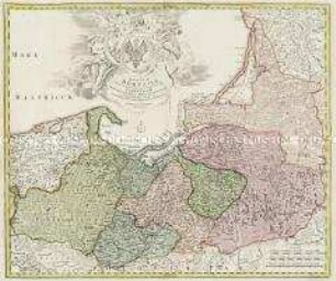
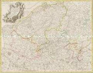
TRACTVVM BORVSSIAE, circa Gedanum et Elbingam,/ ab incolis WERDER appellati; cum/ adiuncta NERINGIA, nova et/ elaboratißima delineatio./ Authore Olao Ioannis Gotho.
- Location
-
Deutsches Historisches Museum, Berlin
- Inventory number
-
Do 2002/27
- Measurements
-
Höhe x Breite: 55,7 x 64,9 cm (Blatt), Höhe x Breite: 41,9 x 53,1 cm (Platte)
- Material/Technique
-
Papier, Kupferstich, koloriert
- Classification
-
Kartografie (Gattung)
- Subject (what)
-
Westpreußen
- Event
-
Herstellung
- (who)
-
Kartograf: Olof Hansson Örnehufvud
- (where)
-
Deutschland [historisch: Heiliges Römisches Reich]
- (when)
-
um 1640
- Rights
-
Deutsches Historisches Museum
- Last update
-
24.03.2023, 9:30 AM CET
Data provider
This object is provided by:
Stiftung Deutsches Historisches Museum. If you have any questions about the object, please contact the data provider.
Stiftung Deutsches Historisches Museum. If you have any questions about the object, please contact the data provider.
Object type
- Regionalkarte
Associated
- Kartograf: Olof Hansson Örnehufvud
Time of origin
- um 1640
Other Objects (12)
Regnum Borussiae

Regnum Borussiae
Prospectus Regni Borussiae
Borussiae Occidentalis Tabula. Mit einer Nebenkarte: Ermland
Regnum Borussiae Gloriosis auspicijs Serenissimi e(t) Potentissimi Princ(ipis) Friderici III. Primi Borussiae Regis, March(ionis) Et Elect(oris) Brand(enburgensis) inauguratum die 18. Ian(uarii) A(nno) 1701. Geographice cum vicinis Regionibus adumbratum

Tabula Geographica Totam Borussiam ut et Districtum Notecensem. Mit einer Nebenkarte: Charte welche den Netz District vorstellet
Charte von Schwaben No. 60

Holstein, Lauenburg, Hamburg u. Lübeck
Charte von Schwaben (unvollständig; Titel nicht erhalten)
La Flandre, le Hainaut, le Brabant, l'Artois une partie de la Picardie, et du Luxembourg
Atlas Nouveau: Isles Britanniques Troisieme Carte
Grand Atlas . Bl. 43 (Böhmen...): Contenant une Partie du Royaume de Boheme, Scavoir la Ville de Prague, les Cercles de Ragonitz, Saatz, Leitmeriz, Kaurizim et de Buntzlau.
Regnum Borussiae
Regnum Borussiae
Prospectus Regni Borussiae
Borussiae Occidentalis Tabula. Mit einer Nebenkarte: Ermland
Regnum Borussiae Gloriosis auspicijs Serenissimi e(t) Potentissimi Princ(ipis) Friderici III. Primi Borussiae Regis, March(ionis) Et Elect(oris) Brand(enburgensis) inauguratum die 18. Ian(uarii) A(nno) 1701. Geographice cum vicinis Regionibus adumbratum
Tabula Geographica Totam Borussiam ut et Districtum Notecensem. Mit einer Nebenkarte: Charte welche den Netz District vorstellet
Charte von Schwaben No. 60
Holstein, Lauenburg, Hamburg u. Lübeck
Charte von Schwaben (unvollständig; Titel nicht erhalten)
La Flandre, le Hainaut, le Brabant, l'Artois une partie de la Picardie, et du Luxembourg
Atlas Nouveau: Isles Britanniques Troisieme Carte