- Alternativer Titel
-
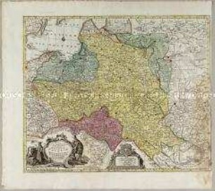
MAPPA GEOGRRAPHICA / REGNUM / BOHEMIAE / CUM ADIUNCTIS
- Standort
-
Deutsches Historisches Museum, Berlin
- Inventarnummer
-
Do 2006/604
- Maße
-
Höhe x Breite: 59,5 x 72,5 cm (Blatt)
Höhe x Breite: 47,2 x 55,3 cm (Karte)
Höhe x Breite: 50 x 58 cm (Platte)
- Material/Technik
-
Papier, Kupferstich, koloriert
- Klassifikation
-
Kartografie (Gattung)
- Bezug (was)
-
Böhmen
Mähren
Schlesien
Lausitz
- Ereignis
-
Herstellung
- (wer)
-
Geograph, Verleger, Stecher: Tobias Konrad Lotter
- (wo)
-
Augsburg, Deutschland
- (wann)
-
um 1760
- Rechteinformation
-
Deutsches Historisches Museum
- Letzte Aktualisierung
- 24.03.2023, 09:27 MEZ
Datenpartner
Dieses Objekt wird bereitgestellt von:
Stiftung Deutsches Historisches Museum. Bei Fragen zum Objekt wenden Sie sich bitte an den Datenpartner.
Stiftung Deutsches Historisches Museum. Bei Fragen zum Objekt wenden Sie sich bitte an den Datenpartner.
Objekttyp
- Regionalkarte
Beteiligte
- Geograph, Verleger, Stecher: Tobias Konrad Lotter
Entstanden
- um 1760
Ähnliche Objekte (12)

Mappa Geographica Regnum Bohemiae
Mappa Geographica, ex novissimis observationibus repraesentans Regnum Poloniae Et Magnum Ducatum Lithuaniae
Mappa Totius Regni Bohemiae
Mappa Geographica Regni Poloniae
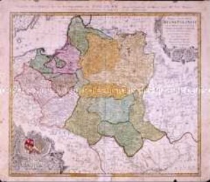
Mappa Geographica Regni Poloniae
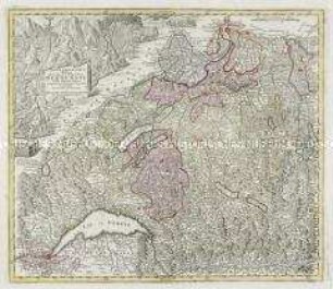
Mappa geographica illustris Helvetiorum Reipublicae Bernensis
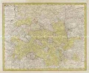
Mappa geographica exhibens Principatum Brandenburgico Onolsbacensem
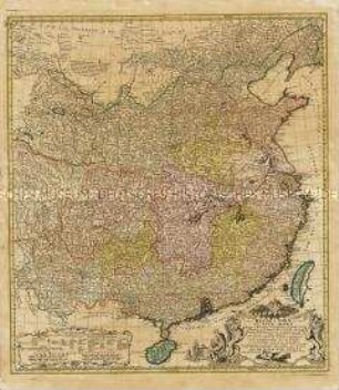
Regni Sinae vel Sinae Propriae Mappa et Descriptio Geographica
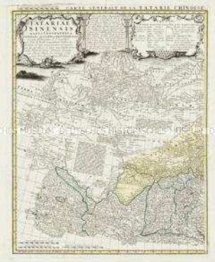
Tatariae Sinensis Mappa Geographica / Carte Generale de la Tatarie Chinoise
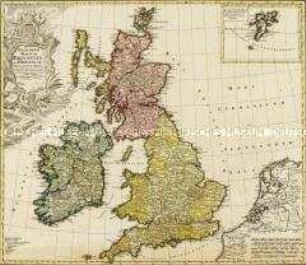
Regnorum Magnae Britanniae Et Hiberniae Mappa Geographica. Mit einer Nebenkarte: Insulae Schetlandiae
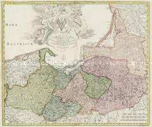
Regnum Borussiae
Regnum Borussiae
Mappa Geographica Regnum Bohemiae
Mappa Geographica, ex novissimis observationibus repraesentans Regnum Poloniae Et Magnum Ducatum Lithuaniae
Mappa Totius Regni Bohemiae
Mappa Geographica Regni Poloniae
Mappa Geographica Regni Poloniae
Mappa geographica illustris Helvetiorum Reipublicae Bernensis
Mappa geographica exhibens Principatum Brandenburgico Onolsbacensem
Regni Sinae vel Sinae Propriae Mappa et Descriptio Geographica
Tatariae Sinensis Mappa Geographica / Carte Generale de la Tatarie Chinoise
Regnorum Magnae Britanniae Et Hiberniae Mappa Geographica. Mit einer Nebenkarte: Insulae Schetlandiae
Regnum Borussiae
Regnum Borussiae
Mappa Geographica Regnum Bohemiae
Mappa Geographica, ex novissimis observationibus repraesentans Regnum Poloniae Et Magnum Ducatum Lithuaniae
Mappa Totius Regni Bohemiae
Mappa Geographica Regni Poloniae
Mappa Geographica Regni Poloniae
Mappa geographica illustris Helvetiorum Reipublicae Bernensis
Mappa geographica exhibens Principatum Brandenburgico Onolsbacensem
Regni Sinae vel Sinae Propriae Mappa et Descriptio Geographica
Tatariae Sinensis Mappa Geographica / Carte Generale de la Tatarie Chinoise
Regnorum Magnae Britanniae Et Hiberniae Mappa Geographica. Mit einer Nebenkarte: Insulae Schetlandiae
Regnum Borussiae