Grenzkarte
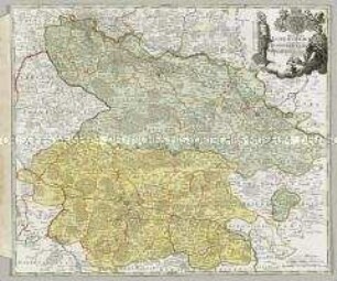
Archiepiscopatus et Electoratus Coloniensis ut et Ducatuum Iuliacensis et Montensis nec non Comitatus Meursiae Nova Tabula
- Alternative title
-
ARCHIEPISCOPATUS / et / ELECTORATUS / COLONIENSIS
- Location
-
Deutsches Historisches Museum, Berlin
- Inventory number
-
Do 2006/1198
- Measurements
-
Höhe x Breite: 56,8 x 68 cm (Blatt)
Höhe x Breite: 46,7 x 55,7 cm (Karte)
Höhe x Breite: 49,3 x 58,5 cm (Platte)
- Material/Technique
-
Papier, Kupferstich, koloriert
- Classification
-
Kartografie (Gattung)
- Subject (what)
-
Köln
Jülich
Berg
- Event
-
Herstellung
- (who)
-
Kartograf, Verleger, Kupferstecher, Geograph: Johann Baptist Homann
- (where)
-
Nürnberg, Deutschland
- (when)
-
um 1720
- Rights
-
Deutsches Historisches Museum
- Last update
-
24.03.2023, 9:30 AM CET
Data provider
This object is provided by:
Stiftung Deutsches Historisches Museum. If you have any questions about the object, please contact the data provider.
Stiftung Deutsches Historisches Museum. If you have any questions about the object, please contact the data provider.
Object type
- Grenzkarte
Associated
- Kartograf, Verleger, Kupferstecher, Geograph: Johann Baptist Homann
Time of origin
- um 1720
Other Objects (12)
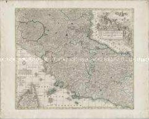
Novissima et accuratissima Delineatio Status Ecclesiae et Magni Ducatus Hetruriae

Novissima et Accuratissima Helvetiae
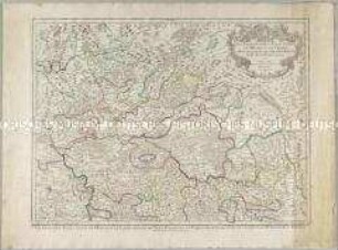
Les Archeveschés et Eslectorats de Mayence et de Treves, Le Palatinat et Eslectorat du Rhein, le Duché de Wirtenberg
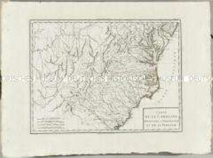
Atlas Nouveau: Carte de la Caroline Méridionale et Septentrionale et de la Virginie
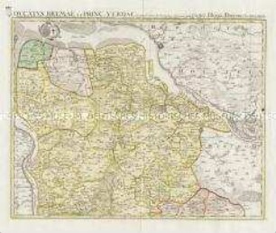
Ducatus Bremae et Princ. Verdae
Ducatus Luneburgici et Comitatus Dannebergensis

Imperium Romano-Germanicum in suos Circulos Electorat. Et Status Summa cum et Studio divisum aeri insculpt. et venale prostans apud Matth. Seutter
Le Royaume de Boheme, le Duché de Silésie, et les Marquisats de Moravie et Lusace
Cataloniae Principatus et Ruscinonis ac Cerretaniae Comitatuum
L'Eveche et l'Etat de Liege

Italia annexis Insulis Sicilia, Sardinia et Corsica
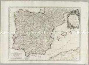
Les Royaumes d'Espagne et de Portugal
Novissima et accuratissima Delineatio Status Ecclesiae et Magni Ducatus Hetruriae
Novissima et Accuratissima Helvetiae
Les Archeveschés et Eslectorats de Mayence et de Treves, Le Palatinat et Eslectorat du Rhein, le Duché de Wirtenberg
Atlas Nouveau: Carte de la Caroline Méridionale et Septentrionale et de la Virginie
Ducatus Bremae et Princ. Verdae
Ducatus Luneburgici et Comitatus Dannebergensis
Imperium Romano-Germanicum in suos Circulos Electorat. Et Status Summa cum et Studio divisum aeri insculpt. et venale prostans apud Matth. Seutter
Le Royaume de Boheme, le Duché de Silésie, et les Marquisats de Moravie et Lusace
Cataloniae Principatus et Ruscinonis ac Cerretaniae Comitatuum
L'Eveche et l'Etat de Liege
Italia annexis Insulis Sicilia, Sardinia et Corsica