- Alternative title
-
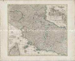
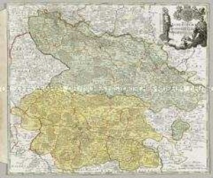
CATALONIAE / PRINCIPATUS / et / RUSCINONIS
- Location
-
Deutsches Historisches Museum, Berlin
- Inventory number
-
Do 2006/658
- Measurements
-
Höhe x Breite: 59 x 72,5 cm (Blatt)
Höhe x Breite: 47,4 x 55,7 cm (Karte)
Höhe x Breite: 50,3 x 58,5 cm (Platte)
- Material/Technique
-
Papier, Kupferstich, koloriert
- Classification
-
Kartografie (Gattung)
- Subject (what)
-
Katalonien
Roussillon
Cerdagne
Spanien
Frankreich
- Event
-
Herstellung
- (who)
-
Stecher, Verleger, Geograph: Tobias Konrad Lotter
- (where)
-
Augsburg, Deutschland
- (when)
-
um 1760
- Rights
-
Deutsches Historisches Museum
- Last update
- 24.03.2023, 9:30 AM CET
Data provider
This object is provided by:
Stiftung Deutsches Historisches Museum. If you have any questions about the object, please contact the data provider.
Stiftung Deutsches Historisches Museum. If you have any questions about the object, please contact the data provider.
Object type
- Grenzkarte
Associated
- Stecher, Verleger, Geograph: Tobias Konrad Lotter
Time of origin
- um 1760
Other Objects (12)
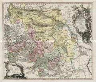
Principatus Halberstadiensis
Tabulae Principatus Brandenburgico-Culmbacensis sive Baruthini Pars Superior

Tabulae Geographicae Principatus Brandenburg. Culmb. sive Baruthini Pars Inferior
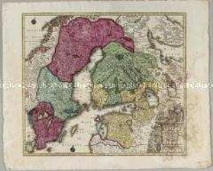
Nova Mappa Geographica Sueciae ac Gothiae Regna ut et Finlandiae Ducatum ac Lapponiam
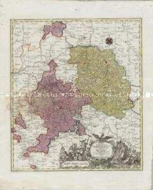
Archiepiscopatus et Electoratus Coloniensis ut et Ducatuum Iuliacensis et Montensis nec non Comitatus Meursiae Nova Tabula
Novissima et accuratissima Delineatio Status Ecclesiae et Magni Ducatus Hetruriae

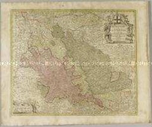
Fränkischer Reichskreis: Circuli Franconiae Pars Orientalis Et Potior novissime delineata quam Illustrißimis Generosißismis ac Excellentißimis Dn. Dn. Totius Circ. Francon. Legatis pro Salute publ. Norimbergae congregatis Dominis suis Gratiosis humillime D. D. D. Io. Bapt. Homann

Novissima et Accuratissima Helvetiae
Les Archeveschés et Eslectorats de Mayence et de Treves, Le Palatinat et Eslectorat du Rhein, le Duché de Wirtenberg
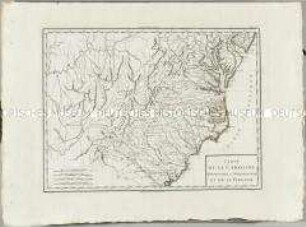
Atlas Nouveau: Carte de la Caroline Méridionale et Septentrionale et de la Virginie
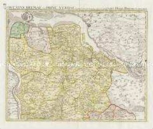
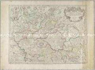
Ducatus Bremae et Princ. Verdae
Ducatus Luneburgici et Comitatus Dannebergensis
Principatus Halberstadiensis
Tabulae Principatus Brandenburgico-Culmbacensis sive Baruthini Pars Superior
Tabulae Geographicae Principatus Brandenburg. Culmb. sive Baruthini Pars Inferior
Nova Mappa Geographica Sueciae ac Gothiae Regna ut et Finlandiae Ducatum ac Lapponiam
Archiepiscopatus et Electoratus Coloniensis ut et Ducatuum Iuliacensis et Montensis nec non Comitatus Meursiae Nova Tabula
Novissima et accuratissima Delineatio Status Ecclesiae et Magni Ducatus Hetruriae
Fränkischer Reichskreis: Circuli Franconiae Pars Orientalis Et Potior novissime delineata quam Illustrißimis Generosißismis ac Excellentißimis Dn. Dn. Totius Circ. Francon. Legatis pro Salute publ. Norimbergae congregatis Dominis suis Gratiosis humillime D. D. D. Io. Bapt. Homann
Novissima et Accuratissima Helvetiae
Les Archeveschés et Eslectorats de Mayence et de Treves, Le Palatinat et Eslectorat du Rhein, le Duché de Wirtenberg
Atlas Nouveau: Carte de la Caroline Méridionale et Septentrionale et de la Virginie
Ducatus Bremae et Princ. Verdae