Grenzkarte
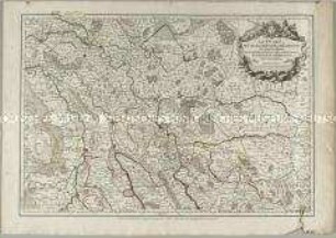
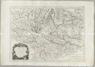
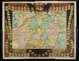
Le Royaume de Boheme, le Duché de Silésie, et les Marquisats de Moravie et Lusace
- Alternativer Titel
-
LE ROYAUME / DE BOHEME, / LE DUCHÉ DE SILÉSIE, / ET LES MARQUISATS
- Standort
-
Deutsches Historisches Museum, Berlin
- Inventarnummer
-
Do 2006/869
- Maße
-
Höhe x Breite: 55 x 78 cm (Blatt)
Höhe x Breite: 46,3 x 53,2 cm (Karte)
Höhe x Breite: 50 x 57,3 cm (Platte)
- Material/Technik
-
Papier, Kupferstich, grenzkoloriert
- Klassifikation
-
Kartografie (Gattung)
- Bezug (was)
-
Böhmen
Schlesien
Mähren
Lausitz
Tschechische Republik
- Ereignis
-
Herstellung
- (wer)
-
Kartograf: Johann Christoph Müller
Kartograf, Geograph: Didier Robert de Vaugondy
Stecher, Kartograf: Paolo Santini
Kartograf, Verleger: Giuseppe Antonio Remondini
- (wo)
-
Venedig, Italien
- (wann)
-
um 1777
- Rechteinformation
-
Deutsches Historisches Museum
- Letzte Aktualisierung
-
24.03.2023, 09:28 MEZ
Datenpartner
Dieses Objekt wird bereitgestellt von:
Stiftung Deutsches Historisches Museum. Bei Fragen zum Objekt wenden Sie sich bitte an den Datenpartner.
Stiftung Deutsches Historisches Museum. Bei Fragen zum Objekt wenden Sie sich bitte an den Datenpartner.
Objekttyp
- Grenzkarte
Beteiligte
- Kartograf: Johann Christoph Müller
- Kartograf, Geograph: Didier Robert de Vaugondy
- Stecher, Kartograf: Paolo Santini
- Kartograf, Verleger: Giuseppe Antonio Remondini
Entstanden
- um 1777
Ähnliche Objekte (12)
Les Duchés de Cleves, de Iuliers et de Limbourg, le Comté de Meurs, le Quartier de Ruremonde dans le Duché de Guelders, l'Archevesché et Eslectorat de Cologne
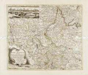
Le Duché De Magdebourg. Mit einer Ansicht: Magdebourg
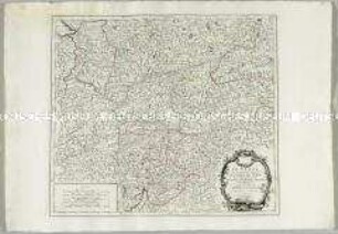
Les Archeveschés et Eslectorats de Mayence et de Treves, Le Palatinat et Eslectorat du Rhein, le Duché de Wirtenberg

Partie Occidentale du Palatinat et Eslectorat du Rhein, Le Duché de Simmeren, Les Comtés de Spanheim et de Veldentz a la Maison Palatine
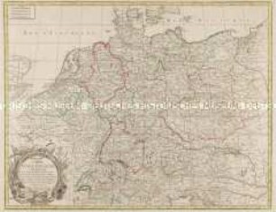
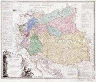
Carte d'Allemagne contenant les Etats de la Maison d'Autriche, les Electorats de Mayence, Treves, Cologne, Baviere, du Haut et Bas Rhein, de Saxe, de Brandebourg, et d'Hanovre, le Royaume de Boheme, la Silesie, les Cercles de Souabe, Franconie, Westphalie, Hte. et Bse. Saxe, et le Landgraviat de Hesse, etc., etc.
Nouvelle Carte de l'Etat de Milan. Mit einer Nebenkarte: Nouvelle Carte du Duché de Mantoue
Brion et Maire: Tableau Géographique Et Politique De L'Allemagne. Blatt 3: Carte Des Etats de la Confédération du Rhin. Conformément au traité de paix de Vienne, 14 Octobre 1809. Carte comprenant en entier l'Empire d' Autriche, la Confédération du Rhin, le Duché de Warsovie, au Roi de Saxe, le Royaume de Prusse; les Provinces Illyriennes et autre Etats à l'Empereur des Francais. Roi d'Italie. Par Brion et Maire, Ing. Géog. 1809. avec des changemens on 1811.
Le Tyrol
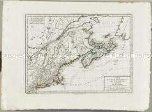
Atlas Nouveau: Carte de la partie septentrionale des Etats Unis comprenant le Canada
L'Empire D'Allemagne Dressée Et Dédiée A Monseigneur Le Dauphin. Par N. de Fer Géographe de sa Majesté Catholique, et de Monseigneur le Dauphin. Corigee et augmentée par Desnos Geographe a Paris rue St. Jacques au Globe 1770.

Le Cercle De Westphalie divisé en tous ses Etats et Souverainetés., M ca. 1 : 1 300 000
Carte de l'Empire de Perse
Les Duchés de Cleves, de Iuliers et de Limbourg, le Comté de Meurs, le Quartier de Ruremonde dans le Duché de Guelders, l'Archevesché et Eslectorat de Cologne
Le Duché De Magdebourg. Mit einer Ansicht: Magdebourg
Les Archeveschés et Eslectorats de Mayence et de Treves, Le Palatinat et Eslectorat du Rhein, le Duché de Wirtenberg
Partie Occidentale du Palatinat et Eslectorat du Rhein, Le Duché de Simmeren, Les Comtés de Spanheim et de Veldentz a la Maison Palatine
Carte d'Allemagne contenant les Etats de la Maison d'Autriche, les Electorats de Mayence, Treves, Cologne, Baviere, du Haut et Bas Rhein, de Saxe, de Brandebourg, et d'Hanovre, le Royaume de Boheme, la Silesie, les Cercles de Souabe, Franconie, Westphalie, Hte. et Bse. Saxe, et le Landgraviat de Hesse, etc., etc.
Nouvelle Carte de l'Etat de Milan. Mit einer Nebenkarte: Nouvelle Carte du Duché de Mantoue
Brion et Maire: Tableau Géographique Et Politique De L'Allemagne. Blatt 3: Carte Des Etats de la Confédération du Rhin. Conformément au traité de paix de Vienne, 14 Octobre 1809. Carte comprenant en entier l'Empire d' Autriche, la Confédération du Rhin, le Duché de Warsovie, au Roi de Saxe, le Royaume de Prusse; les Provinces Illyriennes et autre Etats à l'Empereur des Francais. Roi d'Italie. Par Brion et Maire, Ing. Géog. 1809. avec des changemens on 1811.
Le Tyrol
Atlas Nouveau: Carte de la partie septentrionale des Etats Unis comprenant le Canada
L'Empire D'Allemagne Dressée Et Dédiée A Monseigneur Le Dauphin. Par N. de Fer Géographe de sa Majesté Catholique, et de Monseigneur le Dauphin. Corigee et augmentée par Desnos Geographe a Paris rue St. Jacques au Globe 1770.
Le Cercle De Westphalie divisé en tous ses Etats et Souverainetés., M ca. 1 : 1 300 000