Altkarte
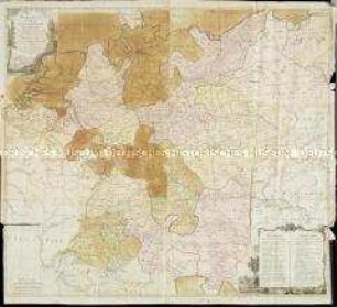
Neueste Post- und General-Karte von Europa : Mit der neuesten Länder-Abtheilung des Letzten Frieden-Tractats = Nouvelle Carte Géographique, et des Postes de L'Europe
- Alternative title
-
Nouvelle Carte Géographique, et des Postes de L'Europe
- Location
-
München, Bayerische Staatsbibliothek -- 4 Bibl.Mont. 1081
- Dimensions
-
Gesamtgr. 141 x 121 cm
- Extent
-
1 Kt.
- Notes
-
Kupferstich
NW oben. - Maßstab in graph. Form (Milles comunes d'Allemagne, Milles d'Angleterre). - Nullmeridian: Ferro. - Es handelt sich um Johann Spiegl d. Jüngeren. - Titelkartusche unten rechts
- Keyword
-
Postroute
Europa
- Event
-
Veröffentlichung
- (where)
-
Wien
- (who)
-
Artaria und Compagnie
- (when)
-
[1807]
- Contributor
- URN
-
urn:nbn:de:bvb:12-bsb00076145-2
- Last update
-
16.04.2025, 8:48 AM CEST
Data provider
This object is provided by:
Bayerische Staatsbibliothek. If you have any questions about the object, please contact the data provider.
Bayerische Staatsbibliothek. If you have any questions about the object, please contact the data provider.
Object type
- Altkarte
Associated
- Artaria, ...
- Arrowsmith, Aaron
- Spiegl, Johann
- Artaria und Compagnie
Time of origin
- [1807]
Other Objects (12)

1: Description géographique, administration, postes, cours d'eau
![Neueste Post- und General Karte von Europa mit der neuesten Länder Abtheilung des letzten Frieden Tractats nach [Aaron] Arrowsmiths großer Karte / Nouvelle Carte Géographique, et des Postes de L'Europe ...](/assets/placeholder/searchResultMediaNoDigitisedMedia.png)
Neueste Post- und General Karte von Europa mit der neuesten Länder Abtheilung des letzten Frieden Tractats nach [Aaron] Arrowsmiths großer Karte / Nouvelle Carte Géographique, et des Postes de L'Europe ...
Nouvelle Carte Géographique des postes et autres routes d'Allemagne
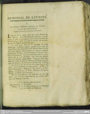
I. Division Géographique Et Générale De L'Europe
Generalkarte
Generalkarte
Generalkarte
Generalkarte
Generalkarte
Generalkarte
Generalkarte
Generalkarte
1: Description géographique, administration, postes, cours d'eau
Neueste Post- und General Karte von Europa mit der neuesten Länder Abtheilung des letzten Frieden Tractats nach [Aaron] Arrowsmiths großer Karte / Nouvelle Carte Géographique, et des Postes de L'Europe ...
Nouvelle Carte Géographique des postes et autres routes d'Allemagne
I. Division Géographique Et Générale De L'Europe
Generalkarte
Generalkarte
Generalkarte
Generalkarte
Generalkarte
Generalkarte
Generalkarte