Eisenbahn-Atlas von Deutschland, Belgien, Elsass und dem nördlichsten Theile von Italien : in 15 Specialkarten auf 12 Blättern, nebst einer Uebersichtskarte, 12. Eisenbahnen zwischen Köln, Hannover, Bremen und Cassel
- Location
-
München, Bayerische Staatsbibliothek -- Mapp. 51 m-12
- Dimensions
-
26 x 22 cm
- Extent
-
1 Kt.
- Language
-
Deutsch
- Notes
-
Kupferstich
- Bibliographic citation
-
Eisenbahn-Atlas von Deutschland, Belgien, Elsass und dem nördlichsten Theile von Italien ; 12
- Event
-
Veröffentlichung
- (where)
-
Gotha
- (who)
-
Justus Perthes
- (when)
-
1849
- Contributor
-
Perthes, Justus
- URN
-
urn:nbn:de:bvb:12-bsb00044786-4
- Last update
-
16.04.2025, 8:44 AM CEST
Data provider
This object is provided by:
Bayerische Staatsbibliothek. If you have any questions about the object, please contact the data provider.
Bayerische Staatsbibliothek. If you have any questions about the object, please contact the data provider.
Associated
- Stülpnagel, Friedrich von
- Bär, Johann Christoph
- Perthes, Justus
- Justus Perthes
Time of origin
- 1849
Other Objects (12)
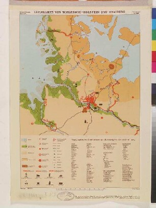
LERNKARTE VON SCHLESWIG-HOLSTEIN UND HAMBURG

"Bundesrepublik Deutschland" physisch und politisch Ausf.-Art: Farbiger Druck Herst.: Justus Perthes Format: 123 x 99,5 cm Maßstab: 1 : 830 000
Lombardei "Straßenkarte von der Lombardischen Ebene" Ausf.-Art: Farbiger Druck Herst.: Justus Perthes Format: 39 x 67 cm Maßstab: 1 : 450 000
"Bundesrepublik Deutschland" physisch und politisch Ausf.-Art: Farbiger Druck Herst.: Justus Perthes Format: 123 x 99,5 cm Maßstab: 1 : 830 000
"Bundesrepublik Deutschland" physisch und politisch Ausf.-Art: Farbiger Druck Herst.: Justus Perthes Format: 123 x 99,5 cm Maßstab: 1 : 830 000
Gerollte Schulwandkarte zur Industrie und Landwirtschaft Europas
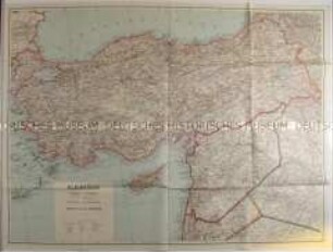
Politisch-geografische Karte von Kleinasien aus der Zeit des 2. Weltkrieges
Gothaischer genealogischer Kalender auf das Jahr 1817. - Gotha : Justus Perthes, 1817
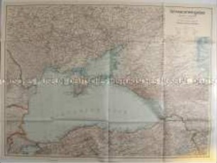
Politisch-geografische Karte des Schwarzmeerraumes aus der Zeit des 2. Weltkrieges
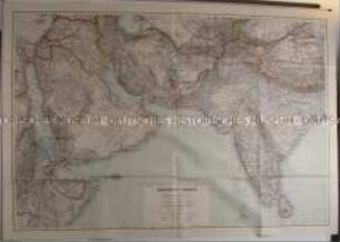
Politisch-geografische Karte von Südwest-Asien und Arabien
Gerollte Wandkarte zu den europäischen Vorkommen verschiedener Bodenschätze
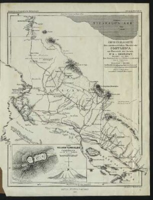
Originalkarte des nordwestlichen Theiles von Costarica zur Übersicht der Reisen Dr. K. v. Seebach's : Den Küstenaufnahmen v. Belcher u. a. adjustiert, von A. Petermann
LERNKARTE VON SCHLESWIG-HOLSTEIN UND HAMBURG
"Bundesrepublik Deutschland" physisch und politisch Ausf.-Art: Farbiger Druck Herst.: Justus Perthes Format: 123 x 99,5 cm Maßstab: 1 : 830 000
Lombardei "Straßenkarte von der Lombardischen Ebene" Ausf.-Art: Farbiger Druck Herst.: Justus Perthes Format: 39 x 67 cm Maßstab: 1 : 450 000
"Bundesrepublik Deutschland" physisch und politisch Ausf.-Art: Farbiger Druck Herst.: Justus Perthes Format: 123 x 99,5 cm Maßstab: 1 : 830 000
"Bundesrepublik Deutschland" physisch und politisch Ausf.-Art: Farbiger Druck Herst.: Justus Perthes Format: 123 x 99,5 cm Maßstab: 1 : 830 000
Gerollte Schulwandkarte zur Industrie und Landwirtschaft Europas
Politisch-geografische Karte von Kleinasien aus der Zeit des 2. Weltkrieges
Gothaischer genealogischer Kalender auf das Jahr 1817. - Gotha : Justus Perthes, 1817
Politisch-geografische Karte des Schwarzmeerraumes aus der Zeit des 2. Weltkrieges
Politisch-geografische Karte von Südwest-Asien und Arabien
Gerollte Wandkarte zu den europäischen Vorkommen verschiedener Bodenschätze