Altkarte
Hydrographische Karte von Baiern, Der Obern Pfalz und Neuburg : = Carte Hydrographique de Bavière, du haut Palatinat et de Neubourg
- Alternative title
-
Hydrographische Charte von Baiern
Carte Hydrographique de Bavière, du haut Palatinat et de Neubourg
- Location
-
München, Bayerische Staatsbibliothek -- Mapp. XI,544
- Dimensions
-
Gesamtgr. 101 x 134 cm, je Teil 51 x 67 cm
- Extent
-
1 Kt. in 4 Teilen auf 4 Bl.
- Notes
-
Kupferstich
Maßstab in graph. Form (Maasstab von 2 Meilen, jede zu 25406 Baierschen Schuhen)
NT: Hydrographische Charte von Baiern
- Keyword
-
Geschichte 1623-1805
Hydrologie
Regierungsbezirk Oberpfalz
Bayern
- Event
-
Veröffentlichung
- (where)
-
Munic//München//
- (when)
-
1807
- Contributor
- URN
-
urn:nbn:de:bvb:12-bsb00090739-2
- Last update
-
16.04.2025, 8:38 AM CEST
Data provider
This object is provided by:
Bayerische Staatsbibliothek. If you have any questions about the object, please contact the data provider.
Bayerische Staatsbibliothek. If you have any questions about the object, please contact the data provider.
Object type
- Altkarte
Associated
Time of origin
- 1807
Other Objects (12)
Über die Ursachen der großen Überschwemmung am 16. Aug. 1807 in München den Zeitungs-Nachrichten ... entgegengestellt
Verbesserte Auflage des Adrian von Riedlschen Reise-Atlas vom Königreiche Bayern, 1
Instruction, wie künftighin diejenige Chausséen, in Baiern und Oberpfalz, welche dem gnädigsten Landesherrn bisheriger Verfassung gemäß zu unterhalten obliegen, von den Churfürstl. Cameral-Strassen-Inspections-Ämtern dem gnädigsten Rescripte vom 26. Jänner dieses Jahres gemäß unterhalten werden sollen
Instruction, wie künftighin diejenige Chausséen, in Baiern und Oberpfalz, welche dem gnädigsten Landesherrn bisheriger Verfassung gemäß zu unterhalten obliegen, von den Churfürstl. Cameral-Strassen-Inspections-Ämtern dem gnädigsten Rescripte vom 26. Jänner dieses Jahres gemäß unterhalten werden sollen
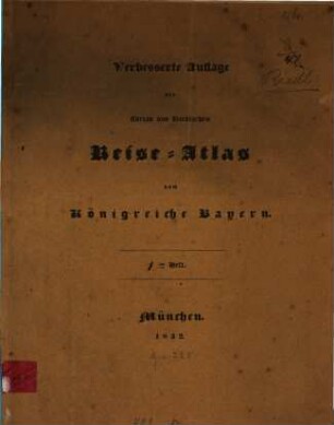
Verbesserte Auflage des Adrian von Riedlschen Reise-Atlas vom Königreiche Bayern, 1
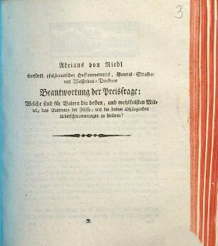
Beantwortung der Preisfrage: Welche sind für Baiern die besten, und wohlfeilsten Mittel, das Austreten der Flüsse, und die davon abhängenden Ueberschwemmungen zu hindern?
Verbesserte Auflage des Adrian von Riedlschen Reise-Atlas vom Königreiche Bayern, 2
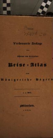
Verbesserte Auflage des Adrian von Riedlschen Reise-Atlas vom Königreiche Bayern, 2
Fortsetzung des Adrian von Riedlschen Reise-Atlas vom Königreiche Bayern, 1
Ankündigung eines Hydrographischen Werkes für Baiern
![Ankündigung eines hydrographischen Werkes für Baiern : [München den 7. Februar 1805]](https://iiif.deutsche-digitale-bibliothek.de/image/2/5c6bec18-6e66-4183-ba03-fe516d984829/full/!306,450/0/default.jpg)
Ankündigung eines hydrographischen Werkes für Baiern : [München den 7. Februar 1805]
Fortsetzung des Adrian von Riedlschen Reise-Atlas vom Königreiche Bayern, 2
Über die Ursachen der großen Überschwemmung am 16. Aug. 1807 in München den Zeitungs-Nachrichten ... entgegengestellt
Verbesserte Auflage des Adrian von Riedlschen Reise-Atlas vom Königreiche Bayern, 1
Instruction, wie künftighin diejenige Chausséen, in Baiern und Oberpfalz, welche dem gnädigsten Landesherrn bisheriger Verfassung gemäß zu unterhalten obliegen, von den Churfürstl. Cameral-Strassen-Inspections-Ämtern dem gnädigsten Rescripte vom 26. Jänner dieses Jahres gemäß unterhalten werden sollen
Instruction, wie künftighin diejenige Chausséen, in Baiern und Oberpfalz, welche dem gnädigsten Landesherrn bisheriger Verfassung gemäß zu unterhalten obliegen, von den Churfürstl. Cameral-Strassen-Inspections-Ämtern dem gnädigsten Rescripte vom 26. Jänner dieses Jahres gemäß unterhalten werden sollen
Verbesserte Auflage des Adrian von Riedlschen Reise-Atlas vom Königreiche Bayern, 1
Beantwortung der Preisfrage: Welche sind für Baiern die besten, und wohlfeilsten Mittel, das Austreten der Flüsse, und die davon abhängenden Ueberschwemmungen zu hindern?
Verbesserte Auflage des Adrian von Riedlschen Reise-Atlas vom Königreiche Bayern, 2
Verbesserte Auflage des Adrian von Riedlschen Reise-Atlas vom Königreiche Bayern, 2
Fortsetzung des Adrian von Riedlschen Reise-Atlas vom Königreiche Bayern, 1
Ankündigung eines Hydrographischen Werkes für Baiern
Ankündigung eines hydrographischen Werkes für Baiern : [München den 7. Februar 1805]