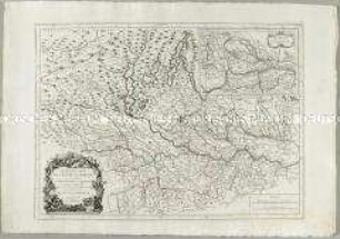
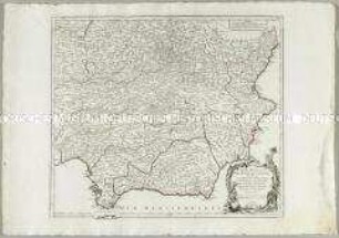
Grenzkarte
La Principauté d'Ost-Frise ou Le Comté d'Embden. Mit einer Nebenkarte: Dollart und zwei Stadtplänen: Embden und Aurich
- Alternativer Titel
-
LA PRINCIPAUTÉ / D'OST=FRISE, / ou, / LE COMTÉ
- Standort
-
Deutsches Historisches Museum, Berlin
- Inventarnummer
-
Do 2006/609
- Maße
-
Höhe x Breite: 59 x 72 cm (Blatt)
Höhe x Breite: 46,5 x 55,8 cm (Karte)
Höhe x Breite: 49,4 x 58,8 cm (Platte)
- Material/Technik
-
Papier, Kupferstich, koloriert
- Klassifikation
-
Kartografie (Gattung)
- Bezug (was)
-
Deutschland
Ostfriesland
- Ereignis
-
Herstellung
- (wer)
-
Stecher, Verleger, Geograph: Tobias Konrad Lotter
Stecher: Georg Friedrich Lotter
- (wo)
-
Augsburg, Deutschland
- (wann)
-
um 1760
- Rechteinformation
-
Deutsches Historisches Museum
- Letzte Aktualisierung
-
24.03.2023, 09:31 MEZ
Datenpartner
Dieses Objekt wird bereitgestellt von:
Stiftung Deutsches Historisches Museum. Bei Fragen zum Objekt wenden Sie sich bitte an den Datenpartner.
Stiftung Deutsches Historisches Museum. Bei Fragen zum Objekt wenden Sie sich bitte an den Datenpartner.
Objekttyp
- Grenzkarte
Beteiligte
- Stecher, Verleger, Geograph: Tobias Konrad Lotter
- Stecher: Georg Friedrich Lotter
Entstanden
- um 1760
Ähnliche Objekte (12)
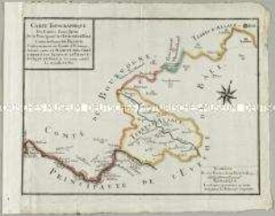
Carte Topographique des Limites d'une Partie de la Principauté de l'Evêche de Bâle contre les Terres de France

Karte: Beschreibung der Schweiz; 1751

Deutschland vom Major C. F. Hammer. Nürnberg bey Friedrich Campe

Tableau Général de l'Asie
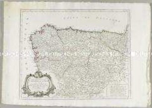
Partie Septentrionale de la Couronne de Castille
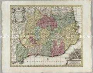
Cataloniae Principatus et Ruscinonis ac Cerretaniae Comitatuum
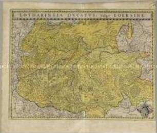
Lotharingia Ducatus
Nouvelle Carte de l'Etat de Milan. Mit einer Nebenkarte: Nouvelle Carte du Duché de Mantoue
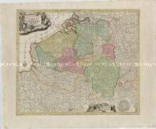
Germaniae Inferioris sive Belgii. Mit einem Fortifikationsplan: Ostende
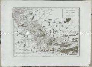
Atlas Nouveau: Gouvernement de Flandre
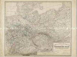
Nord und West-Deutschland der Preussische Staat und die übrigen Zollvereinsstaaten
Partie Meridionale des Etats de Castille
Carte Topographique des Limites d'une Partie de la Principauté de l'Evêche de Bâle contre les Terres de France
Karte: Beschreibung der Schweiz; 1751
Deutschland vom Major C. F. Hammer. Nürnberg bey Friedrich Campe
Tableau Général de l'Asie
Partie Septentrionale de la Couronne de Castille
Cataloniae Principatus et Ruscinonis ac Cerretaniae Comitatuum
Lotharingia Ducatus
Nouvelle Carte de l'Etat de Milan. Mit einer Nebenkarte: Nouvelle Carte du Duché de Mantoue
Germaniae Inferioris sive Belgii. Mit einem Fortifikationsplan: Ostende
Atlas Nouveau: Gouvernement de Flandre
Nord und West-Deutschland der Preussische Staat und die übrigen Zollvereinsstaaten