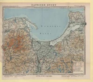
Landkarte (topographische Karte)
Danziger Bucht mit Danziger Höhe und Niederung
- Location
-
Museum HAUS HANSESTADT DANZIG, Lübeck
- Inventory number
-
2632
- Measurements
-
H: 39,8 cm, B: 49,8 cm
- Material/Technique
-
Papier; Druckverfahren
- Inscription/Labeling
-
Signatur: betitelt und datiert (oben links/rechts: Karte des Deutschen Reiches 1:100.000 / 70 Danzig)
- Classification
-
Topographische Karten (Sachgruppe)
- Subject (what)
-
Land, Region
- Event
-
Herstellung
- (who)
-
Reichsamt für Landesaufnahme, Ausgabe 1941 (Hersteller)
- (where)
-
Danzig
Zoppot
Landkreis Danziger Höhe
Landkreis Danziger Niederung
- (when)
-
1941
- Delivered via
- Rights
-
Museum HAUS HANSESTADT DANZIG
- Last update
-
28.04.2023, 10:47 AM CEST
Data provider
This object is provided by:
Museum HAUS HANSESTADT DANZIG. If you have any questions about the object, please contact the data provider.
Museum HAUS HANSESTADT DANZIG. If you have any questions about the object, please contact the data provider.
Object type
- Landkarte (topographische Karte)
Associated
- Reichsamt für Landesaufnahme, Ausgabe 1941 (Hersteller)
Time of origin
- 1941
Other Objects (12)

Einwohnerbuch der Danziger Landkreise Danziger Höhe, Danziger Niederung, Großes Werder 1927/28
Kreis Danziger Niederung
Danziger Bucht
Danziger Bucht
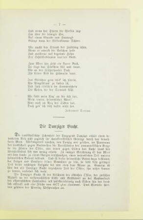
Die Danziger Bucht
Quadratkarte Danziger Bucht
Verhandlungen des Kreistags Danziger Niederung
Kreisvermögen des Kreises Danziger Niederung
Protokollbuch des Kreistags Danziger Niederung
Sitzungen des Kreisausschusses Danziger Niederung
Gdynia (Gdingen), Danziger Bucht
Das Territorium der Stadt Danzig und die Danziger Hospitalgüter bei der Preussischen Landesaufnahme von 1793, Bd. 1.. Danziger Bauamt, Danziger Höhe, Danziger Niederung
Einwohnerbuch der Danziger Landkreise Danziger Höhe, Danziger Niederung, Großes Werder 1927/28
Kreis Danziger Niederung
Danziger Bucht
Danziger Bucht
Die Danziger Bucht
Quadratkarte Danziger Bucht
Verhandlungen des Kreistags Danziger Niederung
Kreisvermögen des Kreises Danziger Niederung
Protokollbuch des Kreistags Danziger Niederung
Sitzungen des Kreisausschusses Danziger Niederung
Gdynia (Gdingen), Danziger Bucht