Regionalkarte
Special-Karte der Vereinigten Staaten von Nord-Amerika / Map of the United States. Mit einem Titelblatt und einer Nebenkarte
- Alternative title
-
SPECIAL-KARTE / DER VEREINIGTEN STAATEN / VON / NORD-AMERIKA.
- Location
-
Deutsches Historisches Museum, Berlin
- Inventory number
-
Do 2006/807.0-15
- Measurements
-
Höhe x Breite: 43 x 56 cm (Blatt 2)
Höhe x Breite: 35,3 x 45,3 cm (Karte 2)
- Material/Technique
-
Papier, Lithographie, koloriert
- Classification
-
Kartografie (Gattung)
- Subject (what)
-
Nordamerika
USA
Amerika
- Event
-
Herstellung
- (who)
-
Kartograf: John Calvin Smith
Verleger: Theodor Fischer (1848)
- (where)
-
New York?
- (when)
-
um 1850
- Rights
-
Deutsches Historisches Museum
- Last update
-
24.03.2023, 9:28 AM CET
Data provider
This object is provided by:
Stiftung Deutsches Historisches Museum. If you have any questions about the object, please contact the data provider.
Stiftung Deutsches Historisches Museum. If you have any questions about the object, please contact the data provider.
Object type
- Regionalkarte
Associated
- Kartograf: John Calvin Smith
- Verleger: Theodor Fischer (1848)
Time of origin
- um 1850
Other Objects (12)
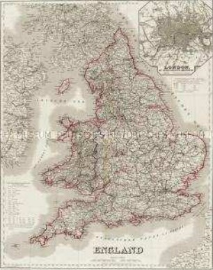
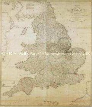
England. Mit einer Nebenkarte: London
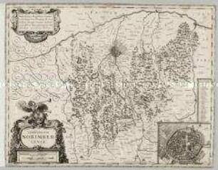
Territorium Norimbergense. Mit einer Nebenkarte: Nurnberg
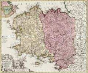
Tabula Ducatus Britanniae. Mit einer Nebenkarte: BREST
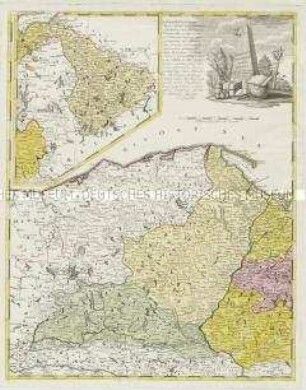
Borussiae Occidentalis Tabula. Mit einer Nebenkarte: Ermland
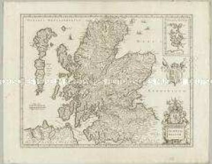
Scotia Regnum. Mit einer Nebenkarte: Orcades Insulae.
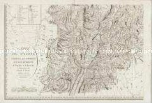
Carte du Tyrol. Mit einer Nebenkarte: Carte Générale
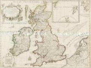
Les Isles Britanniques. Mit einer Nebenkarte: Orkney- und Shetlandinseln
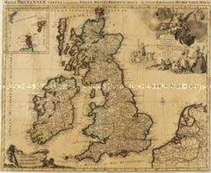
Les Isles Britanniques. Mit einer Nebenkarte: Orkney- und Shetlandinseln
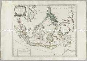
Archipel des Indes Orientales. Mit einer Nebenkarte: Isles Marianes

Special-Karte der Halbinsel Krymm. Mit zwei Nebenkarten: (Strasse von Kertsch); (Ssewsstopol), einer Ansicht: Ansicht von Ssewasstopol und einer Verlagsanzeige
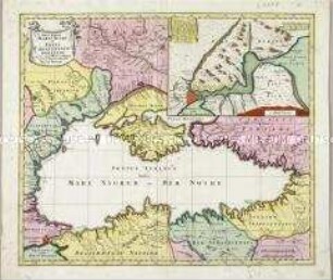
Nova Mappa Maris Nigri et Freti Constantinopolitani. Mit einer Nebenkarte
Charte von England und Wallis. Mit einer Nebenkarte (Insel Scilly)
England. Mit einer Nebenkarte: London
Territorium Norimbergense. Mit einer Nebenkarte: Nurnberg
Tabula Ducatus Britanniae. Mit einer Nebenkarte: BREST
Borussiae Occidentalis Tabula. Mit einer Nebenkarte: Ermland
Scotia Regnum. Mit einer Nebenkarte: Orcades Insulae.
Carte du Tyrol. Mit einer Nebenkarte: Carte Générale
Les Isles Britanniques. Mit einer Nebenkarte: Orkney- und Shetlandinseln
Les Isles Britanniques. Mit einer Nebenkarte: Orkney- und Shetlandinseln
Archipel des Indes Orientales. Mit einer Nebenkarte: Isles Marianes
Special-Karte der Halbinsel Krymm. Mit zwei Nebenkarten: (Strasse von Kertsch); (Ssewsstopol), einer Ansicht: Ansicht von Ssewasstopol und einer Verlagsanzeige
Nova Mappa Maris Nigri et Freti Constantinopolitani. Mit einer Nebenkarte