Regionalkarte
Special-Karte der Halbinsel Krymm. Mit zwei Nebenkarten: (Strasse von Kertsch); (Ssewsstopol), einer Ansicht: Ansicht von Ssewasstopol und einer Verlagsanzeige
- Alternative title
-
SPECIAL-KARTE / der / HALBINSEL KRYMM, / entworfen und gezeichnet
- Location
-
Deutsches Historisches Museum, Berlin
- Inventory number
-
Do 2006/808.1-4
- Measurements
-
Höhe x Breite: 44,2 x 55 cm (Blatt 1)
Höhe x Breite: 30 x 38,4 cm (Karte 1)
- Material/Technique
-
Papier, Lithographie, teilkoloriert
- Classification
-
Kartografie (Gattung)
- Subject (what)
-
Krim
Ukraine
Russland
- Event
-
Herstellung
- (who)
-
Kartograf: Friedrich H. Handtke
Verlag: Carl Flemming
- (where)
-
Berlin, Deutschland
- (when)
-
um 1856
- Rights
-
Deutsches Historisches Museum
- Last update
- 24.03.2023, 9:28 AM CET
Data provider
This object is provided by:
Stiftung Deutsches Historisches Museum. If you have any questions about the object, please contact the data provider.
Stiftung Deutsches Historisches Museum. If you have any questions about the object, please contact the data provider.
Object type
- Regionalkarte
Associated
- Kartograf: Friedrich H. Handtke
- Verlag: Carl Flemming
Time of origin
- um 1856
Other Objects (12)
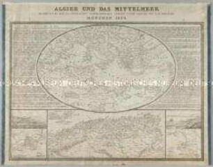
Algier und das Mittelmeer. Mit zwei Nebenkarten: Ansicht u. Plan der Stadt Algier; Ansicht und Topograph. Skizze von Algier's Golf und Umgebungen und zwei Ansichten
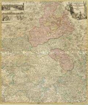
Tabula Geographica Campaniae. Mit zwei Nebenkarten: Reims und Troyes
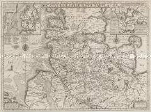
Ducatus Holsatiae Nova Tabula. Mit zwei Nebenkarten: Alluvies propè Detzbul...; Tabula Barmerensis...
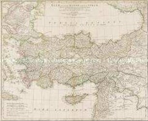
Asiae, Quae Vulgo Minor dicitur, et Syriae. Mit zwei Nebenkarten: Troas; Bosporus
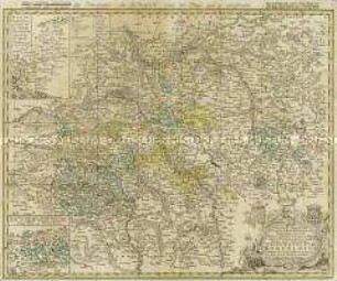
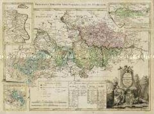
Principatus utr: Hohenloici. Mit zwei Nebenkarten: Grafschaft Gleichen; Aempter Ober- und Nieder-Brunn
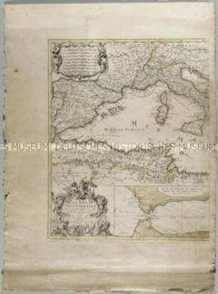
La Mer Mediterranée. Mit zwei Nebenkarten: Plan du détroit de Gibraltar; Baye de Gibraltar
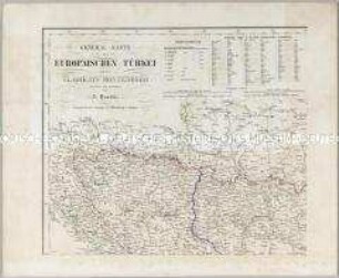
General-Karte der Europaeischen Tuerkei. Mit vier Nebenkarten: (Dardanellen Strasse), (Konstantinopel), (Kreta) und (Stadtplan von Konstantinopel)
Charte vom Fürstenthum Anhalt. Mit drei Nebenkarten: Hause Anhalt-Zerbst, Hause Anhalt-Dessau, Hause Anhalt-Bernburg-Hoym
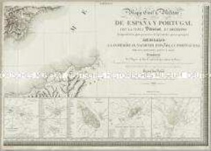
Mapa Civil y Militar de España y Portugal. Mit 23 Nebenkarten, einer Übersicht, zwei Profilen und einer Zusatzkarte
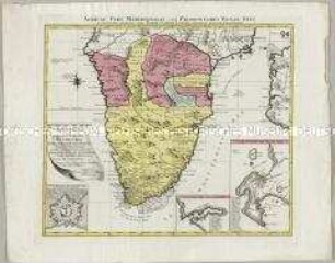
Africae Pars Meridionalis. Mit zwei Nebenkarten: Sinus Saldanhae of Saldanha Baay; Ager Promontorii Bonae Spei und einem Fortifikationsplan: Castellum Batavorum
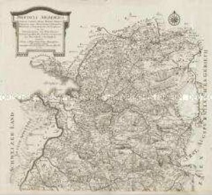
Provincia Arlbergica. Mit einer Ansicht

Chorographische Karte des Koenigreichs Hannover. (Titel nicht erhalten!) Mit zwei Nebenkarten: Kleine Postkarte des Königreichs Hannover; Post Karte des Königreichs Hannover
Algier und das Mittelmeer. Mit zwei Nebenkarten: Ansicht u. Plan der Stadt Algier; Ansicht und Topograph. Skizze von Algier's Golf und Umgebungen und zwei Ansichten
Tabula Geographica Campaniae. Mit zwei Nebenkarten: Reims und Troyes
Ducatus Holsatiae Nova Tabula. Mit zwei Nebenkarten: Alluvies propè Detzbul...; Tabula Barmerensis...
Asiae, Quae Vulgo Minor dicitur, et Syriae. Mit zwei Nebenkarten: Troas; Bosporus
Principatus utr: Hohenloici. Mit zwei Nebenkarten: Grafschaft Gleichen; Aempter Ober- und Nieder-Brunn
La Mer Mediterranée. Mit zwei Nebenkarten: Plan du détroit de Gibraltar; Baye de Gibraltar
General-Karte der Europaeischen Tuerkei. Mit vier Nebenkarten: (Dardanellen Strasse), (Konstantinopel), (Kreta) und (Stadtplan von Konstantinopel)
Charte vom Fürstenthum Anhalt. Mit drei Nebenkarten: Hause Anhalt-Zerbst, Hause Anhalt-Dessau, Hause Anhalt-Bernburg-Hoym
Mapa Civil y Militar de España y Portugal. Mit 23 Nebenkarten, einer Übersicht, zwei Profilen und einer Zusatzkarte
Africae Pars Meridionalis. Mit zwei Nebenkarten: Sinus Saldanhae of Saldanha Baay; Ager Promontorii Bonae Spei und einem Fortifikationsplan: Castellum Batavorum
Provincia Arlbergica. Mit einer Ansicht