Regionalkarte
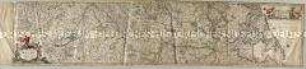
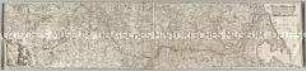
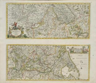
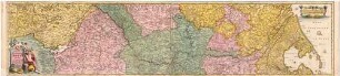
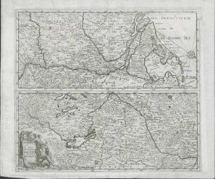
Totius Fluminis Rheni Novissima Descriptio. Mit 20 Stadt-, und Fortifikationsplänen und Landschaftsansichten
- Alternativer Titel
-
Totius / FLUMINIS / RHENI / Novissima
- Standort
-
Deutsches Historisches Museum, Berlin
- Inventarnummer
-
Do 2006/968
- Maße
-
Höhe x Breite: 45,5 x 115,5 cm (Blatt)
Höhe x Breite: 22,7 x 102 cm (Karte)
Höhe x Breite: 39 x 104 cm (Platte)
- Material/Technik
-
Papier, Kupferstich
- Klassifikation
-
Kartografie (Gattung)
- Bezug (was)
-
Rhein
- Ereignis
-
Herstellung
- (wer)
-
Kupferstecher, Verleger: Jakob von Sandrart (1630)
- (wo)
-
Nürnberg, Deutschland
- (wann)
-
um 1670
- Rechteinformation
-
Deutsches Historisches Museum
- Letzte Aktualisierung
-
24.03.2023, 09:29 MEZ
Datenpartner
Dieses Objekt wird bereitgestellt von:
Stiftung Deutsches Historisches Museum. Bei Fragen zum Objekt wenden Sie sich bitte an den Datenpartner.
Stiftung Deutsches Historisches Museum. Bei Fragen zum Objekt wenden Sie sich bitte an den Datenpartner.
Objekttyp
- Regionalkarte
Beteiligte
- Kupferstecher, Verleger: Jakob von Sandrart (1630)
Entstanden
- um 1670
Ähnliche Objekte (12)
Totius fluminis Rheni Novissima Descriptio
Totius Fluminis Rheni Novissima Descriptio
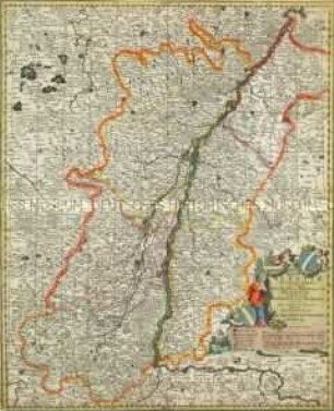
Totius Alsatiae Novissima Tabula
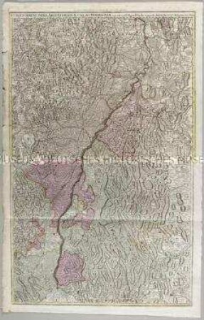
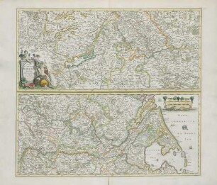
Cursus Rheni infra Argentoratum usq ad Wormatiam
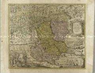
Ducatus Stiriae Novissima Tabula. Mit einer Stadtansicht: Grätz

Tabula Synoptica Totius Fluminis Danubii a Fontibus usque ad Ostia. Mit einer Nebenkarte: Ex nuce fit corylus e guttis flumina crescent.
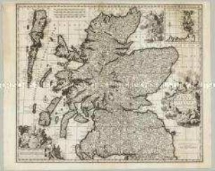
Novissima Regni Scotiae Septentrionalis et Meridionalis Tabula. Mit einer Nebenkarte: Orcades Insulae
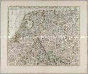
Tabula Geographica qua Pars Meridionalis sive Superior / Pars Septentrionalis sive Inferior Rheni, Mosae et Mosellae
Totius Fluminis Rheni Novissima Descriptio
Totius Fluminis Rheni Novissima Descriptio
Totius Fluminis Rheni Novissima Descriptio
Totius Fluminis Rheni Novißima Descriptio
Totius fluminis Rheni Novissima Descriptio
Totius Fluminis Rheni Novissima Descriptio
Totius Alsatiae Novissima Tabula
Cursus Rheni infra Argentoratum usq ad Wormatiam
Ducatus Stiriae Novissima Tabula. Mit einer Stadtansicht: Grätz
Tabula Synoptica Totius Fluminis Danubii a Fontibus usque ad Ostia. Mit einer Nebenkarte: Ex nuce fit corylus e guttis flumina crescent.
Novissima Regni Scotiae Septentrionalis et Meridionalis Tabula. Mit einer Nebenkarte: Orcades Insulae
Tabula Geographica qua Pars Meridionalis sive Superior / Pars Septentrionalis sive Inferior Rheni, Mosae et Mosellae
Totius Fluminis Rheni Novissima Descriptio
Totius Fluminis Rheni Novissima Descriptio
Totius Fluminis Rheni Novissima Descriptio