Regionalkarte
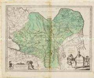
Tabula Geographica qua Pars Meridionalis sive Superior / Pars Septentrionalis sive Inferior Rheni, Mosae et Mosellae
- Alternativer Titel
-
TABULA GEOGRAPHICA QUA PARS SEPTENTRIONALIS SIVE INFERIOR RHENI, MOSAE, ET MOSELLAE, / maximaeque partes VISURGIS, MOENI, AMASI, SCALDIS, Isalae, et alia in eosdem influentia Flumina nec non Provinciae GERMANIAE INFERIORIS, WESTPHALIAE, HASSIAE, / ARCHIEPISCOPATUS et ELECTORATUS COLONIENSIS ac TREVIRENSIS cum partibus MOGUNTINI et PALATINATUS RHENI, et aliae Regiones adjacentes. / accuratissme ostenduntur per NICOLAUM VISSCHER Amst. Bat., cum Privil. ordin. General. Belgii Foederati. Nunc apud Petrum Schenk Jun.
- Standort
-
Deutsches Historisches Museum, Berlin
- Inventarnummer
-
Do 2006/970.1-2
- Maße
-
Höhe x Breite: 57,5 x 66,7 cm (Blatt 1)
Höhe x Breite: 45,7 x 54,5 cm (Karte 1)
Höhe x Breite: 48 x 57 cm (Platte 1)
Höhe x Breite: 57,5 x 67 cm (Blatt 2)
Höhe x Breite: 45,6 x 54,3 cm (Karte 2)
Höhe x Breite: 47,7 x 57 cm (Platte 2)
- Material/Technik
-
Papier, Kupferstich, grenzkoloriert
- Klassifikation
-
Kartografie (Gattung)
- Bezug (was)
-
Rheinland
Deutschland
- Ereignis
-
Herstellung
- (wer)
-
Stecher, Verleger: Nicolaes Jansz. Visscher
Stecher, Verleger: Pieter Schenk (1728)?
- (wo)
-
Amsterdam, Niederlande
- (wann)
-
nach 1702
- Rechteinformation
-
Deutsches Historisches Museum
- Letzte Aktualisierung
- 24.03.2023, 09:29 MEZ
Datenpartner
Dieses Objekt wird bereitgestellt von:
Stiftung Deutsches Historisches Museum. Bei Fragen zum Objekt wenden Sie sich bitte an den Datenpartner.
Stiftung Deutsches Historisches Museum. Bei Fragen zum Objekt wenden Sie sich bitte an den Datenpartner.
Objekttyp
- Regionalkarte
Beteiligte
- Stecher, Verleger: Nicolaes Jansz. Visscher
- Stecher, Verleger: Pieter Schenk (1728)?
Entstanden
- nach 1702
Ähnliche Objekte (12)
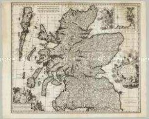
Novissima Regni Scotiae Septentrionalis et Meridionalis Tabula. Mit einer Nebenkarte: Orcades Insulae
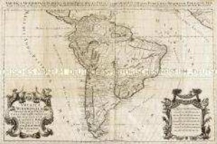
America Meridionalis.

America Septentrionalis
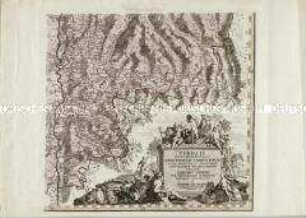
Tirolis Pars Meridionalis Episcopatum Tridentinum olim Ducatum et Marchiam Finitimasque Valles Complexa una cum Limitibus Venetis
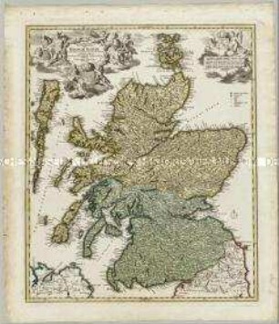
Magnae Britanniae Pars Septentrionalis qua Regnum Scotiae in Suas Partes et subjacentes Insulas divisum Accurata Tabula
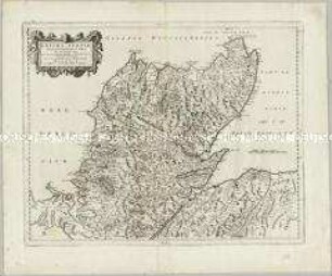
Extima Scotiae Septentrionalis Ora
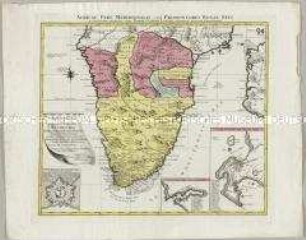
Africae Pars Meridionalis. Mit zwei Nebenkarten: Sinus Saldanhae of Saldanha Baay; Ager Promontorii Bonae Spei und einem Fortifikationsplan: Castellum Batavorum
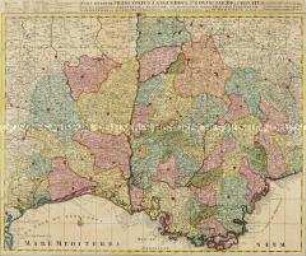
Pars inferior Principatus Languedoci
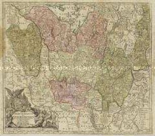
Electoratus sive Marchia Brandenburgensis
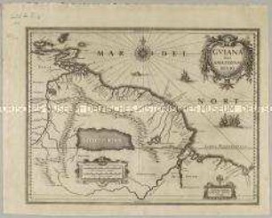
Guiana sive Amazonum Regio
Ukrainae Pars, quae Podolia Palatinatus
Tartaria sive Magni Chami Imperium
Novissima Regni Scotiae Septentrionalis et Meridionalis Tabula. Mit einer Nebenkarte: Orcades Insulae
America Meridionalis.
America Septentrionalis
Tirolis Pars Meridionalis Episcopatum Tridentinum olim Ducatum et Marchiam Finitimasque Valles Complexa una cum Limitibus Venetis
Magnae Britanniae Pars Septentrionalis qua Regnum Scotiae in Suas Partes et subjacentes Insulas divisum Accurata Tabula
Extima Scotiae Septentrionalis Ora
Africae Pars Meridionalis. Mit zwei Nebenkarten: Sinus Saldanhae of Saldanha Baay; Ager Promontorii Bonae Spei und einem Fortifikationsplan: Castellum Batavorum
Pars inferior Principatus Languedoci
Electoratus sive Marchia Brandenburgensis
Guiana sive Amazonum Regio
Ukrainae Pars, quae Podolia Palatinatus