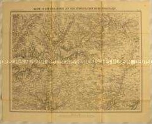
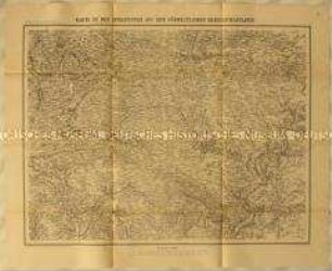
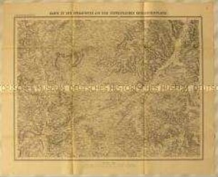
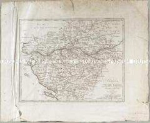
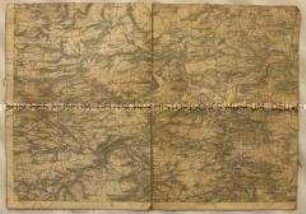
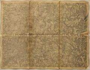
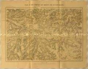
Militärkarte
Topographische Karte der Gegend um Metz, wohl als Schauplatz des Deutsch-Französischen Kriegs
- Location
-
Deutsches Historisches Museum, Berlin
- Inventory number
-
Do 90/9472
- Measurements
-
Höhe x Breite: 55 x 69,9 cm (Blatt)
- Material/Technique
-
Druckfarbe (schwarz, braun), Papier, gedruckt
- Classification
-
Kartografie (Gattung)
- Subject (what)
-
Krieg
Militär
Eisenbahn
Fluss
- Event
-
Herstellung
- (where)
-
Deutschland [historisch: Deutsches Reich]
- (when)
-
nach 1871
- Rights
-
Deutsches Historisches Museum
- Last update
-
24.03.2023, 9:30 AM CET
Data provider
This object is provided by:
Stiftung Deutsches Historisches Museum. If you have any questions about the object, please contact the data provider.
Stiftung Deutsches Historisches Museum. If you have any questions about the object, please contact the data provider.
Object type
- Militärkarte
Time of origin
- nach 1871
Other Objects (12)
Topographische Karte der Gegend um Vendôme im Département Eure-et-Loir als südwestlicher Schauplatz des Deutsch-Französischen Krieges
Topographische Karte der Gegend westlich von Châteaudun im Département Eure-et-Loir als südwestlicher Schauplatz des Deutsch-Französischen Krieges
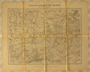
Topographische Karte der Gegend nördlich von Orléans zwischen Escrennes und Orgères als Schauplatz der Schlacht bei Orléans im Deutsch-Französischen Krieg
Topographische Karte der Gegend nordöstlich von Le Mans in der Region Pays de la Loire als südwestlicher Schauplatz des Deutsch-Französischen Krieges

Topographische Karte der Gegend nordwestlich von Beaugency als Schauplatz der Kämpfe bei Meung-sur-Loire und Beaugency während des Deutsch-Französischen Krieges
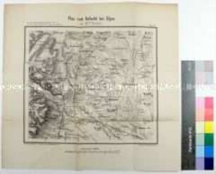
Topographische Karte zur Schlacht bei Dijon als Schauplatz des Deutsch-Französischen Kriegs
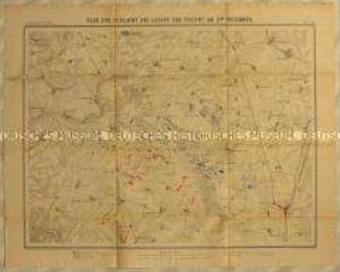
Topographische Karte der Gegend um Loigny zwischen Janville, Artenay, Guillonville und Fontenay als Schauplatz der Schlacht bei Loigny während des Deutsch-Französischen Krieges
Schauplatz des Vendee-Krieges
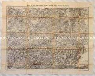
Topographische Karte der Franche-Comté westlich von Montbéliard als Schauplatz des Deutsch-Französischen Kriegs
Topographische Teilkarte der Gegend um Naumburg (Karte unvollständig)
Topographische Karte der Gegend um Fénétrange in Lothringen
Topographische Karte der Gegend um Amiens zwischen Albert, Montauban, Goyencourt, Conty und Vignacourt als Schauplatz der Schlachten von Amiens und an der Hallue während des Deutsch-Französischen Krieges
Topographische Karte der Gegend um Vendôme im Département Eure-et-Loir als südwestlicher Schauplatz des Deutsch-Französischen Krieges
Topographische Karte der Gegend westlich von Châteaudun im Département Eure-et-Loir als südwestlicher Schauplatz des Deutsch-Französischen Krieges
Topographische Karte der Gegend nördlich von Orléans zwischen Escrennes und Orgères als Schauplatz der Schlacht bei Orléans im Deutsch-Französischen Krieg
Topographische Karte der Gegend nordöstlich von Le Mans in der Region Pays de la Loire als südwestlicher Schauplatz des Deutsch-Französischen Krieges
Topographische Karte der Gegend nordwestlich von Beaugency als Schauplatz der Kämpfe bei Meung-sur-Loire und Beaugency während des Deutsch-Französischen Krieges
Topographische Karte zur Schlacht bei Dijon als Schauplatz des Deutsch-Französischen Kriegs
Topographische Karte der Gegend um Loigny zwischen Janville, Artenay, Guillonville und Fontenay als Schauplatz der Schlacht bei Loigny während des Deutsch-Französischen Krieges
Schauplatz des Vendee-Krieges
Topographische Karte der Franche-Comté westlich von Montbéliard als Schauplatz des Deutsch-Französischen Kriegs
Topographische Teilkarte der Gegend um Naumburg (Karte unvollständig)
Topographische Karte der Gegend um Fénétrange in Lothringen