- Alternativer Titel
-
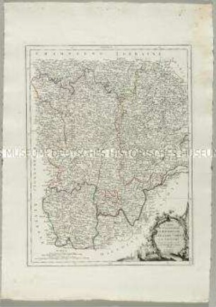
CARTE / des Gouvernements / DE LORRAINE ET / D'ALSACE
- Standort
-
Deutsches Historisches Museum, Berlin
- Inventarnummer
-
Do 2006/854
- Maße
-
Höhe x Breite: 54,5 x 78 cm (Blatt)
Höhe x Breite: 40,6 x 55 cm (Karte)
Höhe x Breite: 44,3 x 58,5 cm (Platte)
- Material/Technik
-
Papier, Kupferstich, grenzkoloriert
- Klassifikation
-
Kartografie (Gattung)
- Bezug (was)
-
Frankreich
Lothringen
Elsass
- Ereignis
-
Herstellung
- (wer)
-
Kartograf: Rigobert Bonne
Stecher, Kartograf: Paolo Santini
- (wo)
-
Venedig, Italien
- (wann)
-
1777
- Rechteinformation
-
Deutsches Historisches Museum
- Letzte Aktualisierung
-
24.03.2023, 09:31 MEZ
Datenpartner
Dieses Objekt wird bereitgestellt von:
Stiftung Deutsches Historisches Museum. Bei Fragen zum Objekt wenden Sie sich bitte an den Datenpartner.
Stiftung Deutsches Historisches Museum. Bei Fragen zum Objekt wenden Sie sich bitte an den Datenpartner.
Objekttyp
- Ämterkarte
Beteiligte
- Kartograf: Rigobert Bonne
- Stecher, Kartograf: Paolo Santini
Entstanden
- 1777
Ähnliche Objekte (12)
Carte des Gouvernements de Dauphiné et de Provence
Carte des Gouvernements de Languedoc, de Foix et de Roussillon
Carte des Gouvernements de Bourgogne, de Franche Comté et de Lyonnois
Carte des Gouvernements du Berri, du Nivernois, de la Marche, du Bourbonnois, du Limosin et de l'Auvergne
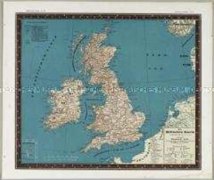
Bauerkeller's Handatlas der allgemeinen Erdkunde, der Länder- und Staatenkunde: Die Britischen Inseln. Mit einer Nebenkarte: Shetlands-Inseln
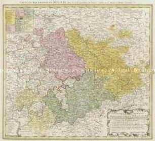
Diocese u. Amt Dresden, 1:110 000, Kupferstich, 1757 : Seutter, Matthaeus: Diocese u. Amt Dresden, um 1757, ca. 1:110 000. Zeichner: (Adam Friedrich Zürner) 38,6 x 47,1 cm (Kupferstich, kol.)
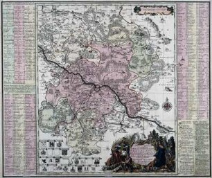
Geographische Abbildung des gantzen Umfangs der Marggrafschaft Meissen
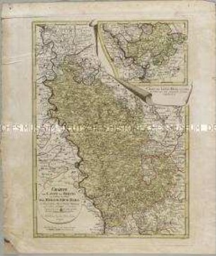
Charte vom Laufe des Rheins von Coblenz bis Wesel. Mit einer Anschlusskarte: Charte den Lauf des Rheins von Coblenz bis Unkel... enthaltend
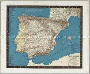
Bauerkeller's Handatlas der allgemeinen Erdkunde, der Länder- und Staatenkunde: Spanien und Portugal
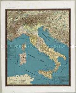
Bauerkeller's Handatlas der allgemeinen Erdkunde, der Länder- und Staatenkunde: Italien
![Karte des Amtes Großenhain, ca. 1:140 000, Kupferstich, 1711 : Accurate Geographische Delineation Der In Dem Meisnischen Creisse Des Churfürstenthums Sachsen Liegenden Dioeces Oder Superintendtur Grossen-Hayn : Sammt Ihren Staedten Flecken Und Dorffschaften ; [gewidmet] Friedrich Augusto, Koenig In Pohlen und Churfürsten zu Sachsen ; mit Königl. und Churf. Sächß. Pr. / Mit Sonderbarem Fleisse Geometrice durchgehends per Intersectiones gesuchet und in disen Riss gebracht Ao. Christi MDCCXI von M. Adam Friedrich Zürner. Gestochen von Peter Schencken Iun.. - [Ca. 1:140 000]. - [Amsterdam] , 1711. - 1 Kt. : Kupferst. ; 54 x 46 cm, Bildgr. 60 x 50 cm](https://iiif.deutsche-digitale-bibliothek.de/image/2/0fe0abae-3cff-4528-92f6-c019a425d8ab/full/!306,450/0/default.jpg)
Karte des Amtes Großenhain, ca. 1:140 000, Kupferstich, 1711 : Accurate Geographische Delineation Der In Dem Meisnischen Creisse Des Churfürstenthums Sachsen Liegenden Dioeces Oder Superintendtur Grossen-Hayn : Sammt Ihren Staedten Flecken Und Dorffschaften ; [gewidmet] Friedrich Augusto, Koenig In Pohlen und Churfürsten zu Sachsen ; mit Königl. und Churf. Sächß. Pr. / Mit Sonderbarem Fleisse Geometrice durchgehends per Intersectiones gesuchet und in disen Riss gebracht Ao. Christi MDCCXI von M. Adam Friedrich Zürner. Gestochen von Peter Schencken Iun.. - [Ca. 1:140 000]. - [Amsterdam] , 1711. - 1 Kt. : Kupferst. ; 54 x 46 cm, Bildgr. 60 x 50 cm
![Karte der Ämter Rochlitz, Colditz und Leissnig, ca. 1:260 000, Kupferstich, 1759 : Haute-Saxe, Bailliage De Rochliz, Coldiz Et Leissnig. - [Ca. 1:260 000]. - [Paris] : [Le Rouge] , [1759]. - 1 Kt. : Kupferst. ; 27 x 20 cm](https://iiif.deutsche-digitale-bibliothek.de/image/2/6609d286-764b-4340-8df8-b0dee5a59688/full/!306,450/0/default.jpg)
Karte der Ämter Rochlitz, Colditz und Leissnig, ca. 1:260 000, Kupferstich, 1759 : Haute-Saxe, Bailliage De Rochliz, Coldiz Et Leissnig. - [Ca. 1:260 000]. - [Paris] : [Le Rouge] , [1759]. - 1 Kt. : Kupferst. ; 27 x 20 cm
Carte des Gouvernements de Dauphiné et de Provence
Carte des Gouvernements de Languedoc, de Foix et de Roussillon
Carte des Gouvernements de Bourgogne, de Franche Comté et de Lyonnois
Carte des Gouvernements du Berri, du Nivernois, de la Marche, du Bourbonnois, du Limosin et de l'Auvergne
Bauerkeller's Handatlas der allgemeinen Erdkunde, der Länder- und Staatenkunde: Die Britischen Inseln. Mit einer Nebenkarte: Shetlands-Inseln
Diocese u. Amt Dresden, 1:110 000, Kupferstich, 1757 : Seutter, Matthaeus: Diocese u. Amt Dresden, um 1757, ca. 1:110 000. Zeichner: (Adam Friedrich Zürner) 38,6 x 47,1 cm (Kupferstich, kol.)
Geographische Abbildung des gantzen Umfangs der Marggrafschaft Meissen
Charte vom Laufe des Rheins von Coblenz bis Wesel. Mit einer Anschlusskarte: Charte den Lauf des Rheins von Coblenz bis Unkel... enthaltend
Bauerkeller's Handatlas der allgemeinen Erdkunde, der Länder- und Staatenkunde: Spanien und Portugal
Bauerkeller's Handatlas der allgemeinen Erdkunde, der Länder- und Staatenkunde: Italien
Karte des Amtes Großenhain, ca. 1:140 000, Kupferstich, 1711 : Accurate Geographische Delineation Der In Dem Meisnischen Creisse Des Churfürstenthums Sachsen Liegenden Dioeces Oder Superintendtur Grossen-Hayn : Sammt Ihren Staedten Flecken Und Dorffschaften ; [gewidmet] Friedrich Augusto, Koenig In Pohlen und Churfürsten zu Sachsen ; mit Königl. und Churf. Sächß. Pr. / Mit Sonderbarem Fleisse Geometrice durchgehends per Intersectiones gesuchet und in disen Riss gebracht Ao. Christi MDCCXI von M. Adam Friedrich Zürner. Gestochen von Peter Schencken Iun.. - [Ca. 1:140 000]. - [Amsterdam] , 1711. - 1 Kt. : Kupferst. ; 54 x 46 cm, Bildgr. 60 x 50 cm